
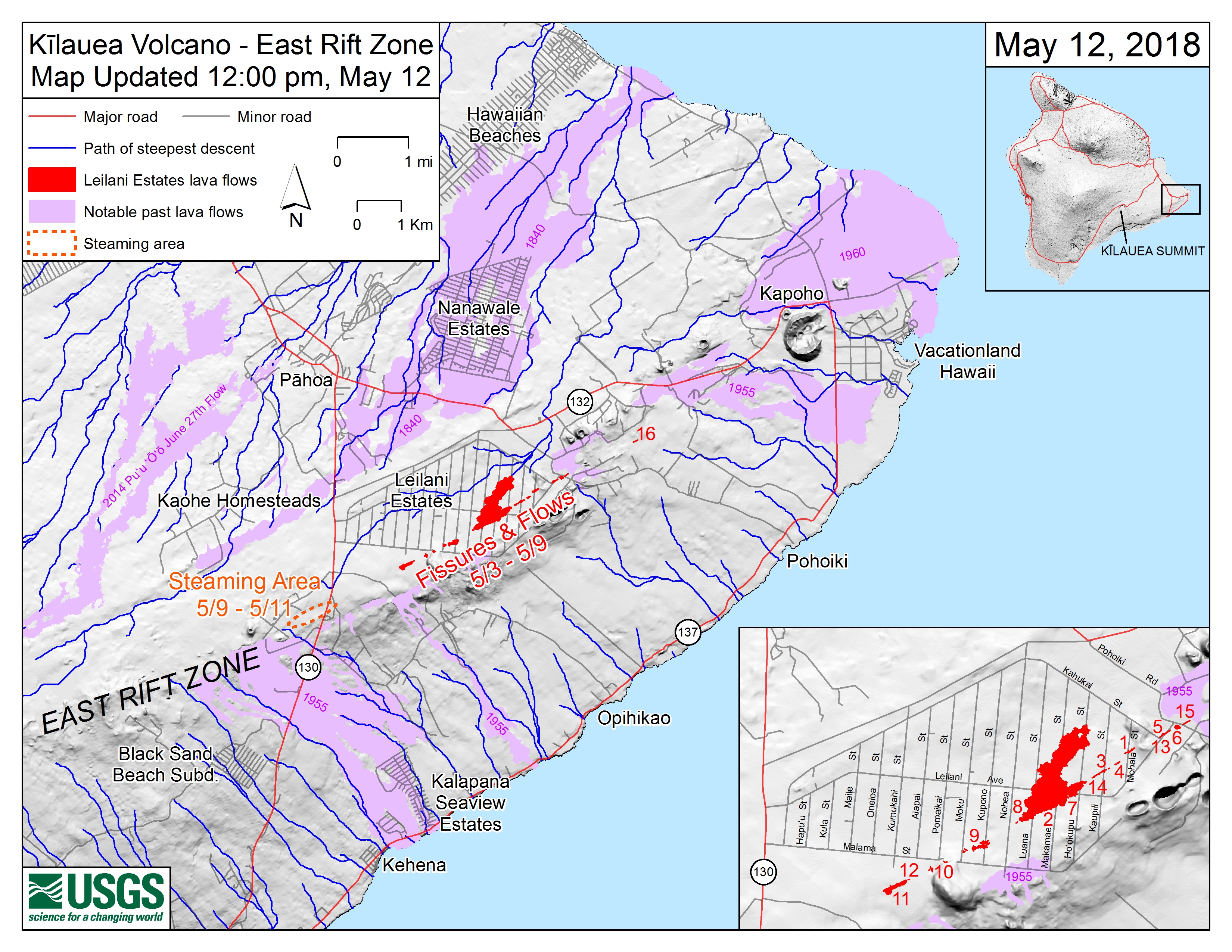
Kīlauea LERZ Fissures, May 12 at 12:00 p.m.

Detailed Description
Main map shows the location of fissure 16, as well as earlier fissures, lava flows, and steaming areas, as of 12:00 p.m. HST, May 12. Inset map shows fissures in Leilani Estates in the order they occurred since May 3. Shaded purple areas indicate lava flows erupted in 1840, 1955, 1960, and 2014-2015.
Sources/Usage
Public Domain.