
Kīlauea's Pu‘u ‘Ō‘ō lava flow advances toward the ocean
Detailed Description
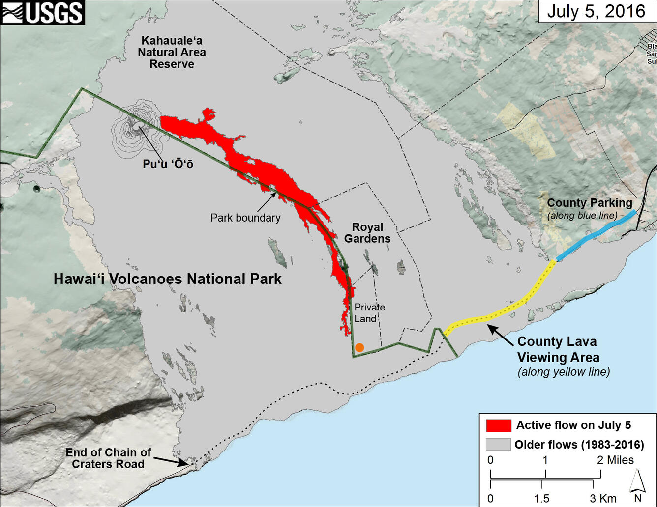
This map of Kīlauea Volcano's lava flow shows the locations of Hawai‘i County's designated lava-viewing and parking areas (http://www.hawaiicounty.gov/lava-viewing/), as well as the lava flow's location relative to the Hawai‘i Volcanoes National Park boundary (green line). The full extent of the active lava flow on July 5 is shown in red; an orange dot shows the location of the flow front as of mid-day on July 7. For recent maps and photos of the lava flow, please visit the USGS Hawaiian Volcano Observatory website (https://volcanoes.usgs.gov/observatories/hvo/). USGS graphic.
Sources/Usage
Public Domain.