
Large-scale map of Kīlauea's ERZ lava flow
Detailed Description
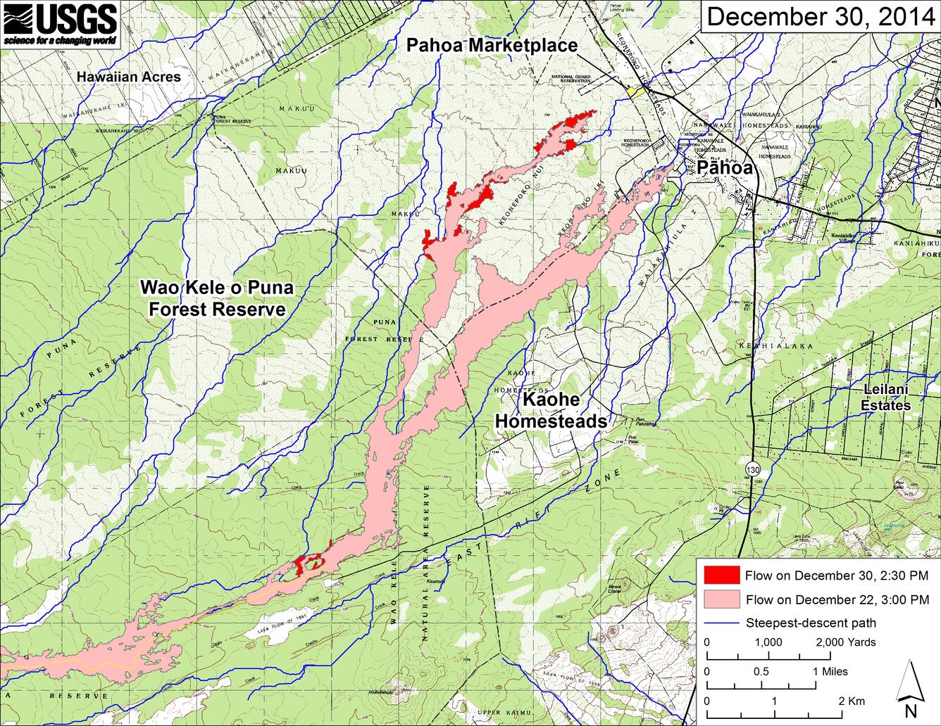
This large-scale map shows the distal part of Kīlauea's active East Rift Zone lava flow in relation to nearby Puna communities. The area of the flow on December 22 at 3:00 PM is shown in pink, while widening and advancement of the flow as mapped on December 30 at 2:30 PM is shown in red.
Most surface activity was within the leading 3 km (2 miles) of the flow, but other small breakouts were scattered along the length of the flow up to the area just north of the True/Mid-Pacific geothermal well pad. One other breakout, outside the map area, was active near Pu‘u ‘Ō‘ō.
The blue lines show steepest-descent paths calculated from a 1983 digital elevation model (DEM; for calculation details, see http://pubs.usgs.gov/of/2007/1264/). Steepest-descent path analysis is based on the assumption that the DEM perfectly represents the earth's surface. DEMs, however, are not perfect, so the blue lines on this map can be used to infer only approximate flow paths. The yellow line marks the mapped extent of the active lava tube.
Sources/Usage
Public Domain.