
Lidar Base Specification version 1. 3 Figure 9
By NGP Standards and Specifications
February 2018 (approx.)
Detailed Description
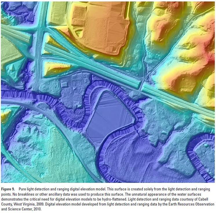
Lidar Base Specification version 1.3: Figure 9. Pure light detection and ranging digital elevation model. This surface is created solely from the light detection and ranging points. No breaklines or other ancillary data was used to produce this surface. The unnatural appearance of the water surfaces demonstrates the critical need for digital elevation models to be hydro-flattened. Light detection and ranging data courtesy of Cabell County, West Virginia, 2009. Digital elevation model developed from light detection and ranging data by the Earth Resources Observation and Science Center, 2010.
Sources/Usage
Public Domain.