
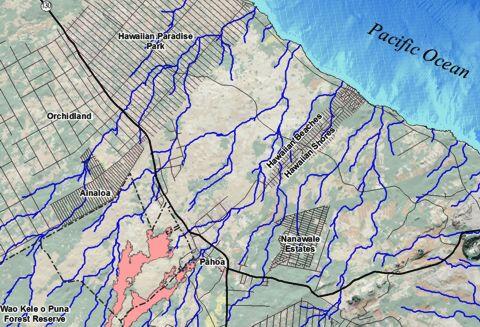
Map of steepest descent paths near Pāhoa, Kīlauea, Hawaii
Detailed Description
Small version of map showing June 27th lava flow boundaries on March 25, 2016, near Pāhoa, Hawaii. Blue lines are steepest descent paths calculated from a 1983 digital elevation model (DEM) of the ground surface.
Sources/Usage
Public Domain.