
October 8, 2021—Kīlauea summit eruption thermal maps
Detailed Description
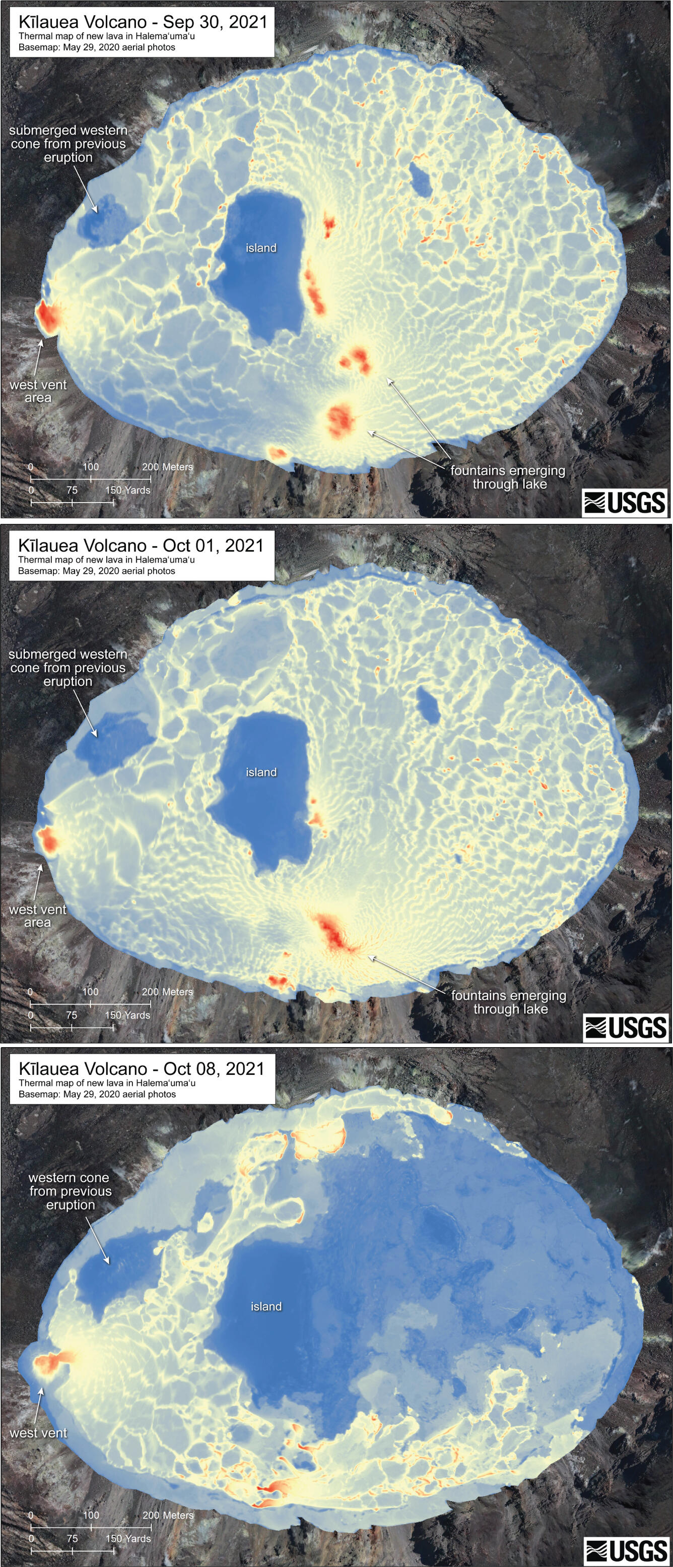
This series of thermal maps depicts the development of the Halema‘uma‘u lava lake since the most recent Kīlauea summit eruption started in the afternoon of September 29, 2021. Between September 30 and October 1, the only substantial change was the deactivation of the eruptive vents within the central and southern parts of the lava lake. Approaching October 8, however, large sections of the lava lake surface began to stagnate and solidify, especially in the northeastern part of the lake. The only remaining active eruptive vent at this time is the west vent. USGS maps by M. Patrick.
Sources/Usage
Public Domain.