
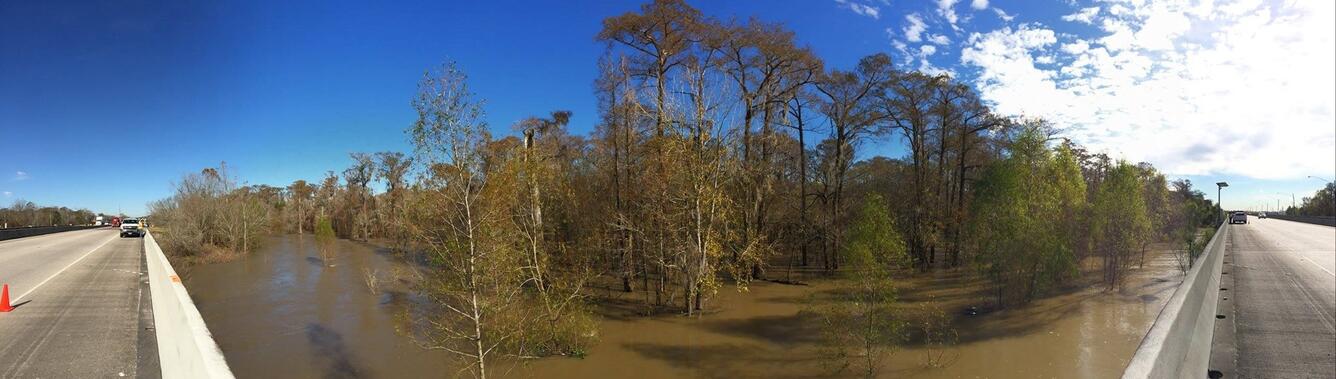
Panorama of the Floodwaters at the Bonnet Carré Spillway
Detailed Description
A panorama of the floodwaters at the Bonnet Carré Spillway. In preparation for the river crests due next week, USGS is out sampling on the Bonnet Carre Spillway, one of two spillways on the Mississippi River operated by the U.S. Army Corps of Engineers. To help the Army Corps make decisions about the use of the spillways, USGS measures both discharge (how much water is moving through and how fast it’s going) and sediment (how much sediment is coming through with the water).
In late 2015/early 2016 unusually large rainfall in the Upper Mississippi River Valley led to significant flooding in Arkansas, Illinois, Louisiana, Mississippi, Missouri, and Tennessee. USGS crews responded to the flooding by collecting streamflow and water quality information and providing it to emergency responders.
Sources/Usage
Public Domain.