
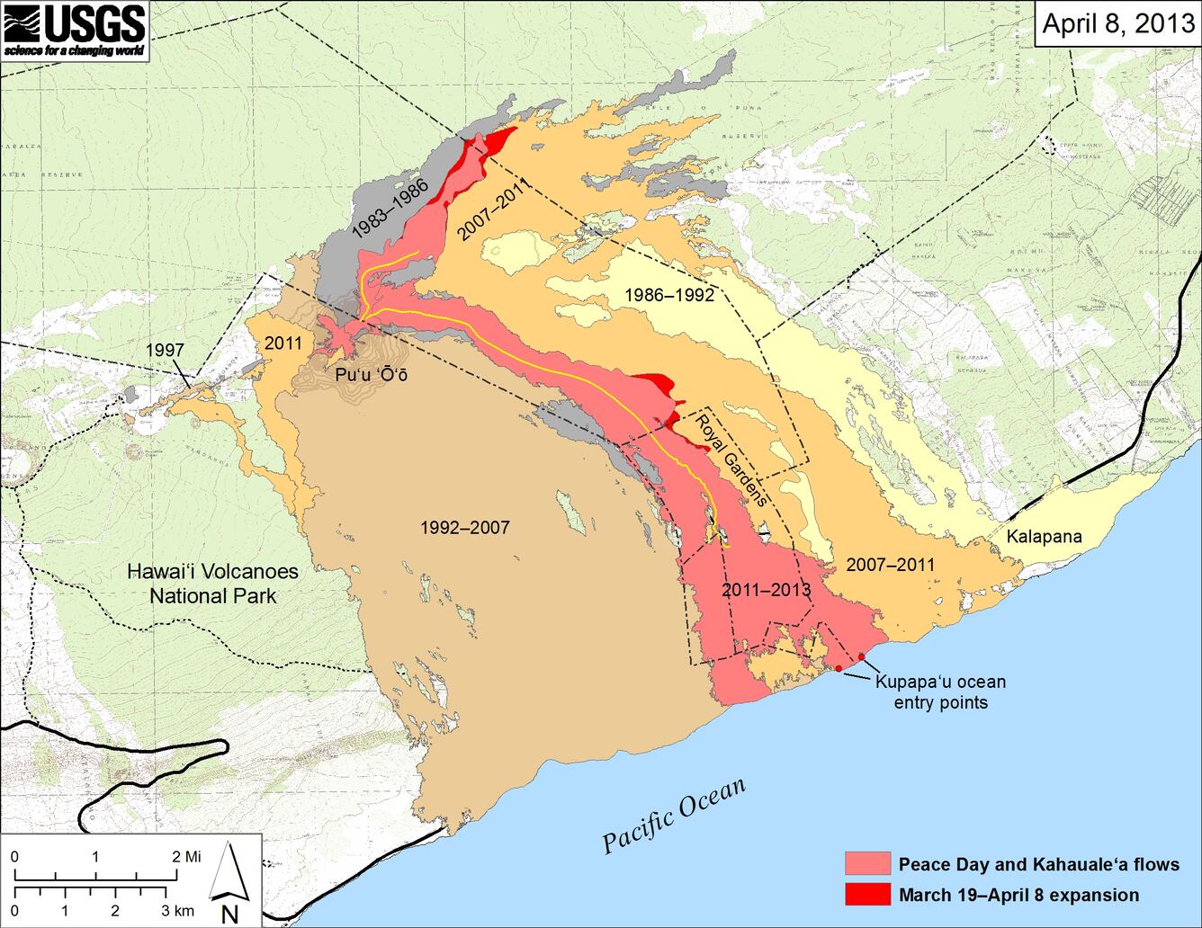
Peace Day and Kahauale‘a flow fields
Detailed Description
Small-scale map showing the active Peace Day flow, carrying lava to the ocean, and the active Kahauale‘a flow northeast of Pu‘u ‘Ō‘ō, as of April 8, 2013. Widening of both flow fields between March 19 and April 8 is shown in bright red, while the extent of the flow fields before March 19 are shown in pink. Older lava flows are labeled with the years in which they were active. Episodes 1-48b (1983-1986) are shown in gray; episodes 48c-49 (1986-1992) are pale yellow; episodes 50-55 (1992-2007) are tan; and episodes 58-60 (2007-2011) are pale orange. The active lava tubes are shown by the yellow lines. The contour interval for topographic lines shown on Pu‘u ‘Ō‘ō is 5 m.