
Small-scale map of Kīlauea's ERZ flow field
Detailed Description
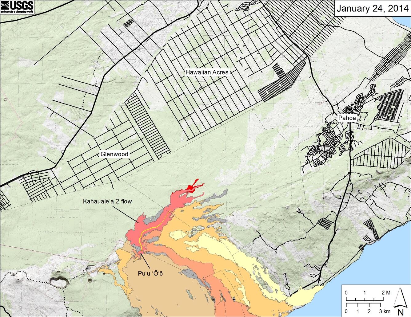
Map showing the Kahauale‘a 2 flow in relation to the eastern part of the Big Island as of January 24, 2014. The front of the Kahauale‘a 2 flow was 7.8 km (4.8 miles) northeast of Pu‘u ‘Ō‘ō last week. These fingers stalled during a prolonged deflation-inflation cycle (DI event) at Kīlauea's summit which started on January 17 and appears to be just finishing today (January 24). Lava flows have since resumed but are active closer to Pu‘u ‘Ō‘ō, with the focus of activity about 5.6 km (3.5 miles) from the vent. The area of the Kahauale‘a 2 flow as of January 10 is shown in pink, while widening of the flow as of January 24 is shown in red. Older lava flows are distinguished by color: episodes 1-48b flows (1983-1986) are shown in gray; episodes 48c-49 flows (1986-1992) are pale yellow; episodes 50-55 flows (1992-2007) are tan; episodes 58-60 flows (2007-2011) are pale orange, and episode 61 flows (2011-2013) are reddish orange. The active lava tube is shown with a yellow line.
Sources/Usage
Public Domain.