
Subsidence in Coachella Valley, CA
By Land Subsidence in California
2011 (approx.)
Detailed Description
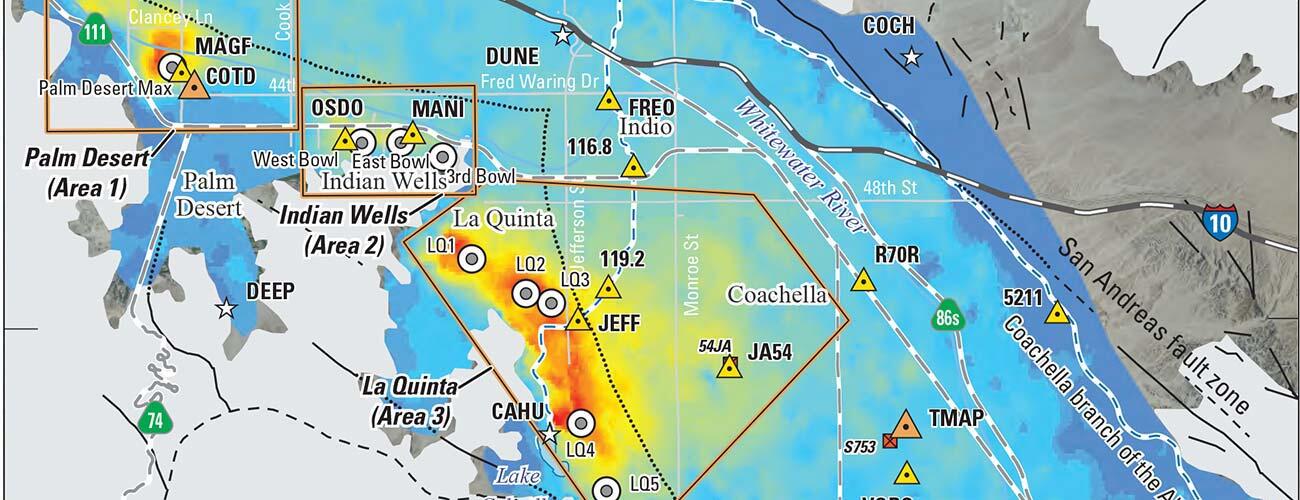
Stacked interferogram from ERS and ENVISAT satellites showing varying amounts of subsidence throughout the valley for June 27, 1995-September 19, 2010 (excluding November 8, 2000-November 30, 2003). Three areas with larger magnitudes of subsidence are outlined. The Coachella Branch of the All-American Canal, which brings in water from the Colorado River, runs through an area of subsidence.