
Thermal map of Kīlauea summit

Detailed Description
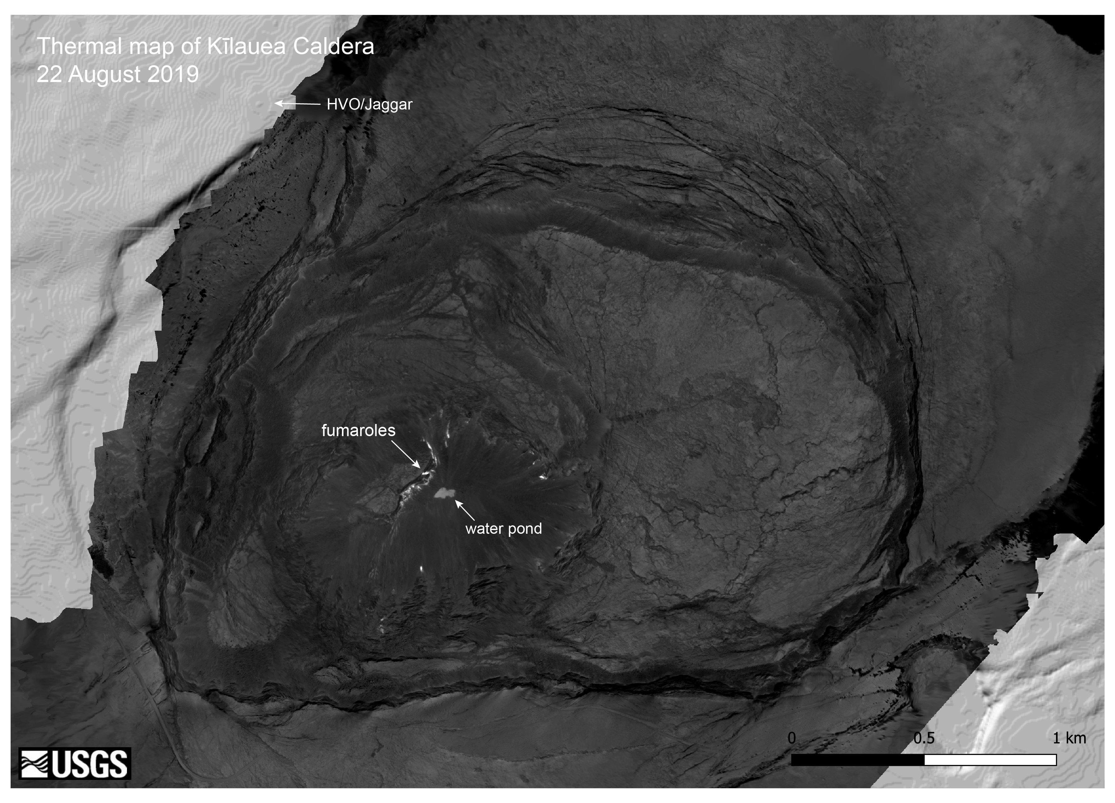
This thermal map was constructed from 1008 images collected by a thermal camera during a helicopter overflight on August 22, 2019. The hottest features in the caldera are the numerous small fumaroles in Halema‘uma‘u crater, and these areas have temperatures up to 200 dg. C (392 dg. F). The pond of water at the bottom of Halema‘uma‘u also stands out, and has a surface temperature of approximately 70 dg. C (158 dg. F). The light grey areas in the upper left and lower right corners of the map are regions not covered by the thermal map, and show a shaded-relief basemap.
Sources/Usage
Public Domain.