
USGS Produced Coastal Change Forecasts for Hurricane Laura

Detailed Description
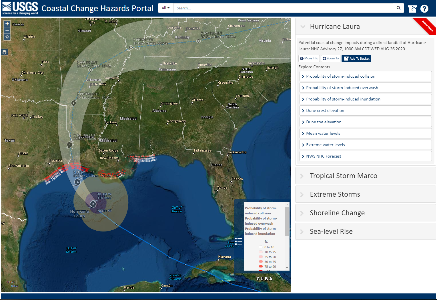
As Hurricane Laura approached the US Gulf Coast, the USGS Coastal Change Hazards team produced a series of forecasts for impacts on the beach. Forecasts were updated daily based on wave and storm surge forecasts from NOAA. Prior to landfall on August 27, 2020, the Coastal Change Hazards Team forecast that 82 percent of Louisiana beaches were very likely to erode at the dunes’ base. In addition, 78 percent of dunes were forecast to be very likely to be overwashed by storm waves and 59 percent of the dunes were forecast to be inundated. In northeast Texas, 59 percent of beaches were very likely to erode at the dunes’ base, 29 percent of dunes were forecast to be very likely to be overwashed by storm waves and 17 percent of the dunes were forecast to be inundated. In addition to informing the public, forecasts were used to determine placement of sensors for USGS real-time response to Hurricane Laura. After landfall of a storm, the Coastal Change Hazards team uses NOAA imagery, USGS CoastCams, other beach cams, Digital Elevation Models (DEMs) constructed from post-storm aerial imagery and lidar data, and observations from USGS sensors to validate forecasts.
Sources/Usage
Public Domain.