Atmospheric rivers cause the majority of precipitation-induced landslides in Western North America
linkAtmospheric rivers (ARs) are transient channels of intense horizontal water vapor transport in the lower atmosphere.
An official website of the United States government
Here's how you know
Official websites use .gov
A .gov website belongs to an official government organization in the United States.
Secure .gov websites use HTTPS
A lock () or https:// means you’ve safely connected to the .gov website. Share sensitive information only on official, secure websites.
Access all multimedia to include images, video, audio, webcams, before-after imagery, and more. Filter and explore with filtering options to refine search.
Atmospheric rivers (ARs) are transient channels of intense horizontal water vapor transport in the lower atmosphere.
In this episode of Eyes on Earth, we aim to separate science fiction from science fact when it comes to how Landsat satellites and the EROS Center are portrayed in popular media. To do that, we consulted experts on a range of potential uses, including military, heat signatures, paleontology, and forests.
This is B-roll video of POV Polar Bear Collar Cam B-roll 2019, 2021, and 2022.
In this episode of Eyes on Earth, we spoke with Mikael Hiestand, a Mendenhall Postdoctoral Fellow. Using algorithms developed at EROS, Mikael is working on near-term drought forecasting. With synthetic Landsat data, he found that predicting evapotranspiration could be used as a means of drought prediction and monitoring.
The Grand Ethiopian Renaissance Dam is set to become the largest hydroelectric power plant in Africa.
Located near the Sudan border in Ethiopia, the promising and controversial project impacts communities up and down the Blue Nile.
Landsat sensors capture the region in false color infrared, emphasizing the reservoir's boundary.
An Instagram Live even hosted by Department of the Interior Secretary Deb Haaland with special guest USGS Director Dr. David Applegate. The even took place on January 5, 2024.
In this monthly update of the Yellowstone Volcano Observatory, we present our take on the top five headlines for 2023.
0:12 - Earthquakes, Deformation
1:20 - Steamboat Geyser Eruptions
2:30 - New Monitoring for Hydrothermal
3:24 - Volcanic Eruptions at Yellowstone
4:34 - Magma Chamber below Yellowstone
First responders need reliable, accurate mapping capabilities as quickly as possible in the wake of a disaster—and they don’t have time to download and organize it.
The home of the Landsat satellite archive is surrounded by corn and soybean fields. The archive is kept at the USGS Earth Resources Observation and Science Center (EROS) located near Sioux Falls, South Dakota. EROS is celebrating its 50th anniversary this year.
In this episode of Eyes on Earth, we hear from several EROS staff members and university graduate students who took part in our Fall Poster Session. Lively conversations filled the EROS atrium during the hour-long event. Participants got to learn from one another as they shared their work. We talked to a few of them to get quick summaries of their research.
The Amazon Rainforest in South America typically experiences its drier season between the months of July and October. Satellite imagery from Landsats 9 and 8 show severe drought conditions in 2023 in comparison to 2022 when the area received average rainfall.
Steamboat Geyser is the tallest geyser in the world. It has been putting on a show the last few years for visitors at Yellowstone National Park with a record number of water eruptions, 48 eruptions each in 2019 and 2020. But it's only had eight eruptions in 2023. Is Steamboat losing steam?
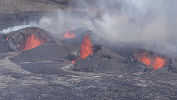
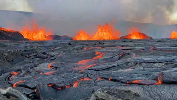
Six Eruptions at Two Volcanoes Over the Past Three Years
How the Hawaiian Volcano Observatory monitors some of Earth’s most active volcanoes
by Katie Mulliken, Geologist, Research Corporation of the University of Hawai‘i and USGS Hawaiian Volcano Observatory
Six Eruptions at Two Volcanoes Over the Past Three Years
How the Hawaiian Volcano Observatory monitors some of Earth’s most active volcanoes
by Katie Mulliken, Geologist, Research Corporation of the University of Hawai‘i and USGS Hawaiian Volcano Observatory
Mauna Loa 2022 eruption anniversary video. Mauna Loa is Earth's largest active volcano and covers just over half of the Island of Hawaiʻi. It erupted most recently in November-December 2022, and it will erupt again.
The Landsat Program is considered the gold standard for satellite Earth-observation imagery. To keep it that way, the USGS EROS Flight Operations Team continually monitors the flight paths of the Landsat satellites to make sure they stay at a consistent 705-kilometer altitude. That means frequently speeding it up to counter the effects of atmospheric drag.
The National Land Cover Database (NLCD) has a long history as the definitive U.S. land cover product. But the newer Land Change Monitoring, Assessment and Projection (LCMAP) effort takes a longer look back in time.
Need time to concentrate or relax? Then listen to the natural sounds of Beryl Spring in Yellowstone National Park, Wyoming. Beryl Spring, in the Gibbon River valley south of Artist's Paintpots, is a complex plumbing system in Yellowstone National Park with a strongly and constantly boiling hot spring pool, and a powerful fumarole just behind the pool.
Need time to concentrate or relax? Then listen to the natural sounds of Blue Mud Steam Vent in Yellowstone National Park, Wyoming. Blue Mud Steam Vent is found within the Norris Geyser Basin in Yellowstone National Park, Wyoming.
Need time to concentrate or relax? Then listen to the natural sounds of a flowing river through Yellowstone National Park, Wyoming. This audio is from a river below the bridge near the Monument Geyser Trailhead in Yellowstone National Park, Wyoming.
Need time to concentrate or relax? Then listen to the natural sounds of Cinnamon Spouter in Yellowstone National Park, Wyoming. Cinnamon Spouter is located in the Black Sand Basin in Yellowstone National Park, Wyoming.
Need time to concentrate or relax? Then listen to the natural sounds of Congress Pool in Yellowstone National Park, Wyoming. Congress Pool is a mud pool/mud pot located in the Norris Geyser Basin in Yellowstone National Park, Wyoming.