
USGS scientist Sara Zeigler records habitat characteristics in iPlover at an ‘exclosed’ nest. On some beaches, managers erect netting around nests to protect eggs/chicks and adults from predators, allowing movement of chicks and parents to and from the nest but excluding predators
Images
Total: 0
Advanced Search
Choose search keyword and/or remove with "X" in search keyword button below.
Filters
Total: 0
Total: 0
Advanced Search
Choose search keyword and/or remove with "X" in search keyword button below.
Filters
Settings
Total: 0
| Type | Release Date |
Title
|
|---|
Explore our planet through photography and imagery, including climate change and water all the way back to the 1800s when the USGS was surveying the country by horse and buggy.
Filter Total Items: 21608

USGS scientist records piping plover habitat characteristics
USGS scientist Sara Zeigler records habitat characteristics in iPlover at an ‘exclosed’ nest. On some beaches, managers erect netting around nests to protect eggs/chicks and adults from predators, allowing movement of chicks and parents to and from the nest but excluding predators

USGS staff ski to and from the Garden Wall weather station.
USGS staff ski to and from the Garden Wall weather station in Glacier National Park (elev. 7400 feet) to complete maintenance and examine the snowpack for avalanche research.
USGS staff ski to and from the Garden Wall weather station in Glacier National Park (elev. 7400 feet) to complete maintenance and examine the snowpack for avalanche research.

USGS storm-tide sensor
This is an example of a USGS storm-tide sensor.
This is an example of a USGS storm-tide sensor.

Video camera atop a hotel in Madeira Beach, Florida.
Video-camera station installed by Jenna Brown and Joe Long atop a hotel in Madeira Beach, Florida.
Video-camera station installed by Jenna Brown and Joe Long atop a hotel in Madeira Beach, Florida.

Wave runup at Madeira Beach Florida during a storm
Wave runup at Madeira Beach, Florida, during Tropical Storm Colin
Wave runup at Madeira Beach, Florida, during Tropical Storm Colin

Well Drill in the Bakken Formation near Williston
Water truck in background is providing maintenance water to a producing well drilled in the Bakken Formation near Williston, North Dakota.
Water truck in background is providing maintenance water to a producing well drilled in the Bakken Formation near Williston, North Dakota.

WERC USGS Scientist in Wetland, Bandon National Wildlife Refuge, OR
Elevation surveys as part of an effort to provide downscaled climate response models to managers, Bandon National Wildlife Refuge, Bandon Oregon. Photo credit: Katherine Powelson/USGS (former employee).
Elevation surveys as part of an effort to provide downscaled climate response models to managers, Bandon National Wildlife Refuge, Bandon Oregon. Photo credit: Katherine Powelson/USGS (former employee).

White Oak Creek downstream of Jones Branch, KY
White Oak Creek downstream of Jones Branch, KY
White Oak Creek downstream of Jones Branch, KY

White-tailed Tropicbird flying
White-tailed Tropicbird (Phaethon lepturus) flying.
White-tailed Tropicbird (Phaethon lepturus) flying.

Wind turbines and a rainbow towering high above trees in Hawaii
Wind turbines and a rainbow towering high above trees on an island in Hawaii. Paul Cryan, USGS, Fort Collins Science Center.
Wind turbines and a rainbow towering high above trees on an island in Hawaii. Paul Cryan, USGS, Fort Collins Science Center.

Yellow River near Brems, IN - view from bridge
Yellow River near Brems, IN - view from bridge
Yellow River near Brems, IN - view from bridge

Biocrusts in healthy grassland data collection
Person taking data in a healthy dryland grassland with dark biocrusts between bunchgrasses and cacti in Utah.
Person taking data in a healthy dryland grassland with dark biocrusts between bunchgrasses and cacti in Utah.

Kīlauea's ERZ eruption: what happened in 2017
On May 24, 2016, two new flows broke out on the flanks of the Pu‘u ‘Ō‘ō cone on Kīlauea Volcano's East Rift Zone. The silvery sheen of new lava erupting from the northern 61f breakout (center) and eastern 61g breakout (upper left) stands out in contrast to the older flows on and around Pu‘u ‘Ō‘ō (right).
On May 24, 2016, two new flows broke out on the flanks of the Pu‘u ‘Ō‘ō cone on Kīlauea Volcano's East Rift Zone. The silvery sheen of new lava erupting from the northern 61f breakout (center) and eastern 61g breakout (upper left) stands out in contrast to the older flows on and around Pu‘u ‘Ō‘ō (right).

Gerry Hatcher and Camera System
USGS ocean engineer Gerry Hatcher with the camera system he helped create for recording the precise time and geographic location of each air photo it takes. The system is mounted in the cargo compartment of a Cessna 182R airplane and takes photos through a window cut into a removable cargo door (right).
USGS ocean engineer Gerry Hatcher with the camera system he helped create for recording the precise time and geographic location of each air photo it takes. The system is mounted in the cargo compartment of a Cessna 182R airplane and takes photos through a window cut into a removable cargo door (right).

Rare Snow Falls at the Edge of Sahara Desert
Landsat 7's Enhanced Thematic Mapper Plus (ETM+) sensor captured the image that shows the white covering on the caramel-colored landscape southwest of the Algerian community of Ain Sefra, a town sometimes referred to as the gateway to the desert.
Landsat 7's Enhanced Thematic Mapper Plus (ETM+) sensor captured the image that shows the white covering on the caramel-colored landscape southwest of the Algerian community of Ain Sefra, a town sometimes referred to as the gateway to the desert.

Adam Terando - American Geophysical Union, Fall 2016
Adam Terando (right) and his colleagues from left to right, Dr. Azad Henareh, Dr. Jared Bowden, Ms. Sarah Grade, at the American Geophysical Union conference in the Fall of 2016.
Adam Terando (right) and his colleagues from left to right, Dr. Azad Henareh, Dr. Jared Bowden, Ms. Sarah Grade, at the American Geophysical Union conference in the Fall of 2016.

Acoustic Doppler Current Profiler (ADCP) to measure streamflow
The use of acoustic Doppler current profilers (ADCPs) from a moving boat is now a commonly used method for measuring streamflow. The technology and methods for making ADCP-based discharge measurements are different from the technology and methods used to make traditional discharge measurements with mechanical meters.
The use of acoustic Doppler current profilers (ADCPs) from a moving boat is now a commonly used method for measuring streamflow. The technology and methods for making ADCP-based discharge measurements are different from the technology and methods used to make traditional discharge measurements with mechanical meters.

Before and after pictures - Hurricane Rita and Holly Beach, Louisiana
Hurricanes can cause severe beach erosion
——————————————————————
Hurricanes can cause severe beach erosion
——————————————————————

Dec. 13 - 14, 2016 Long Valley Caldera earthquake swarm recorded on...
December 13 - 14, 2016 Long Valley Caldera earthquake swarm recorded on instrument MDH1 webicorder. Swarm begins at 23:28 PST.
December 13 - 14, 2016 Long Valley Caldera earthquake swarm recorded on instrument MDH1 webicorder. Swarm begins at 23:28 PST.

Neosho River
Icicles hang from the bank of the Neosho River near Parsons, Kansas with temperatures below 5 degress Celsius.
Icicles hang from the bank of the Neosho River near Parsons, Kansas with temperatures below 5 degress Celsius.
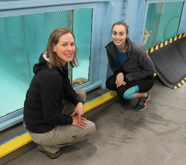
Michelle Staudinger at the New England Aquarium
Staudinger and UMass Amherst undergraduate honors student (Gabrielle (Mila) Calandrino) at the New England Aquarium sea turtle rehabilitation center.
Staudinger and UMass Amherst undergraduate honors student (Gabrielle (Mila) Calandrino) at the New England Aquarium sea turtle rehabilitation center.