The Earth As Art project began in the early 2000s, and its original intent remains the same: to produce images that do not look like satellite images at first glance.
Videos
The USGS is a science organization that provides impartial information on the health of our ecosystems and environment, the natural hazards that threaten us, the natural resources we rely on, the impacts of climate and land-use change, and the core science systems that help us provide timely, relevant, and useable information.
The Earth As Art project began in the early 2000s, and its original intent remains the same: to produce images that do not look like satellite images at first glance.
 Earthquake Briefing — The Antelope Valley, CA Earthquake, July 8, 2021
Earthquake Briefing with Austin Elliot, USGS on the Antelope Valley, CA earthquake that occurred on July 8, 2021.
Earthquake Briefing with Austin Elliot, USGS on the Antelope Valley, CA earthquake that occurred on July 8, 2021.
 Monthly update of activity at Yellowstone Volcano for June 2021
From the boardwalk near Echinus Geyser (the largest acid geyser in the world), Yellowstone Volcano Observatory Scientist-in-Charge Mike Poland provides an update on activity in Yellowstone during the month of June. The Yellowstone Seismic Network located 445 earthquakes in the Yellowstone National Park region.
From the boardwalk near Echinus Geyser (the largest acid geyser in the world), Yellowstone Volcano Observatory Scientist-in-Charge Mike Poland provides an update on activity in Yellowstone during the month of June. The Yellowstone Seismic Network located 445 earthquakes in the Yellowstone National Park region.
This is an animation showing the changing conditions of USGS streamgages from April 1, 2021 to June 30, 2021. The river conditions shown range from the driest condition seen at a gage (red open circles) to the wettest (blue closed circles). A purple outer ring indicates it is flooding.
This is an animation showing the changing conditions of USGS streamgages from April 1, 2021 to June 30, 2021. The river conditions shown range from the driest condition seen at a gage (red open circles) to the wettest (blue closed circles). A purple outer ring indicates it is flooding.
Title: Mount St. Helens Revisited: Lives Changed, Lessons Learned, and Legacies of the 1980 Eruptions
By Carolyn Driedger, USGS Hydrologist & Outreach Specialist
Title: Mount St. Helens Revisited: Lives Changed, Lessons Learned, and Legacies of the 1980 Eruptions
By Carolyn Driedger, USGS Hydrologist & Outreach Specialist
A 1.1 mile long 509 foot tall concrete dam spanning the Blue Nile River is set to become the largest hydropower plant in Africa.
A 1.1 mile long 509 foot tall concrete dam spanning the Blue Nile River is set to become the largest hydropower plant in Africa.
 Volcano Awareness Month 2022 Short Feature — Kīlauea’s recent explosive history
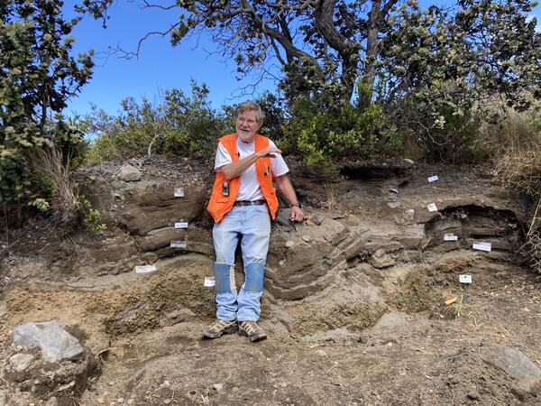
Join USGS Hawaiian Volcano Observatory retired geologist Don Swanson on a virtual field visit to an exposure of the Keanakāko‘i Tephra near the summit of Kīlauea as part of Volcano Awareness Month.
Join USGS Hawaiian Volcano Observatory retired geologist Don Swanson on a virtual field visit to an exposure of the Keanakāko‘i Tephra near the summit of Kīlauea as part of Volcano Awareness Month.
The eruption in Halema`uma`u crater, at the summit of Kilauea, is no longer active. The lava lake that was active between December 2020 and May 2021 remains solidified at the surface. A routine summit overflight observed no signs of residual incandescence in cracks, and only a diffuse gas plume rising from the northern portion of the lake.
The eruption in Halema`uma`u crater, at the summit of Kilauea, is no longer active. The lava lake that was active between December 2020 and May 2021 remains solidified at the surface. A routine summit overflight observed no signs of residual incandescence in cracks, and only a diffuse gas plume rising from the northern portion of the lake.
Welcome to the "The I Am A..." series. This is the eighth video in a series of USGS whiteboard animations that highlight USGS careers.
Welcome to the "The I Am A..." series. This is the eighth video in a series of USGS whiteboard animations that highlight USGS careers.
 YVO monthly activity update from rim of Yellowstone's Grand Canyon!
Yellowstone Volcano Observatory scientist-in-charge Mike Poland provides the YVO monthly update from the rim of Yellowstone’s Grand Canyon. The V-shaped gorge tells an amazing geologic story. About half a million years ago, a large rhyolite lava flow erupted. Over time, hot water and gases heated by the magma chamber rose through faults in the lava flow.
Yellowstone Volcano Observatory scientist-in-charge Mike Poland provides the YVO monthly update from the rim of Yellowstone’s Grand Canyon. The V-shaped gorge tells an amazing geologic story. About half a million years ago, a large rhyolite lava flow erupted. Over time, hot water and gases heated by the magma chamber rose through faults in the lava flow.
This video shows a typical day on Mauna Loa, captured from a new webcam looking south towards the volcano. The field of view covers the summit region and much of the Northeast Rift Zone.
This video shows a typical day on Mauna Loa, captured from a new webcam looking south towards the volcano. The field of view covers the summit region and much of the Northeast Rift Zone.
If you're watching this video, you're probably using a lithium battery. Smartphones, tablets and laptops all rely on lithium metal to store energy. It comes from surface mines or brine ponds, found in places like Australia, China and the United States. One of the leading sources for this increasingly valuable resource is the South American nation of Chile.
If you're watching this video, you're probably using a lithium battery. Smartphones, tablets and laptops all rely on lithium metal to store energy. It comes from surface mines or brine ponds, found in places like Australia, China and the United States. One of the leading sources for this increasingly valuable resource is the South American nation of Chile.
 PubTalk 5/2021 - Where Earthquakes Hide in the Desert
Title: Where Earthquakes Hide in the Desert: What we've learned from recent fault ruptures in the western U.S.
By Austin J. Elliott, USGS Research Geologist
Title: Where Earthquakes Hide in the Desert: What we've learned from recent fault ruptures in the western U.S.
By Austin J. Elliott, USGS Research Geologist
 IRIC Pilot Applications for the Potomac River Using Bathy-Lidar Data
This short presentation will illustrate how detailed topographic-bathymetric LiDAR data sets can be used within the USGS iRIC software package to compute detailed flow and particle tracking simulations across a range of length and time scales, including capturing the effects of local unsteadiness and turbulent mixing.
This short presentation will illustrate how detailed topographic-bathymetric LiDAR data sets can be used within the USGS iRIC software package to compute detailed flow and particle tracking simulations across a range of length and time scales, including capturing the effects of local unsteadiness and turbulent mixing.
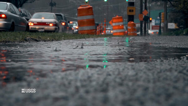
Why storm drains are essential to watershed management.
Why storm drains are essential to watershed management.
 Resurfacing event on small lava pond in Halema`uma`u
The area of active surface lava has diminished over the past month in Halema`uma`u crater, at the summit of Kilauea. Today, active surface lava was limited to a small pond, about 20 meters (yards) long. The pond surface was normally covered with a stationary crust, but occasionally resurfaced. This video shows crustal foundering during a resurfacing event.
The area of active surface lava has diminished over the past month in Halema`uma`u crater, at the summit of Kilauea. Today, active surface lava was limited to a small pond, about 20 meters (yards) long. The pond surface was normally covered with a stationary crust, but occasionally resurfaced. This video shows crustal foundering during a resurfacing event.
The USGS Coastal Change Hazards team works to identify and address the Nation’s coastal change hazards problems. By integrating research, technical capabilities and applications, and stakeholder engagement and communications, the Coastal Change Hazards team develops robust and accessible coastal change assessments, forecasts, and tools that help improve the lives,
The USGS Coastal Change Hazards team works to identify and address the Nation’s coastal change hazards problems. By integrating research, technical capabilities and applications, and stakeholder engagement and communications, the Coastal Change Hazards team develops robust and accessible coastal change assessments, forecasts, and tools that help improve the lives,
The USGS Coastal Change Hazards team works to identify and address the Nation’s coastal change hazards problems. By integrating research, technical capabilities and applications, and stakeholder engagement and communications, the Coastal Change Hazards team develops robust and accessible coastal change assessments, forecasts, and tools that help improve the lives,
The USGS Coastal Change Hazards team works to identify and address the Nation’s coastal change hazards problems. By integrating research, technical capabilities and applications, and stakeholder engagement and communications, the Coastal Change Hazards team develops robust and accessible coastal change assessments, forecasts, and tools that help improve the lives,
The lava lake in Halemaʻumaʻu crater, at the summit of Kīlauea, remains active but has diminished in area and vigor over the past month. This thermal timelapse sequence shows the changes in the lake activity over the past month. In mid-April the area of active surface lava in the lake was approximately 7.5 acres (3 hectares).
The lava lake in Halemaʻumaʻu crater, at the summit of Kīlauea, remains active but has diminished in area and vigor over the past month. This thermal timelapse sequence shows the changes in the lake activity over the past month. In mid-April the area of active surface lava in the lake was approximately 7.5 acres (3 hectares).
 Status of (mostly) WA Volcanoes: Report to Emergency Managers 2020-21
Jon Major, scientist-in-charge of the USGS Cascades Volcano Observatory, provides an overview of the major volcano hazards in the Cascades, the function and responsibilities of the Cascades Volcano Observatory, and a brief synopsis of what's been going on at Mount Baker, Glacier Peak, Mount Rainier, Mount Adams, Mount St.
Jon Major, scientist-in-charge of the USGS Cascades Volcano Observatory, provides an overview of the major volcano hazards in the Cascades, the function and responsibilities of the Cascades Volcano Observatory, and a brief synopsis of what's been going on at Mount Baker, Glacier Peak, Mount Rainier, Mount Adams, Mount St.
Scientists from the U.S. Geological Survey conducted a dye-trace assessment on May 5, 2021 along the Missouri River near Huntsdale, Missouri. The assessment helped scientists understand how larvae from the critically endangered pallid sturgeon drift downstream after hatching and how they find supportive habitat in the complex Missouri River.
Scientists from the U.S. Geological Survey conducted a dye-trace assessment on May 5, 2021 along the Missouri River near Huntsdale, Missouri. The assessment helped scientists understand how larvae from the critically endangered pallid sturgeon drift downstream after hatching and how they find supportive habitat in the complex Missouri River.


