
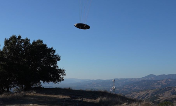
USGS National Innovation Center UAS Research Center Saucer Shark Project, before science flight tests, Aeroshell and payload. Sling configuration and payload orientation verified before science flight deployment. Payload is on and ready to record!
Images
Images described and linked on this webpage come from a wide variety of USGS science activities and presentations performed by USGS Science Center staff members in the Region 10: California-Great Basin. A search tool is provided to narrow the number of image files shown.
Filter Total Items: 56

Saucer Shark Aeroshell and payload suspended by sling
USGS National Innovation Center UAS Research Center Saucer Shark Project, before science flight tests, Aeroshell and payload. Sling configuration and payload orientation verified before science flight deployment. Payload is on and ready to record!

BisonCore (MagEdition) displays live magnetic data (top) and lidar altitude (bottom)
USGS National Innovation Center UAS Research Center Saucer Shark Project, BisonCore displays the path of the sensor live, as it covers transects. Data received from the payload is then displayed within the BisonCore Ecosystem and is accessible for field viewing. The magnetic map is also used to validate payload directed algorithms.
USGS National Innovation Center UAS Research Center Saucer Shark Project, BisonCore displays the path of the sensor live, as it covers transects. Data received from the payload is then displayed within the BisonCore Ecosystem and is accessible for field viewing. The magnetic map is also used to validate payload directed algorithms.

Redwood Creek at Orick Streamgage 11482500 photo by Travis Apo
Anthony Smith photo cred. Redwood Cr at Orick, 11482500. Under 101 bridge and is also the measuring section. Provisional peak was 42,700 cfs. Looks to be the highest peak since 1975. NWS had concerns of levee capacity that night. At the gage, highwater mark which exceeded CSG's, looked to be roughly 8 ft from top of levee.
Anthony Smith photo cred. Redwood Cr at Orick, 11482500. Under 101 bridge and is also the measuring section. Provisional peak was 42,700 cfs. Looks to be the highest peak since 1975. NWS had concerns of levee capacity that night. At the gage, highwater mark which exceeded CSG's, looked to be roughly 8 ft from top of levee.

LCR.Virtual.Tribal.Open_.House_.Image_11_29_2023.jpg
Title Slide for Lower Colorado River Basin Panel Discussion for USGS Virtual Open House meeting to discuss drought issues with Native American Tribal Members. Held online via Microsoft Teams on November 29, 2024.
Title Slide for Lower Colorado River Basin Panel Discussion for USGS Virtual Open House meeting to discuss drought issues with Native American Tribal Members. Held online via Microsoft Teams on November 29, 2024.

UCR.Virtual.Tribal.Open_.House_11_29_2023.jpg
Cover slide for USGS Upper Colorado River Basin Panel Discussion Virtual Open House about drought issues with Tribal Representatives, conducted on November 29, 2023 via Microsoft Teams
Cover slide for USGS Upper Colorado River Basin Panel Discussion Virtual Open House about drought issues with Tribal Representatives, conducted on November 29, 2023 via Microsoft Teams

Upper Colorado River Basin streamflow, March-August 2023
March-August daily average streamflow for the last 30 years (1991-2022) (dark gray lines) compared to 2023, showing the periods where 2023 streamflow was above (blue) and below (orange) the historical average. Individual years of the relevant historical streamflow period are shown in light gray.
March-August daily average streamflow for the last 30 years (1991-2022) (dark gray lines) compared to 2023, showing the periods where 2023 streamflow was above (blue) and below (orange) the historical average. Individual years of the relevant historical streamflow period are shown in light gray.
Flying Saucer Shark Deployed over the skies of California
USGS National Innovation Center UAS Research Center Saucer Shark Project, during flight tests, aeroshell. Saucer Shark on landing approach after completed mission. Just above the landing pad.
USGS National Innovation Center UAS Research Center Saucer Shark Project, during flight tests, aeroshell. Saucer Shark on landing approach after completed mission. Just above the landing pad.

ASIST.Tribal.Open_.House_.A.Oct_.16.2023.jpg
Photograph taken by Jessica Driscoll of USGS ASIST Project Tribal Open House, Tucson, AZ, Oct. 16, 2023
Photograph taken by Jessica Driscoll of USGS ASIST Project Tribal Open House, Tucson, AZ, Oct. 16, 2023

ASIST.Tribal.Open_.House_.B.Oct_.16.2023.jpg
Photograph taken at USGS ASIST Project Tribal Open House, Tucson, AZ, Oct. 16, 2023
Photograph taken at USGS ASIST Project Tribal Open House, Tucson, AZ, Oct. 16, 2023

SIPI.Albuquerque.Tribal.Open_.House_A.Sept_.26.2023.JPG
Photograph taken at USGS ASIST Project Open House related to Drought Issues in Tribal Lands in and near the Colorado River Basin, held at the Southwestern Indian Polytechnic Institute, Albuquerque, New Mexico, September 26, 2023
Photograph taken at USGS ASIST Project Open House related to Drought Issues in Tribal Lands in and near the Colorado River Basin, held at the Southwestern Indian Polytechnic Institute, Albuquerque, New Mexico, September 26, 2023

Panel Discussion at USGS ASIST Project Tribal Drought Issues Open House, Albuquerque, NM, Sept. 26, 2023
linkPhotograph of Panel Discussion at USGS ASIST Project Open House related to Drought Issues in Tribal Lands in and near the Colorado River Basin, held at the Southwestern Indian Polytechnic Institute, Albuquerque, New Mexico, September 26, 2023

Habitat of the Mountain Yellow Legged Frog
Mountain yellow-legged frog habitat found in a riparian area of Los Angeles County.
Mountain yellow-legged frog habitat found in a riparian area of Los Angeles County.

Northern Arizona University graduate students monitor seedling emergence in a northern Arizona RestoreNet site
linkNorthern Arizona University graduate students monitor seedling emergence in a northern Arizona RestoreNet site.
Northern Arizona University graduate students monitor seedling emergence in a northern Arizona RestoreNet site
linkNorthern Arizona University graduate students monitor seedling emergence in a northern Arizona RestoreNet site.

A Northern Arizona University graduate student collects soil for RestoreNet greenhouse inoculation experiments
linkNorthern Arizona University graduate student Ri Corwin collects soil for greenhouse inoculation experiments. Photo by Laura Shriver.
A Northern Arizona University graduate student collects soil for RestoreNet greenhouse inoculation experiments
linkNorthern Arizona University graduate student Ri Corwin collects soil for greenhouse inoculation experiments. Photo by Laura Shriver.

Hinkley, CA Pacific Gas and Electric Company compressor station
A Pacific Gas and Electric Company (PG&E) compressor station in Hinkley, California. Although hexavalent chromium occurs naturally in groundwater in the Mojave Desert, concentrations increased in Hinkley Valley beginning in 1952 when the PG&E discharged it into unlined ponds. From there, hexavalent chromium entered the aquifer.
A Pacific Gas and Electric Company (PG&E) compressor station in Hinkley, California. Although hexavalent chromium occurs naturally in groundwater in the Mojave Desert, concentrations increased in Hinkley Valley beginning in 1952 when the PG&E discharged it into unlined ponds. From there, hexavalent chromium entered the aquifer.

Landscape surrounding a Pacific Gas and Electric Company compressor station in Hinkley, California
linkHexavalent chromium, a known carcinogen under specific circumstances, occurs naturally in groundwater in the Mojave Desert. However, concentrations of hexavalent chromium increased in California’s Hinkley Valley beginning in 1952 when the Pacific Gas and Electric Company (PG&E) discharged it into unlined ponds.

A view of the East River Valley from the shoulder of Gothic Mountain, Colorado
A view of the East River Valley from the shoulder of Gothic Mountain, Colorado
A view of the East River Valley from the shoulder of Gothic Mountain, Colorado

Map with Southwest Region Boundary
USGS Southwest Region boundary encompassing California, Arizone, Nevada, and a small portion of Oregon overlain on a colorized digital elevation model.
USGS Southwest Region boundary encompassing California, Arizone, Nevada, and a small portion of Oregon overlain on a colorized digital elevation model.

Federal Building in Sacramento on Cottage way
Photo of the GSA federal building where the USGS Regional Office is colocated with other DOI offices
Photo of the GSA federal building where the USGS Regional Office is colocated with other DOI offices

Map of Southwest Region Boundary
Map of Southwest Region generated from ArcGIS Pro using public domain layers from AGOL at 1:20M scale.
Map of Southwest Region generated from ArcGIS Pro using public domain layers from AGOL at 1:20M scale.

Biologists from RAMPS and McDowell Sonoran Preserve monitor a RestoreNet site in the Sonoran Desert
linkBiologists from RAMPS and McDowell Sonoran Preserve monitor a RestoreNet restoration site in the Sonoran Desert
Biologists from RAMPS and McDowell Sonoran Preserve monitor a RestoreNet site in the Sonoran Desert
linkBiologists from RAMPS and McDowell Sonoran Preserve monitor a RestoreNet restoration site in the Sonoran Desert