Water
Where can I find flood maps?
What is the difference between a confined and unconfined aquifer?
Does the use of pesticides affect our Nation's water quality?
How much natural water is there?
The USGS monitors and studies a wide range of water resources and water conditions, including streamflow, groundwater, water quality, and water use and availability.
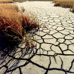
Why doesn't a drought end when it rains?
Rainfall in any form will provide some drought relief. A good analogy might be how medicine and illness relate to each other. A single dose of medicine can alleviate symptoms of illness, but it usually takes a sustained program of medication to cure an illness. Likewise, a single rainstorm will not break the drought, but it might provide temporary relief. A light to moderate shower will probably...
When does a drought begin and end?
The beginning of a drought is difficult to determine. Several weeks, months, or even years might pass before people know that a drought is occurring. The end of a drought can occur as gradually as it began. The first evidence of drought is usually seen in records of rainfall. Within a short period of time, the amount of moisture in soils can begin to decrease. The effects of a drought on flow in...
Where in the Nation are droughts or very low flows occurring now? How can I see these sites on a map and get to the data?
To view the USGS streamflow information on drought, see the drought map on our WaterWatch site, which shows below-normal, 7-day average streamflow compared to historical streamflow for the United States. Links to additional maps and drought data are listed on the USGS Drought website and the National Integrated Drought Information System (NIDIS) .
What causes drought?
A drought is a period of drier-than-normal conditions that results in water-related problems. The amount of precipitation at a particular location varies from year to year, but over a period of years the average amount is fairly constant. In the deserts of the Southwest, the average precipitation is less than 3 inches per year. In contrast, the average precipitation in the Northwest is more than...
Where can I find flood maps?
FEMA is the official public source for flood maps for insurance purposes: FEMA’s Flood Map Service Center FEMA’s National Flood Hazard Layer NOAA is responsible for producing flood forecast maps that combine precipitation data with USGS streamflow data: National Weather Service - Advanced Hydrologic Prediction Service River Forecasts Long-Range River Flood Risk Coastal Inundation Dashboard : Real...
How are floods predicted?
Flood predictions require several types of data: The amount of rainfall occurring on a real-time basis. The rate of change in river stage on a real-time basis, which can help indicate the severity and immediacy of the threat. Knowledge about the type of storm producing the moisture, such as duration, intensity and areal extent, which can be valuable for determining possible severity of the...
What are the two types of floods?
There are two basic types of floods: flash floods and the more widespread river floods. Flash floods generally cause greater loss of life and river floods generally cause greater loss of property. A flash flood occurs when runoff from excessive rainfall causes a rapid rise in the water height (stage) of a stream or normally-dry channel. Flash floods are more common in areas with a dry climate and...
Why are some lakes full of algae and thick plants?
Plants naturally grow in and around lakes, but sometimes lakes and ponds can get an overgrowth of plants, algae, or bacteria. In many cases, humans are responsible. Chemicals that are used on lawns and in agriculture (like nitrogen and potassium) wash into our water systems. Once there, plants and algae have a feast on this “food”. Sometimes overgrowths of cyanobacteria (called “blooms”) can make...
How does acid precipitation affect marble and limestone buildings?
When sulfurous, sulfuric, and nitric acids in polluted air and rain react with the calcite in marble and limestone, the calcite dissolves. In exposed areas of buildings and statues, we see roughened surfaces, removal of material, and loss of carved details. Stone surface material may be lost all over or only in spots that are more reactive. You might expect that sheltered areas of stone buildings...
How does mine drainage occur?
Mine drainage is surface water or groundwater that drains from an active or abandoned mine. In some cases, pyrite (an iron sulfide mineral) is exposed and reacts with air and water to form sulfuric acid and dissolved iron. Some or all of this iron can precipitate to form the red, orange, or yellow sediments in the bottom of streams containing mine drainage. The acid runoff further dissolves heavy...
What is methane and why is it a safety concern?
Methane (a gas composed of carbon and hydrogen) is produced two ways: Through biologic decomposition of organic matter at shallow depths. Swamps, landfills, and even shallow bedrock are some settings where this occurs. Methane can also be derived over millions of years by high pressure and high temperature processes that produce fossil fuels deep underground. Examples include coal deposits and oil...


