


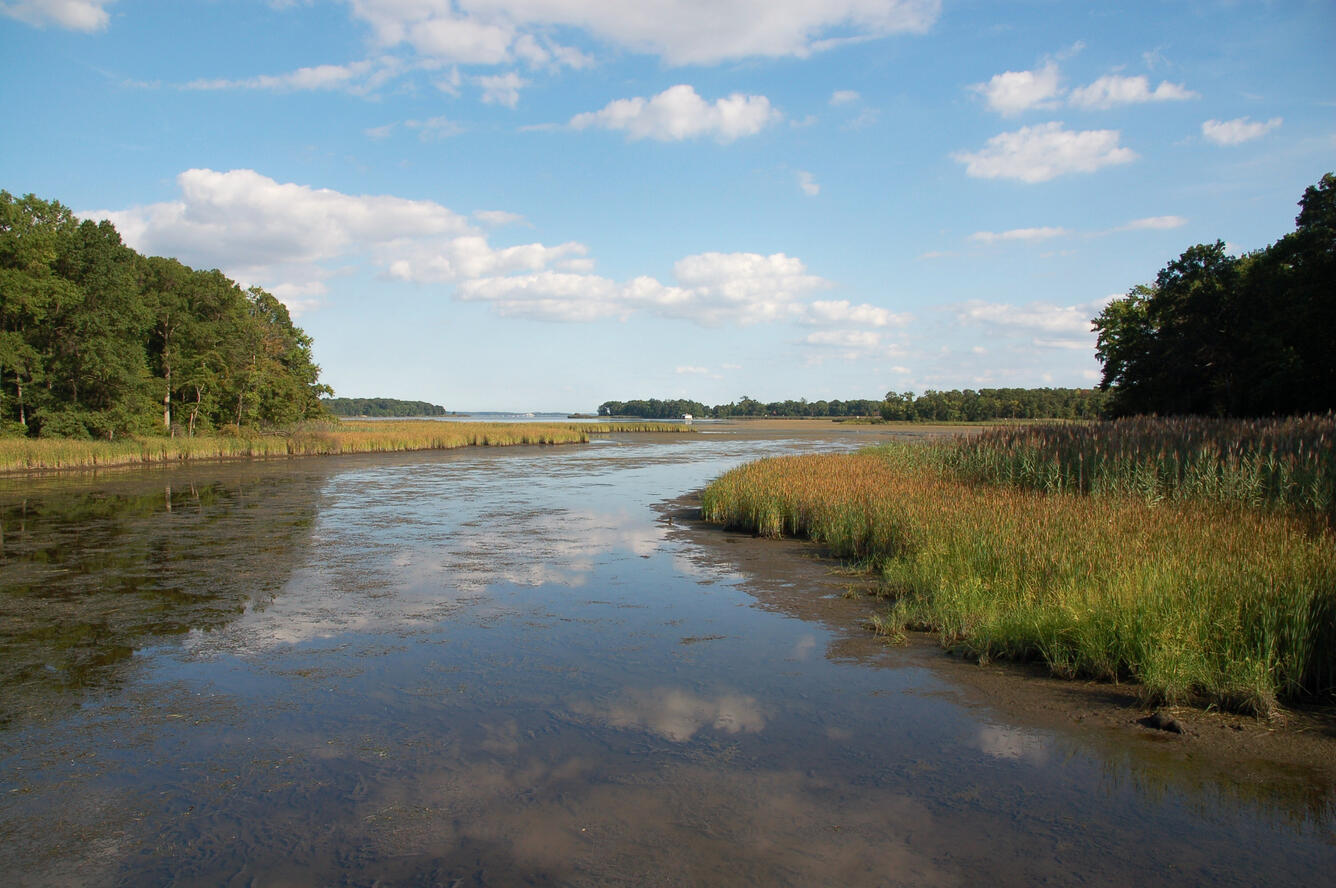
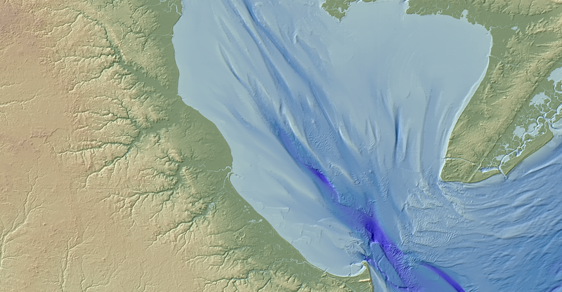
Salt marshes provide important economic and ecologic services but are vulnerable to habitat loss, particularly due to shoreline erosion from storms and sea level rise. Sediments eroded at the marsh edge are either delivered onto the marsh platform or into the estuary, the latter resulting in a net loss to the marsh sediment budget and released soil carbon.
Wetlands and Estuaries
Coastal wetlands and estuaries connect lands and watersheds to the ocean. They are biologically and physically dynamic and are among the most productive and valuable ecosystems in the world. Many different types of USGS scientists work together to increase our understanding of these ecosystems under past, present and future conditions, and how human activities influence them.
What is a coastal wetland?
Coastal wetlands are transitional areas between dry land and open water that are either permanently or seasonally inundated with fresh, brackish, or salt water. They contain a range of plant and animal species that are uniquely adapted to the wet soil conditions, the type of water present, and the degree of inundation.
Types of coastal wetlands include salt marshes, freshwater marshes, seagrass meadows, mangrove swamps, and forested swamps.
What is an estuary?
Estuaries are created where watersheds meet the ocean, bringing land-based waters and salt water from the ocean together. A dynamic ecosystem is created where river flows meet ocean tides. These regions offer food sources and shelter for many different species, including humans.
Estuaries also face a variety of issues that alter their productivity as an ecosystem—many related to the watershed that supplies water from the mainland, including:


Sources/Usage: Public Domain. View Media Details
Why are coastal wetlands and estuaries important?
Some of America’s largest cities and communities are located along wetlands and estuaries, such as New York-New Jersey Harbor, Chesapeake Bay, San Francisco Bay, Biscayne Bay, Puget Sound, Tampa Bay, and many others. Coastal wetlands and estuaries provide numerous critical benefits and services to society—these are known as ecosystem services. Specifically, they:
-
Protect coastal communities from storms and flooding
-
Help prevent erosion
-
Provide essential food, refuge, and nursery habitat for commercially and recreationally important species
-
Improve water quality by filtering runoff and absorbing excess nutrients
-
Decrease the effects of climate change by storing large quantities of the greenhouse gas carbon dioxide from the atmosphere
-
Provide recreational opportunities like boating, hiking, hunting, fishing, kayaking, and wildlife/bird watching
-
Serve as important areas of commerce, shipping activity, and ocean/port access
USGS Research
Estuaries are the mixing point between land and coasts. The water that flows into them is critical to their high biological productivity. Changes to the quality, quantity, and type of water, sediment, and river flow affect everything from the types of plants and animals that live there, the landscapes that develop, and the ecosystem services provided to coastal communities.
USGS scientists work in and bring expertise in hydrology, water chemistry, ecology, and sediment transport science, to integrate various information that can help forecast, predict, and identify threats or effects of changes. This helps decision-makers and resources managers develop science-based policies that balance sustainable use of these rich coastal ecosystems while maintaining their productivity for the benefit of all.

Sources/Usage: Public Domain. View Media Details
Storms, sea-level rise, and other elements of climate and coastal change often involve coastal engineering in order to accommodate human needs. These natural systems are highly adaptable. Many plant and animal species can move and grow in response to changing conditions, but some management actions like building coastal defense structures (e.g., seawalls and dikes) and maintaining roads restrict the ability of these coastal ecosystems to adapt or migrate. When estuaries and coastal wetlands are constrained by seawalls or unable to move, they can be inundated, dried out or exposed to too much salt or fresh water. When they are depleted or destroyed, the benefits and services they provide to people and the environment could be diminished or lost. The loss of estuary and wetland health can have far-reaching effects such as reduced fish catch, diminished water quality, algal blooms, and lost habitat and food sources for many migratory species.

Sources/Usage: Public Domain. View Media Details
The USGS conducts a variety of research on coastal wetlands and estuaries that support management decisions of federal, state, regional, and local partners and help in evaluating the effectiveness of restoring these valuable habitats so that will continue to provide the most benefits to society and ecosystems.
The USGS creates topobathymetric digital elevation models (DEMs) to assist with identifying flood, hurricane, and sea-level rise inundation hazard zones. These maps also assist with other earth science applications such as the development of sediment transport and storm surge models. The DEM data are important for a range of applications needed for climate change analysis in sensitive coastal regions. Access the Coastal National Elevation Database (CoNED) viewer.


Past, Present, and Future Conditions
USGS scientists collect basic observational data on physical processes (e.g., storms and sea-level rise) and human activities (e.g., nutrient loading), develop numerical models of these data, and apply models to understand the past, present, and future states of these ecosystems. Through this work, USGS scientists can assess vulnerability (e.g., UnVegetated-Vegetated marsh Ratio or UVVR), water-quality conditions, and resilience and identify human activities that are preventing wetland migration and causing tidal restriction, impoundments, and other issues causing degradation.

Sources/Usage: Public Domain. View Media Details
Blue Carbon
Additionally, USGS scientists are working to better understand blue carbon—carbon that is stored in coastal and marine ecosystems. Terrestrial and aquatic ecosystems can capture and store carbon dioxide from the atmosphere, a process known as carbon sequestration. Though coastal ecosystems, such as wetlands, may be smaller in size when compared to say, a forest, they can sequester more carbon per unit area, making them an incredible climate change mitigation tool.
USGS scientists are researching how environmental changes and human activities (e.g., land use management) can impact the ability of coastal wetlands and estuaries to sequester carbon and store it in soil and plant materials. These ecosystems are powerful carbon sinks and store carbon that has accumulated over hundreds to thousands of years. However, when coastal ecosystems are degraded or destroyed, their capacity to store carbon is diminished, and the carbon stored there can be released back into the atmosphere. Improved management of coastal wetlands and estuaries, leading to enhanced conservation and restoration, is therefore a crucial climate change mitigation strategy. Ultimately, USGS blue carbon research and science-based tools will help guide decision-making regarding climate change mitigation and adaptation, wetland restoration, coastal resilience, and carbon sequestration and storage.

Sources/Usage: Public Domain. View Media Details

Sources/Usage: Public Domain. View Media Details
Learn more.
Science
Priority Landscapes: San Francisco Bay-Delta
The San Francisco Bay-Delta PES is one way that USGS continues to provide science for the restoration and conservation of the SF Bay and its watershed. USGS research topics range from wetland restoration in the Bay to restoring habitat for anadromous fish (e.g., salmon) in the uplands. USGS has made several important discoveries critical to the fundamental understanding of this system and...
Sediment Transport in Coastal Environments
Our research goals are to provide the scientific information, knowledge, and tools required to ensure that decisions about land and resource use, management practices, and future development in the coastal zone and adjacent watersheds can be evaluated with a complete understanding of the probable effects on coastal ecosystems and communities, and a full assessment of their vulnerability to natural...
Coastal Habitats in Puget Sound
A Pacific Northwest icon, Puget Sound is the second-largest estuary in the United States. Its unique geology, climate, and nutrient-rich waters produce and sustain biologically productive coastal habitats. These same natural characteristics also contribute to a high quality of life that has led to growth in human population and urbanization. This growth has played a role in degrading the Sound...
Coastal watershed and estuary restoration in the Monterey Bay area
Objectives: Support further work by the USGS and collaborating federal, state, and local agencies and academic partners in analyzing the effectiveness of restoration work in coastal watersheds and estuaries in the Monterey Bay area. The USGS will play a supporting role in field efforts led by NOAA and California State University - Monterey Bay to measure physical and ecological changes in the...
Columbia River estuary
This research is part of the project “Sediment Transport in Coastal Environments.” We aim to support regional sediment management in the Columbia River littoral cell by monitoring and modeling shoreline change, modeling fate of disposed dredged material, and studying bedform morphology.
Multimedia

Marsh lateral shoreline erosion and shore-proximal sediment deposition
Salt marshes provide important economic and ecologic services but are vulnerable to habitat loss, particularly due to shoreline erosion from storms and sea level rise. Sediments eroded at the marsh edge are either delivered onto the marsh platform or into the estuary, the latter resulting in a net loss to the marsh sediment budget and released soil carbon.

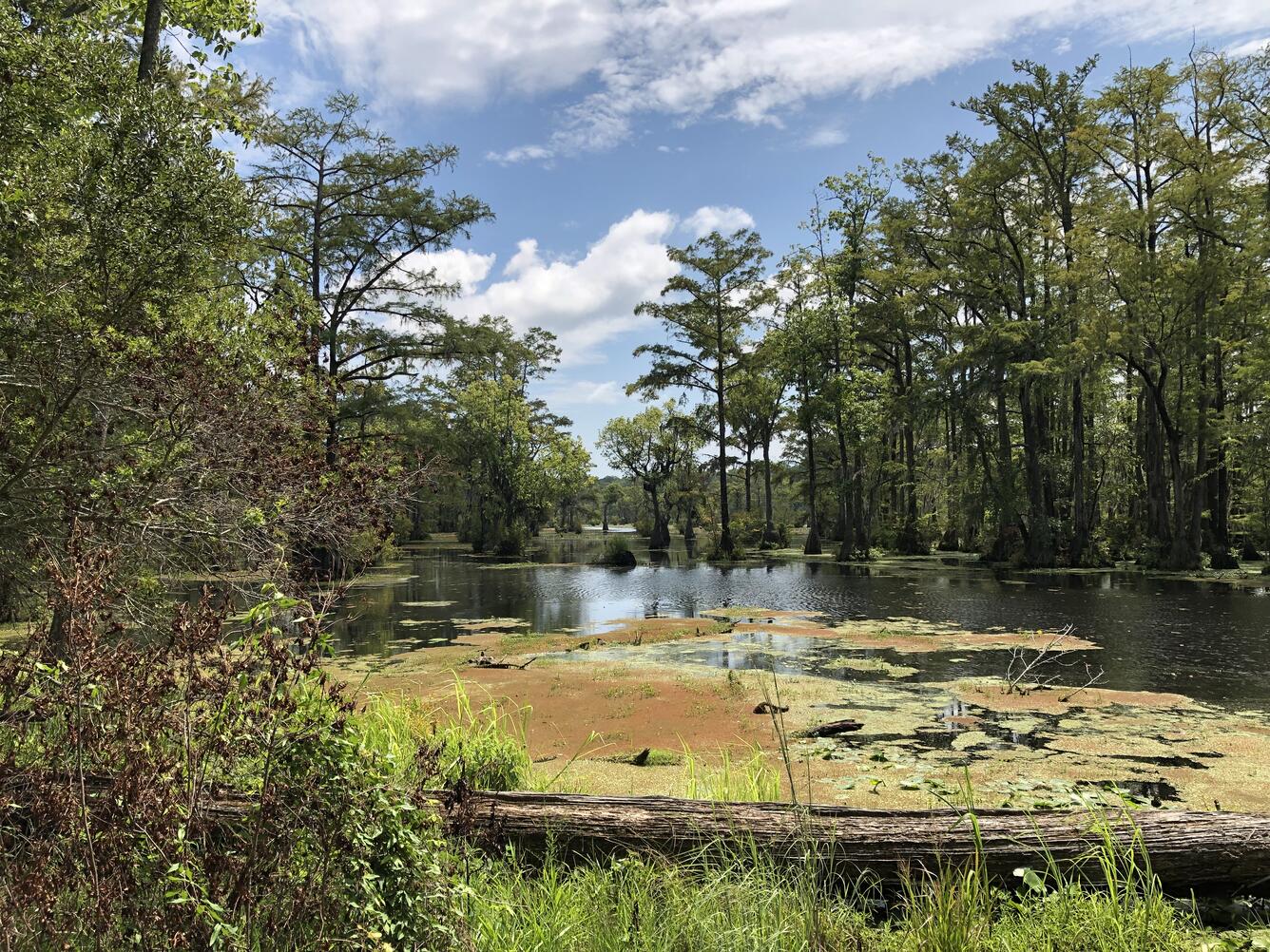
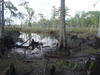
Snedden_coastal wetland.jpg
Coastal wetland

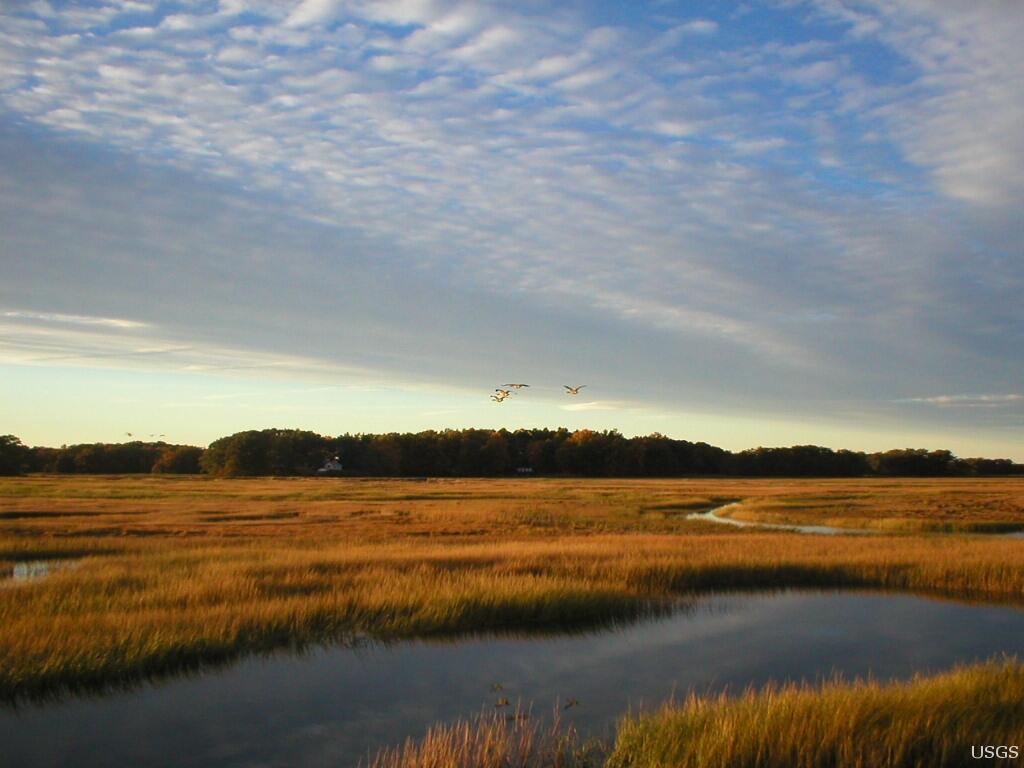
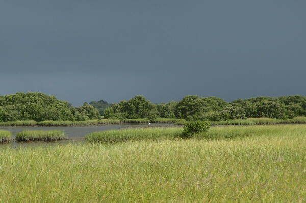
Tidal Marshland in the Plum Island Estuary, Massachusetts
The marshes of Plum Island Estuary are among those predicted by scientists to submerge during the next century under conservative projections of sea-level rise.
The marshes of Plum Island Estuary are among those predicted by scientists to submerge during the next century under conservative projections of sea-level rise.

Meagan Eagle and team in a coastal wetland
Sophie Kuhl, Simone Gibson, Meagan Eagle, and Lindsey Smith in a coastal wetland, Mashpee, Massachusetts. Photo credit Jen O'Keefe Suttles (USG
Sophie Kuhl, Simone Gibson, Meagan Eagle, and Lindsey Smith in a coastal wetland, Mashpee, Massachusetts. Photo credit Jen O'Keefe Suttles (USG

Algal Accumulation at Ferguson Marsh
Algal accumulation at Ferguson Marsh in the Perry Lake Wetland Complex.
Algal accumulation at Ferguson Marsh in the Perry Lake Wetland Complex.


Spartina patens-dominated high marsh
Spartina patens-dominated high marsh in Grand Chenier, Louisiana in 2019.
Spartina patens-dominated high marsh in Grand Chenier, Louisiana in 2019.

Wonderful Watery Wetlands - Part 2
Scientists at the U.S. Geological Survey Wetland and Aquatic Research Center (www.usgs.gov/warc) study important aspects of wetlands, such as the flow and quality of water, the chemistry of soil, and the plants and animals which call this ecosystem home.
Scientists at the U.S. Geological Survey Wetland and Aquatic Research Center (www.usgs.gov/warc) study important aspects of wetlands, such as the flow and quality of water, the chemistry of soil, and the plants and animals which call this ecosystem home.
")
What makes a wetland a wetland? (Part 1)
Scientists at the U.S. Geological Survey Wetland and Aquatic Research Center study important aspects of wetlands, such as the flow and quality of water, the chemistry of soil, and the plants and animals which call this ecosystem home.
Scientists at the U.S. Geological Survey Wetland and Aquatic Research Center study important aspects of wetlands, such as the flow and quality of water, the chemistry of soil, and the plants and animals which call this ecosystem home.
Filter Total Items: 29

The Response of Coastal Wetlands to Sea-level Rise: Understanding how Macroscale Drivers Influence Local Processes and Feedbacks
The purpose of this work is to advance our understanding of how coastal wetland responses to sea-level rise (SLR) within the conterminous United States are likely to vary as a function of local, regional, and macroscale drivers, including climate. Based on our interactions with managers and decision makers, as well as our knowledge of the current state of the science, we propose to: (a) conduct a...

Impacts of coastal and watershed changes on upper estuaries: causes and implications of wetland ecosystem transitions along the US Atlantic and Gulf Coasts
Estuaries and their surrounding wetlands are coastal transition zones where freshwater rivers meet tidal seawater. As sea levels rise, tidal forces move saltier water farther upstream, extending into freshwater wetland areas. Human changes to the surrounding landscape may amplify the effects of this tidal extension, impacting the resiliency and function of the upper estuarine wetlands. One visible...

Ecological Modeling in Support of the Western Everglades Restoration Project
Joint Ecosystem Modeling (JEM) provides ecological models tailored to address specific management issues, for example, the Western Everglades Restoration Project.

The Story of the USGS Research Vessel (R/V) Polaris
For the past 50 years, the USGS has been conducting research in the San Francisco Bay and Delta, California and beyond. This research would not have been possible without the Research Vessel (R/V) Polaris . Many scientists who have been fortunate to work on the Polaris have come and gone, but the Polaris sailed from the South San Francisco Bay continuously from 1968 until her retirement in 2015.

Estuarine Processes, Hazards, and Ecosystems
Estuarine processes, hazards, and ecosystems describes several interdisciplinary projects that aim to quantify and understand estuarine processes through observations and numerical modeling. Both the spatial and temporal scales of these mechanisms are important, and therefore require modern instrumentation and state-of-the-art hydrodynamic models. These projects are led from the U.S. Geological...

Coastal and Estuarine Dynamics Project
Coastal and Estuarine Dynamics Project exists to support ocean, coastal and estuarine research. The staff have a broad set of skills; from instrument design and development to all forms of work at sea to software development and data management. The team has successfully deployed and recovered more than 1000 data collection platforms for research in the last 30 years.

Coastal National Elevation Database (CoNED) Applications Project
High-resolution coastal elevation data is required to identify flood, hurricane, and sea-level rise inundation hazard zones and other earth science applications, such as the development of sediment transport and storm surge models. Light detection and ranging (lidar) enables the rapid collection of very accurate elevation data over large areas, and during the last decade, airborne laser altimetry...

Environmental Geochemistry
Coastal Environmental Geochemistry research at the Woods Hole Coastal and Marine Science Center spans multiple ecosystems and topics, including coastal wetlands, aquifers, and estuaries, with the goal of providing data and guidance to federal, state, local, and private land owners and managers on these vital ecosystems.

Sea Level Rise and Climate: Impacts on the Greater Everglades Ecosystem and Restoration
The Greater Everglades Ecosystem covers much of south Florida, and the highest areas are only a few meters above sea level. Predictions of sea level rise and changes in storm intensity for the 21st century are particularly concerning to the urban population of Miami and the east coast, but also represent a challenge to Everglades National Park and Biscayne National Park resource managers. The...

USGS EROS Archive - Digital Elevation - Coastal National Elevation Database (CoNED) Project - Topobathymetric Digital Elevation Model (TBDEM)
The Coastal National Elevation Database (CoNED) Project - topobathymetric digital elevation models (TBDEMs) are merged renderings of both topography (land elevation) and bathymetry (water depth) to provide seamless elevation products for select coastal regions in the United States (2011-present).

Coastal National Elevation Database (CoNED) Applications
The Coastal National Elevation Database (CoNED) and Applications project at EROS offers information used for a range of applications analysis needed for climate change analysis.

Hyper-Temporal Land Area Change Rates in Coastal Louisiana from 1973 to 2015
This study analyzes changes in the extent of land in coastal Louisiana by using an average of 81 datasets (multiple dates of satellite data from 1973 to 2014) for summarizing land and water areas.
Filter Total Items: 43
Coastal Wetland near Cedar Key National Wildlife Refuge
A coastal wetland near Cedar Key National Wildlife Refuge (Florida) that contains a mixture of salt marsh grasses and mangrove trees. This location is near the northern range limit of mangrove forests in Florida. Thus, freeze events in the past have prevented mangrove forests from outcompeting the salt marsh plants.
A coastal wetland near Cedar Key National Wildlife Refuge (Florida) that contains a mixture of salt marsh grasses and mangrove trees. This location is near the northern range limit of mangrove forests in Florida. Thus, freeze events in the past have prevented mangrove forests from outcompeting the salt marsh plants.

Rapid salt-marsh erosion in Grand Bay, Mississippi
This time-lapse video shows lateral erosion of a salt marsh in the Grand Bay National Estuarine Research Reserve, part of an embayment near the city of Pascagoula, Mississippi, on the US Gulf coast. Wave action over the course of 6.5 months led to about 1.5 meters of erosion.
This time-lapse video shows lateral erosion of a salt marsh in the Grand Bay National Estuarine Research Reserve, part of an embayment near the city of Pascagoula, Mississippi, on the US Gulf coast. Wave action over the course of 6.5 months led to about 1.5 meters of erosion.

Preparing oceanographic platform in Forsythe NWR, NJ
Neil Ganju (standing) and Patrick Dickhudt preparing an oceanographic platform to measure wetland sediment transport in Forsythe NWR, New Jersey
Neil Ganju (standing) and Patrick Dickhudt preparing an oceanographic platform to measure wetland sediment transport in Forsythe NWR, New Jersey
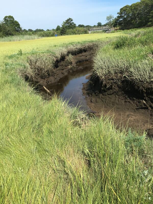
Salt Marsh Creek, Cape Cod, MA
Salt marsh creek at low tide with a tidal restriction/bridge in the background.
Salt marsh creek at low tide with a tidal restriction/bridge in the background.

Rhode Island Salt Marsh Vegetation
Photograph of salt marsh vegetation at a coring site near Narragansett Bay, Rhode Island
Photograph of salt marsh vegetation at a coring site near Narragansett Bay, Rhode Island

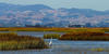
Great Blue Heron (Ardea herodias)
A great blue heron standing in the marsh at Merritt Island National Wildlife Refuge near the Kennedy Space Center.
A great blue heron standing in the marsh at Merritt Island National Wildlife Refuge near the Kennedy Space Center.
Disentangling the mechanisms regulating coastal wetland sustainability in the face of rising sea levels
linkDisentangling the mechanisms regulating coastal wetland sustainability in the face of rising sea levels
Disentangling the mechanisms regulating coastal wetland sustainability in the face of rising sea levels
linkDisentangling the mechanisms regulating coastal wetland sustainability in the face of rising sea levels

Juncus Marsh
Photograph of a Juncus marsh in the Tampa Bay estuary, Florida.
Photograph of a Juncus marsh in the Tampa Bay estuary, Florida.

Daniel Ciarletta, USGS Research Geologist, in a back-barrier marsh
Daniel Ciarletta, USGS Research Geologist and Mendenhall Research Fellow stands in the back-barrier marsh of Parramore Island, Virginia, one research location where he studies long-term sediment dynamics of barrier island systems.
Daniel Ciarletta, USGS Research Geologist and Mendenhall Research Fellow stands in the back-barrier marsh of Parramore Island, Virginia, one research location where he studies long-term sediment dynamics of barrier island systems.
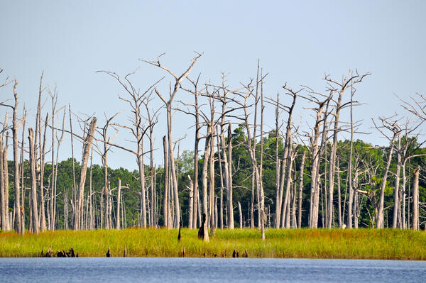
Ghost Forest in South Carolina
A ghost forest in tidal freshwater forested wetlands of the Sampit River, South Carolina.
Photo taken June 17, 2015 by Dr. William Conner, Clemson University
A ghost forest in tidal freshwater forested wetlands of the Sampit River, South Carolina.
Photo taken June 17, 2015 by Dr. William Conner, Clemson University

Collecting pre-sampling measurements in a coastal wetland
USGS hydrologist Tristen Tagliaferri collecting pre-sampling measurements in a coastal wetland after an aerial application of the mosquito insecticide methoprene
USGS hydrologist Tristen Tagliaferri collecting pre-sampling measurements in a coastal wetland after an aerial application of the mosquito insecticide methoprene
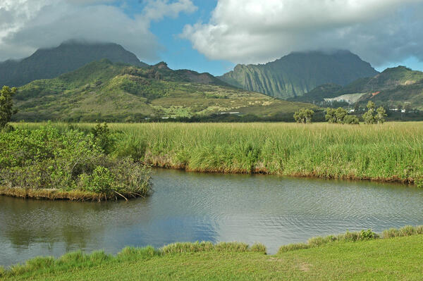
Kawainu Marsh, Oahu
Kawainu Marsh, Oahu

Coastal wetlands near Port Fourchon, La., Northern Gulf of Mexico
To understand how changes in rainfall and temperature might affect coastal wetlands in the northern Gulf of Mexico, USGS researchers conducted field studies at 10 estuaries in five states (Texas, Louisiana, Mississippi, Alabama, and Florida). The fieldwork took place in a variety of coastal wetland types, including mangroves, marshes, and salt flats.
To understand how changes in rainfall and temperature might affect coastal wetlands in the northern Gulf of Mexico, USGS researchers conducted field studies at 10 estuaries in five states (Texas, Louisiana, Mississippi, Alabama, and Florida). The fieldwork took place in a variety of coastal wetland types, including mangroves, marshes, and salt flats.

Brown Marsh in Southeast Louisiana
Brown Marsh observed in southeastern Terrebonne Basin, La
Brown Marsh observed in southeastern Terrebonne Basin, La

Coastal Wetland near Port Fourchon, Louisiana
A coastal wetland near Port Fourchon (Louisiana) that contains a mixture of salt marsh grasses and mangrove trees. This location is near the northern range limit of mangrove forests in Louisiana. Thus, freeze events in the past have prevented mangrove forests from outcompeting the salt marsh plants.
A coastal wetland near Port Fourchon (Louisiana) that contains a mixture of salt marsh grasses and mangrove trees. This location is near the northern range limit of mangrove forests in Louisiana. Thus, freeze events in the past have prevented mangrove forests from outcompeting the salt marsh plants.

Eastern Shore of Maryland Coastal Wetland
An example of a disappearing marsh in the Eastern Shore of Maryland part of the Mid-Atlantic USA.
An example of a disappearing marsh in the Eastern Shore of Maryland part of the Mid-Atlantic USA.
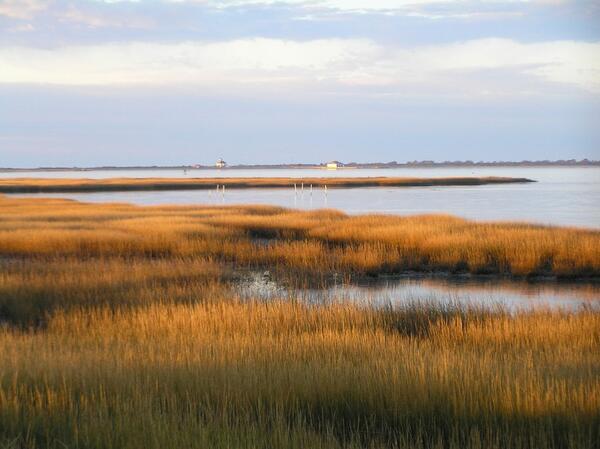
Photo of the salt marsh at Assateague Island
Scenic view of the salt mashes at Assateague Island National Seashore
Scenic view of the salt mashes at Assateague Island National Seashore
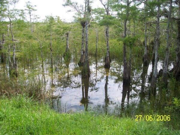
Flooded marsh in Everglades National Park
Flooded marsh in Everglades National Park
Flooded marsh in Everglades National Park

Great Blue Heron
Great Blue Herons are found throughout much of North America, but are always associated with water. Because they fish by sight, they need relatively shallow water. Release of too much water through the canals north of the Everglades can interfere with their ability to find food.
Great Blue Herons are found throughout much of North America, but are always associated with water. Because they fish by sight, they need relatively shallow water. Release of too much water through the canals north of the Everglades can interfere with their ability to find food.
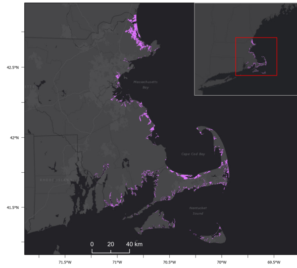
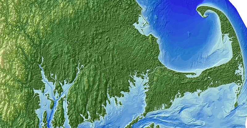
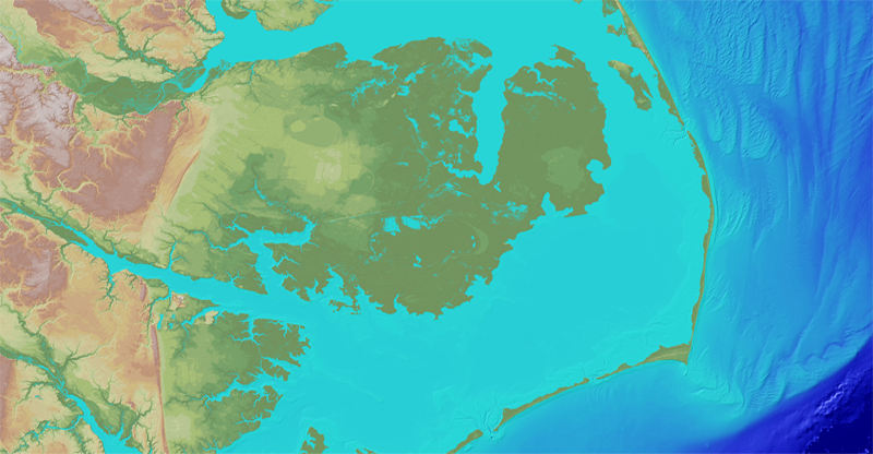
Location Map of Massachusetts Salt Marshes
Location Map of Massachusetts Salt Marshes.
Location Map of Massachusetts Salt Marshes.
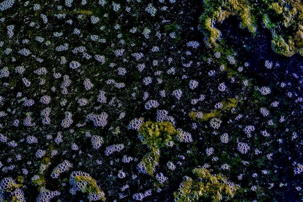
Marsh Gas
Bubbles of methane, also known as marsh gas, created by methanogens.
Bubbles of methane, also known as marsh gas, created by methanogens.
- Overview
What is a coastal wetland?
Coastal wetlands are transitional areas between dry land and open water that are either permanently or seasonally inundated with fresh, brackish, or salt water. They contain a range of plant and animal species that are uniquely adapted to the wet soil conditions, the type of water present, and the degree of inundation.
Types of coastal wetlands include salt marshes, freshwater marshes, seagrass meadows, mangrove swamps, and forested swamps.
Coastal wetlands are among the most productive and valuable ecosystems in the world—comparable to even rainforests and coral reefs. They are often referred to as natural sponges or nature’s kidneys because they slow the flow of water across the watershed, filter out pollutants and excess nutrients, and even absorb and store large quantities of the greenhouse gas carbon dioxide. These capabilities help protect coastal communities from storms and flooding, prevent erosion, improve water quality, and decrease the effects of climate change. Listen to the audio-described version. What is an estuary?
Estuaries are created where watersheds meet the ocean, bringing land-based waters and salt water from the ocean together. A dynamic ecosystem is created where river flows meet ocean tides. These regions offer food sources and shelter for many different species, including humans.
Estuaries also face a variety of issues that alter their productivity as an ecosystem—many related to the watershed that supplies water from the mainland, including:


 Sources/Usage: Public Domain. View Media Details
USGS studies coastal wetlands and estuaries around the Nation. Here are just a few examples. Why are coastal wetlands and estuaries important?
Some of America’s largest cities and communities are located along wetlands and estuaries, such as New York-New Jersey Harbor, Chesapeake Bay, San Francisco Bay, Biscayne Bay, Puget Sound, Tampa Bay, and many others. Coastal wetlands and estuaries provide numerous critical benefits and services to society—these are known as ecosystem services. Specifically, they:
-
Protect coastal communities from storms and flooding
-
Help prevent erosion
-
Provide essential food, refuge, and nursery habitat for commercially and recreationally important species
-
Improve water quality by filtering runoff and absorbing excess nutrients
-
Decrease the effects of climate change by storing large quantities of the greenhouse gas carbon dioxide from the atmosphere
-
Provide recreational opportunities like boating, hiking, hunting, fishing, kayaking, and wildlife/bird watching
-
Serve as important areas of commerce, shipping activity, and ocean/port access
USGS Research
Estuaries are the mixing point between land and coasts. The water that flows into them is critical to their high biological productivity. Changes to the quality, quantity, and type of water, sediment, and river flow affect everything from the types of plants and animals that live there, the landscapes that develop, and the ecosystem services provided to coastal communities.
USGS scientists work in and bring expertise in hydrology, water chemistry, ecology, and sediment transport science, to integrate various information that can help forecast, predict, and identify threats or effects of changes. This helps decision-makers and resources managers develop science-based policies that balance sustainable use of these rich coastal ecosystems while maintaining their productivity for the benefit of all.
Sources/Usage: Public Domain. View Media DetailsSalt marshes provide important economic and ecologic services but are vulnerable to habitat loss, particularly due to shoreline erosion from storms and sea level rise. Sediments eroded at the marsh edge are either delivered onto the marsh platform or into the estuary, the latter resulting in a net loss to the marsh sediment budget and released soil carbon. Knowledge on the timing, distance, and quantity of sediment deposition versus shoreline erosion along the marsh-estuary interface is critical for evaluating the overall health and vulnerability of coastal marshes to future scenarios of sea level rise and storms. This image is a depiction of what happens to sediments as they are eroded at the marsh edge, delivered into the estuary and onto the marsh platform, leading to a higher marsh platform elevation at the marsh shoreline, but loss of wetland habitat area at the eroding shoreline edge. Storms, sea-level rise, and other elements of climate and coastal change often involve coastal engineering in order to accommodate human needs. These natural systems are highly adaptable. Many plant and animal species can move and grow in response to changing conditions, but some management actions like building coastal defense structures (e.g., seawalls and dikes) and maintaining roads restrict the ability of these coastal ecosystems to adapt or migrate. When estuaries and coastal wetlands are constrained by seawalls or unable to move, they can be inundated, dried out or exposed to too much salt or fresh water. When they are depleted or destroyed, the benefits and services they provide to people and the environment could be diminished or lost. The loss of estuary and wetland health can have far-reaching effects such as reduced fish catch, diminished water quality, algal blooms, and lost habitat and food sources for many migratory species.
Sources/Usage: Public Domain. View Media DetailsGraphic showing how drought can impact coastal estuarine ecosystems in the U.S. Caribbean. The USGS conducts a variety of research on coastal wetlands and estuaries that support management decisions of federal, state, regional, and local partners and help in evaluating the effectiveness of restoring these valuable habitats so that will continue to provide the most benefits to society and ecosystems.
The USGS creates topobathymetric digital elevation models (DEMs) to assist with identifying flood, hurricane, and sea-level rise inundation hazard zones. These maps also assist with other earth science applications such as the development of sediment transport and storm surge models. The DEM data are important for a range of applications needed for climate change analysis in sensitive coastal regions. Access the Coastal National Elevation Database (CoNED) viewer.


Past, Present, and Future Conditions
USGS scientists collect basic observational data on physical processes (e.g., storms and sea-level rise) and human activities (e.g., nutrient loading), develop numerical models of these data, and apply models to understand the past, present, and future states of these ecosystems. Through this work, USGS scientists can assess vulnerability (e.g., UnVegetated-Vegetated marsh Ratio or UVVR), water-quality conditions, and resilience and identify human activities that are preventing wetland migration and causing tidal restriction, impoundments, and other issues causing degradation.
Researchers with the [U.S. Geological Survey (USGS) St. Petersburg Coastal and Marine Science Center (SPCMSC) have been working within the Grand Bay National Estuarine Research Reserve and Grand Bay National Wildlife Refuge to track how marsh shorelines are changing over time, study how sediment moves between the marsh and the estuary, and predict how the marsh is responding to sea-level rise. Any use of trade, firm, logos, or product names is for descriptive purposes only and does not imply endorsement by the U.S. Government.
Sources/Usage: Public Domain. View Media DetailsMap showing blue carbon study locations in the United States: Nisqually National Wildlife Refuge, San Francisco Bay National Estuarine Research Reserve, Barataria-Terrebonne National Estuary Program, Shark River, Ding Darling National Wildlife Refuge, LCMAP mangrove change detection pilot study, Great Dismal Swamp and Pocosin Lake National Wildlife Refuge, Chesapeake Bay Smithsonian Environmental Research Center, Waquoit Bay National Estuarine Research Reserve. Blue Carbon
Additionally, USGS scientists are working to better understand blue carbon—carbon that is stored in coastal and marine ecosystems. Terrestrial and aquatic ecosystems can capture and store carbon dioxide from the atmosphere, a process known as carbon sequestration. Though coastal ecosystems, such as wetlands, may be smaller in size when compared to say, a forest, they can sequester more carbon per unit area, making them an incredible climate change mitigation tool.
USGS scientists are researching how environmental changes and human activities (e.g., land use management) can impact the ability of coastal wetlands and estuaries to sequester carbon and store it in soil and plant materials. These ecosystems are powerful carbon sinks and store carbon that has accumulated over hundreds to thousands of years. However, when coastal ecosystems are degraded or destroyed, their capacity to store carbon is diminished, and the carbon stored there can be released back into the atmosphere. Improved management of coastal wetlands and estuaries, leading to enhanced conservation and restoration, is therefore a crucial climate change mitigation strategy. Ultimately, USGS blue carbon research and science-based tools will help guide decision-making regarding climate change mitigation and adaptation, wetland restoration, coastal resilience, and carbon sequestration and storage.
Sources/Usage: Public Domain. View Media DetailsModel-data assimilation workflow for Land Use and Carbon Scenario Simulator (LUCAS) model in coastal “blue carbon” ecosystems of Louisiana.
Sources/Usage: Public Domain. View Media DetailsMeasuring ecosystem-atmosphere carbon exchange at the leaf-level (left) using a porometer and at the ecosystem-level (right) using eddy covariance.
Learn more.Science
Priority Landscapes: San Francisco Bay-Delta
The San Francisco Bay-Delta PES is one way that USGS continues to provide science for the restoration and conservation of the SF Bay and its watershed. USGS research topics range from wetland restoration in the Bay to restoring habitat for anadromous fish (e.g., salmon) in the uplands. USGS has made several important discoveries critical to the fundamental understanding of this system and...Sediment Transport in Coastal Environments
Our research goals are to provide the scientific information, knowledge, and tools required to ensure that decisions about land and resource use, management practices, and future development in the coastal zone and adjacent watersheds can be evaluated with a complete understanding of the probable effects on coastal ecosystems and communities, and a full assessment of their vulnerability to natural...Coastal Habitats in Puget Sound
A Pacific Northwest icon, Puget Sound is the second-largest estuary in the United States. Its unique geology, climate, and nutrient-rich waters produce and sustain biologically productive coastal habitats. These same natural characteristics also contribute to a high quality of life that has led to growth in human population and urbanization. This growth has played a role in degrading the Sound...Coastal watershed and estuary restoration in the Monterey Bay area
Objectives: Support further work by the USGS and collaborating federal, state, and local agencies and academic partners in analyzing the effectiveness of restoration work in coastal watersheds and estuaries in the Monterey Bay area. The USGS will play a supporting role in field efforts led by NOAA and California State University - Monterey Bay to measure physical and ecological changes in the...Columbia River estuary
This research is part of the project “Sediment Transport in Coastal Environments.” We aim to support regional sediment management in the Columbia River littoral cell by monitoring and modeling shoreline change, modeling fate of disposed dredged material, and studying bedform morphology.Multimedia
Marsh lateral shoreline erosion and shore-proximal sediment depositionSalt marshes provide important economic and ecologic services but are vulnerable to habitat loss, particularly due to shoreline erosion from storms and sea level rise. Sediments eroded at the marsh edge are either delivered onto the marsh platform or into the estuary, the latter resulting in a net loss to the marsh sediment budget and released soil carbon.
Salt marshes provide important economic and ecologic services but are vulnerable to habitat loss, particularly due to shoreline erosion from storms and sea level rise. Sediments eroded at the marsh edge are either delivered onto the marsh platform or into the estuary, the latter resulting in a net loss to the marsh sediment budget and released soil carbon.
Snedden_coastal wetland.jpgCoastal wetland
Tidal Marshland in the Plum Island Estuary, MassachusettsThe marshes of Plum Island Estuary are among those predicted by scientists to submerge during the next century under conservative projections of sea-level rise.
The marshes of Plum Island Estuary are among those predicted by scientists to submerge during the next century under conservative projections of sea-level rise.
Meagan Eagle and team in a coastal wetlandSophie Kuhl, Simone Gibson, Meagan Eagle, and Lindsey Smith in a coastal wetland, Mashpee, Massachusetts. Photo credit Jen O'Keefe Suttles (USG
Sophie Kuhl, Simone Gibson, Meagan Eagle, and Lindsey Smith in a coastal wetland, Mashpee, Massachusetts. Photo credit Jen O'Keefe Suttles (USG
Algal Accumulation at Ferguson MarshAlgal accumulation at Ferguson Marsh in the Perry Lake Wetland Complex.
Algal accumulation at Ferguson Marsh in the Perry Lake Wetland Complex.
Spartina patens-dominated high marshSpartina patens-dominated high marsh in Grand Chenier, Louisiana in 2019.
Spartina patens-dominated high marsh in Grand Chenier, Louisiana in 2019.
Wonderful Watery Wetlands - Part 2Scientists at the U.S. Geological Survey Wetland and Aquatic Research Center (www.usgs.gov/warc) study important aspects of wetlands, such as the flow and quality of water, the chemistry of soil, and the plants and animals which call this ecosystem home.
Scientists at the U.S. Geological Survey Wetland and Aquatic Research Center (www.usgs.gov/warc) study important aspects of wetlands, such as the flow and quality of water, the chemistry of soil, and the plants and animals which call this ecosystem home.
What makes a wetland a wetland? (Part 1)Scientists at the U.S. Geological Survey Wetland and Aquatic Research Center study important aspects of wetlands, such as the flow and quality of water, the chemistry of soil, and the plants and animals which call this ecosystem home.
Scientists at the U.S. Geological Survey Wetland and Aquatic Research Center study important aspects of wetlands, such as the flow and quality of water, the chemistry of soil, and the plants and animals which call this ecosystem home.
- Publications
- Science
Filter Total Items: 29
The Response of Coastal Wetlands to Sea-level Rise: Understanding how Macroscale Drivers Influence Local Processes and Feedbacks
The purpose of this work is to advance our understanding of how coastal wetland responses to sea-level rise (SLR) within the conterminous United States are likely to vary as a function of local, regional, and macroscale drivers, including climate. Based on our interactions with managers and decision makers, as well as our knowledge of the current state of the science, we propose to: (a) conduct a...Impacts of coastal and watershed changes on upper estuaries: causes and implications of wetland ecosystem transitions along the US Atlantic and Gulf Coasts
Estuaries and their surrounding wetlands are coastal transition zones where freshwater rivers meet tidal seawater. As sea levels rise, tidal forces move saltier water farther upstream, extending into freshwater wetland areas. Human changes to the surrounding landscape may amplify the effects of this tidal extension, impacting the resiliency and function of the upper estuarine wetlands. One visible...Ecological Modeling in Support of the Western Everglades Restoration Project
Joint Ecosystem Modeling (JEM) provides ecological models tailored to address specific management issues, for example, the Western Everglades Restoration Project.The Story of the USGS Research Vessel (R/V) Polaris
For the past 50 years, the USGS has been conducting research in the San Francisco Bay and Delta, California and beyond. This research would not have been possible without the Research Vessel (R/V) Polaris . Many scientists who have been fortunate to work on the Polaris have come and gone, but the Polaris sailed from the South San Francisco Bay continuously from 1968 until her retirement in 2015.Estuarine Processes, Hazards, and Ecosystems
Estuarine processes, hazards, and ecosystems describes several interdisciplinary projects that aim to quantify and understand estuarine processes through observations and numerical modeling. Both the spatial and temporal scales of these mechanisms are important, and therefore require modern instrumentation and state-of-the-art hydrodynamic models. These projects are led from the U.S. Geological...Coastal and Estuarine Dynamics Project
Coastal and Estuarine Dynamics Project exists to support ocean, coastal and estuarine research. The staff have a broad set of skills; from instrument design and development to all forms of work at sea to software development and data management. The team has successfully deployed and recovered more than 1000 data collection platforms for research in the last 30 years.Coastal National Elevation Database (CoNED) Applications Project
High-resolution coastal elevation data is required to identify flood, hurricane, and sea-level rise inundation hazard zones and other earth science applications, such as the development of sediment transport and storm surge models. Light detection and ranging (lidar) enables the rapid collection of very accurate elevation data over large areas, and during the last decade, airborne laser altimetry...Environmental Geochemistry
Coastal Environmental Geochemistry research at the Woods Hole Coastal and Marine Science Center spans multiple ecosystems and topics, including coastal wetlands, aquifers, and estuaries, with the goal of providing data and guidance to federal, state, local, and private land owners and managers on these vital ecosystems.Sea Level Rise and Climate: Impacts on the Greater Everglades Ecosystem and Restoration
The Greater Everglades Ecosystem covers much of south Florida, and the highest areas are only a few meters above sea level. Predictions of sea level rise and changes in storm intensity for the 21st century are particularly concerning to the urban population of Miami and the east coast, but also represent a challenge to Everglades National Park and Biscayne National Park resource managers. The...USGS EROS Archive - Digital Elevation - Coastal National Elevation Database (CoNED) Project - Topobathymetric Digital Elevation Model (TBDEM)
The Coastal National Elevation Database (CoNED) Project - topobathymetric digital elevation models (TBDEMs) are merged renderings of both topography (land elevation) and bathymetry (water depth) to provide seamless elevation products for select coastal regions in the United States (2011-present).Coastal National Elevation Database (CoNED) Applications
The Coastal National Elevation Database (CoNED) and Applications project at EROS offers information used for a range of applications analysis needed for climate change analysis.Hyper-Temporal Land Area Change Rates in Coastal Louisiana from 1973 to 2015
This study analyzes changes in the extent of land in coastal Louisiana by using an average of 81 datasets (multiple dates of satellite data from 1973 to 2014) for summarizing land and water areas. - Data and More
- Maps
- Multimedia
Filter Total Items: 43
Coastal Wetland near Cedar Key National Wildlife Refuge
A coastal wetland near Cedar Key National Wildlife Refuge (Florida) that contains a mixture of salt marsh grasses and mangrove trees. This location is near the northern range limit of mangrove forests in Florida. Thus, freeze events in the past have prevented mangrove forests from outcompeting the salt marsh plants.
A coastal wetland near Cedar Key National Wildlife Refuge (Florida) that contains a mixture of salt marsh grasses and mangrove trees. This location is near the northern range limit of mangrove forests in Florida. Thus, freeze events in the past have prevented mangrove forests from outcompeting the salt marsh plants.
Rapid salt-marsh erosion in Grand Bay, MississippiThis time-lapse video shows lateral erosion of a salt marsh in the Grand Bay National Estuarine Research Reserve, part of an embayment near the city of Pascagoula, Mississippi, on the US Gulf coast. Wave action over the course of 6.5 months led to about 1.5 meters of erosion.
This time-lapse video shows lateral erosion of a salt marsh in the Grand Bay National Estuarine Research Reserve, part of an embayment near the city of Pascagoula, Mississippi, on the US Gulf coast. Wave action over the course of 6.5 months led to about 1.5 meters of erosion.
Preparing oceanographic platform in Forsythe NWR, NJNeil Ganju (standing) and Patrick Dickhudt preparing an oceanographic platform to measure wetland sediment transport in Forsythe NWR, New Jersey
Neil Ganju (standing) and Patrick Dickhudt preparing an oceanographic platform to measure wetland sediment transport in Forsythe NWR, New Jersey
Salt Marsh Creek, Cape Cod, MASalt marsh creek at low tide with a tidal restriction/bridge in the background.
Salt marsh creek at low tide with a tidal restriction/bridge in the background.
Rhode Island Salt Marsh VegetationPhotograph of salt marsh vegetation at a coring site near Narragansett Bay, Rhode Island
Photograph of salt marsh vegetation at a coring site near Narragansett Bay, Rhode Island
Great Blue Heron (Ardea herodias)A great blue heron standing in the marsh at Merritt Island National Wildlife Refuge near the Kennedy Space Center.
A great blue heron standing in the marsh at Merritt Island National Wildlife Refuge near the Kennedy Space Center.
Disentangling the mechanisms regulating coastal wetland sustainability in the face of rising sea levelsDisentangling the mechanisms regulating coastal wetland sustainability in the face of rising sea levels
linkDisentangling the mechanisms regulating coastal wetland sustainability in the face of rising sea levels
Disentangling the mechanisms regulating coastal wetland sustainability in the face of rising sea levels
linkDisentangling the mechanisms regulating coastal wetland sustainability in the face of rising sea levels
Juncus MarshPhotograph of a Juncus marsh in the Tampa Bay estuary, Florida.
Photograph of a Juncus marsh in the Tampa Bay estuary, Florida.
Daniel Ciarletta, USGS Research Geologist, in a back-barrier marshDaniel Ciarletta, USGS Research Geologist and Mendenhall Research Fellow stands in the back-barrier marsh of Parramore Island, Virginia, one research location where he studies long-term sediment dynamics of barrier island systems.
Daniel Ciarletta, USGS Research Geologist and Mendenhall Research Fellow stands in the back-barrier marsh of Parramore Island, Virginia, one research location where he studies long-term sediment dynamics of barrier island systems.
Ghost Forest in South CarolinaA ghost forest in tidal freshwater forested wetlands of the Sampit River, South Carolina.
Photo taken June 17, 2015 by Dr. William Conner, Clemson UniversityA ghost forest in tidal freshwater forested wetlands of the Sampit River, South Carolina.
Photo taken June 17, 2015 by Dr. William Conner, Clemson University
Collecting pre-sampling measurements in a coastal wetlandUSGS hydrologist Tristen Tagliaferri collecting pre-sampling measurements in a coastal wetland after an aerial application of the mosquito insecticide methoprene
USGS hydrologist Tristen Tagliaferri collecting pre-sampling measurements in a coastal wetland after an aerial application of the mosquito insecticide methoprene
Kawainu Marsh, OahuKawainu Marsh, Oahu
Coastal wetlands near Port Fourchon, La., Northern Gulf of MexicoTo understand how changes in rainfall and temperature might affect coastal wetlands in the northern Gulf of Mexico, USGS researchers conducted field studies at 10 estuaries in five states (Texas, Louisiana, Mississippi, Alabama, and Florida). The fieldwork took place in a variety of coastal wetland types, including mangroves, marshes, and salt flats.
To understand how changes in rainfall and temperature might affect coastal wetlands in the northern Gulf of Mexico, USGS researchers conducted field studies at 10 estuaries in five states (Texas, Louisiana, Mississippi, Alabama, and Florida). The fieldwork took place in a variety of coastal wetland types, including mangroves, marshes, and salt flats.
Brown Marsh in Southeast LouisianaBrown Marsh observed in southeastern Terrebonne Basin, La
Brown Marsh observed in southeastern Terrebonne Basin, La
Coastal Wetland near Port Fourchon, LouisianaA coastal wetland near Port Fourchon (Louisiana) that contains a mixture of salt marsh grasses and mangrove trees. This location is near the northern range limit of mangrove forests in Louisiana. Thus, freeze events in the past have prevented mangrove forests from outcompeting the salt marsh plants.
A coastal wetland near Port Fourchon (Louisiana) that contains a mixture of salt marsh grasses and mangrove trees. This location is near the northern range limit of mangrove forests in Louisiana. Thus, freeze events in the past have prevented mangrove forests from outcompeting the salt marsh plants.
Eastern Shore of Maryland Coastal WetlandAn example of a disappearing marsh in the Eastern Shore of Maryland part of the Mid-Atlantic USA.
An example of a disappearing marsh in the Eastern Shore of Maryland part of the Mid-Atlantic USA.
Photo of the salt marsh at Assateague IslandScenic view of the salt mashes at Assateague Island National Seashore
Scenic view of the salt mashes at Assateague Island National Seashore
Flooded marsh in Everglades National ParkFlooded marsh in Everglades National Park
Flooded marsh in Everglades National Park
Great Blue HeronGreat Blue Herons are found throughout much of North America, but are always associated with water. Because they fish by sight, they need relatively shallow water. Release of too much water through the canals north of the Everglades can interfere with their ability to find food.
Great Blue Herons are found throughout much of North America, but are always associated with water. Because they fish by sight, they need relatively shallow water. Release of too much water through the canals north of the Everglades can interfere with their ability to find food.
Location Map of Massachusetts Salt MarshesLocation Map of Massachusetts Salt Marshes.
Location Map of Massachusetts Salt Marshes.
Marsh GasBubbles of methane, also known as marsh gas, created by methanogens.
Bubbles of methane, also known as marsh gas, created by methanogens.
- News