


Bathymetric map of Grand Traverse Bay, Lake Superior. The 2018 data are shown in gray hillshade, with the combined 2021 data superimposed in color. Index map at lower right shows the extent of each survey.
Great Lakes and Inland Seas
Large inland waterbodies are oceanic in many ways, facing many of the same issues as the ocean. The USGS conducts research and monitoring in the Great Lakes region and in other inland seas across the country to understand these large bodies of water and inform how we use and manage them.
Great Lakes Science Center
Great Lakes Science Center

Great Lakes Science Center (GLSC) scientists work in the Great Lakes region and other parts of the country to meet the nation’s need for scientific information used by resource managers to restore, enhance, manage, and protect the living resources and habitats in the Great Lakes basin.
Great Lakes Restoration Initiative
Great Lakes Restoration Initiative

The Great Lakes Restoration Initiative (GLRI) was established in 2009 to accelerate efforts to protect and restore the Great Lakes. The USGS is collaborating with partners to provide science to meet GLRI Action Plan goals and inform resource management decisions.
Salton Sea
Salton Sea

Changes in regional water management practices have reduced freshwater inflow to the Salton Sea, changing what was once a popular vacation destination to a shrinking hypersaline lake. As the lake bed dries, managers will depend on careful monitoring and research to inform critical decisions affecting the future of the lake and surrounding communities.
The Great Lakes

Sources/Usage: Public Domain. View Media Details
The Great Lakes—Superior, Michigan, Huron, Erie, and Ontario—form the largest surface of freshwater in the world, comprising more than 94,250 square miles (244,106 square kilometers) of east-central North America. The lakes are critical components of the regional economies in both the United States and Canada. They are important sources of drinking water, transportation, and irrigation, and provide recreational opportunities such as boating, fishing, hunting, and bird watching, as well as vital habitat to a myriad of wildlife species like the bald eagle. They also face threats such as invasive species, harmful algal blooms, and pressures from human activities related to mining and other resource use and extraction.


Sources/Usage: Public Domain. View Media Details
Inland Seas
In addition to studying the Great Lakes, USGS scientists are conducting similar research in other inland seas, such as Great Salt Lake and the Salton Sea. This research helps to provide resource managers with the information they need to restore, enhance, manage, and protect living resources and habitats.

Sources/Usage: Public Domain. View Media Details
Changes in regional water management practices have reduced freshwater inflow to the Salton Sea in Southern California, changing what was once a popular vacation destination to a shrinking hypersaline lake. As the lakebed dries, resource managers will depend on careful monitoring and research to inform critical decisions affecting the future of the lake and surrounding communities. Learn more
Sources/Usage: Public Domain. View Media Details
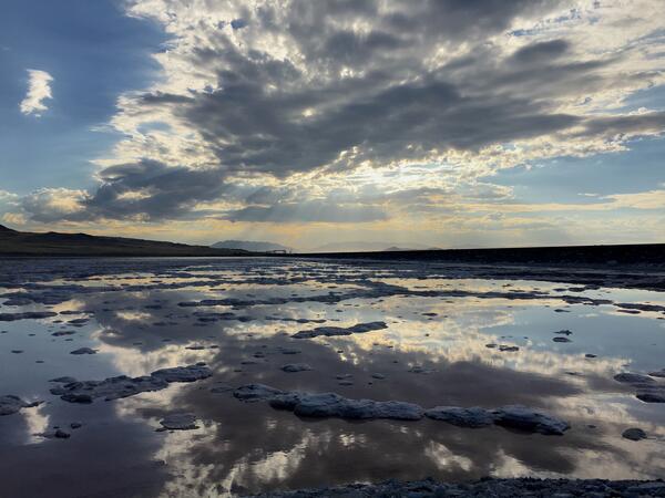
The Great Salt Lake is located on a playa, consequently small changes in the elevation of the water surface result in large changes in the surface area of the lake. The USGS has been collecting water-surface-elevation data from Great Salt Lake since 1875 and continuously since October 1902. The north part of the lake has been monitored since April 1966. Learn more
Science
Lake Michigan Basin groundwater system
The study area for the Lake Michigan Basin groundwater-flow model encompasses the entire Michigan Structural Basin centered in the Lower Peninsula of Michigan and extending into parts of Illinois, Wisconsin, Indiana, Ohio, and Ontario, Canada.
Great Lakes Geologic Mapping Project
Great Lakes Geologic Mapping Project
Invasive Phragmites Science: Management Tools for the Control of Invasive Phragmites to Foster the Restoration of the Great Lakes
The USGS is developing innovative Phragmites control measures to keep this rapidly spreading invasive plant from further expanding its range into new wetland habitats and to aid in the development of successful restoration strategies. Scientists are conducting studies and field tests to determine (1) if microbes (i.e., fungi and bacteria) that live within and around Phragmites are enabling the...
Harmful Algal Blooms in Pennsylvania
The U.S. Geological Survey is collaborating with State and local partners to develop models that provide real-time estimates of Escherichia coli (E. coli) (for pathogens) and (or) microcystin (for freshwater cyanotoxins) levels at Great Lakes beaches and drinking-water intakes.
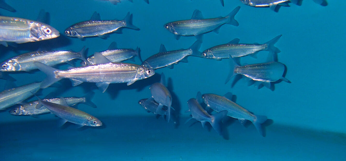
Understanding and Forecasting Potential Recruitment of Lake Michigan Fishes
Yellow perch and alewife are ecologically, economically, and culturally important fish species in Lake Michigan whose populations support recreational and commercial fisheries. However, both of these species’ populations have been in decline for over 20 years. This project seeks to understand the factors affecting variability in offspring survival of yellow perch and alewife in Lake Michigan in o
Multimedia

Bathymetric map of Grand Traverse Bay, Lake Superior
Bathymetric map of Grand Traverse Bay, Lake Superior. The 2018 data are shown in gray hillshade, with the combined 2021 data superimposed in color. Index map at lower right shows the extent of each survey.

Landsat 9 First Light Detroit & Lake Erie
Sediments swirl in Lake Erie and Lake St. Clair in this Landsat 9 image of both Detroit, Michigan, and Windsor, Ontario, from Oct. 31, 2021. The Great Lakes serve as sources of freshwater, recreational activity, transport, and habitat for the upper-midwestern US, and water quality remains a high priority.
Sediments swirl in Lake Erie and Lake St. Clair in this Landsat 9 image of both Detroit, Michigan, and Windsor, Ontario, from Oct. 31, 2021. The Great Lakes serve as sources of freshwater, recreational activity, transport, and habitat for the upper-midwestern US, and water quality remains a high priority.

SeaBOSS deployment in Lake Superior
Patrick Berube of WHCMSC prepares the SEABOSS for deployment in Lake Superior.
Patrick Berube of WHCMSC prepares the SEABOSS for deployment in Lake Superior.

Sampling operations on Lake Superior
The RV Desmid (foreground) alongside the RV Rafael during sampling operations on Lake Superior.
The RV Desmid (foreground) alongside the RV Rafael during sampling operations on Lake Superior.

GLSC Diver Collects Cladophora Samples in Lake Michigan
Emily Wimmer (GLSC, Ann Arbor, Michigan) collects Cladophora growing at 6m depth in Lake Michigan.
Emily Wimmer (GLSC, Ann Arbor, Michigan) collects Cladophora growing at 6m depth in Lake Michigan.

Acoustic Receiver Deployed Near Isle Royale in Lake Superior
A masked USGS Great Lakes Science Center technician deploys an acoustic receiver into the waters of Lake Superior near Isle Royale National Park; the receivers will track the movement of tagged native lake trout in the area.
A masked USGS Great Lakes Science Center technician deploys an acoustic receiver into the waters of Lake Superior near Isle Royale National Park; the receivers will track the movement of tagged native lake trout in the area.

Salton Sea, CA Earthquake Swarm of August 2020 (as of August 11, 2020)
Map showing the Salton Sea, CA earthquake swarm of August 2020 (as of August 11, 2020). Circles are earthquake locations, red indicates an earthquake in the past hour, orange the past 24 hours, and yellow the past 7 days.
Map showing the Salton Sea, CA earthquake swarm of August 2020 (as of August 11, 2020). Circles are earthquake locations, red indicates an earthquake in the past hour, orange the past 24 hours, and yellow the past 7 days.

Great Lakes Geologic Mapping Overview Photo
Location of the Great Lakes Geologic Mapping Project.
Location of the Great Lakes Geologic Mapping Project.

Variable Warming Upper Midwest Lakes and Implications for Sport Fish
Climate change is predicted to alter sport fish communities in Midwestern lakes, but managers currently have limited information on individual lakes that can be used to set local expectations or intervene with mitigation strategies.
Climate change is predicted to alter sport fish communities in Midwestern lakes, but managers currently have limited information on individual lakes that can be used to set local expectations or intervene with mitigation strategies.
Filter Total Items: 19

Lake Ontario Flood Monitoring and Mapping
Problem– Lake Ontario experienced period-of-record (1918-2017) maximum monthly average water levels during May through July 2017. NOAA lake gages recorded instantaneous peaks-of record, 249.2 at Olcott, 249.1 at Rochester, and 249.0 at Oswego and St. Vincent. These high water levels along with wind-generated waves caused flooding of thousands of residences and businesses and the erosion of miles o

Developing Adaptation Strategies for Recreational and Tribal Fisheries in the Upper Midwest
Fisheries in the glacial lakes region of the upper Midwest are culturally, economically, and recreationally beneficial. Walleye, for instance, represent an important subsistence food source for some Wisconsin tribal nations and are also popular among recreational anglers. However, predicted ecological changes to these aquatic communities, such as an increase in invasive fish species, a decrease in

Harmful Algal Blooms (HABs)
The USGS collaborates with local, state, federal, tribal, university, and industry partners to conduct the science necessary to understand the causes and effects of toxic HABs and inform water management and public health decisions. USGS is characterizing the life cycle of HABs, their asociated toxins, and the genes responsible for cyanotoxin production. This work is enhancing the ability of Great...

Invasive Mussel Control Science: Management Tools for Assessing the Risks and Control of Invasive Dreissenid Species
Invasive zebra and quagga mussels ( Dreissena polymorpha and D. rostriformis bugensis , respectively) are causing significant ecological and economic impacts and the scope of these impacts increases as they continue to spread across North America. The USGS conducts science to inform management actions for controlling and mitigating the impacts of invasive mussels. Studies include evaluation and...

Invasive Carp
Adult bighead, silver, and hybrid carp are invavsive species of fish that spread quickly once they are established in a water body. These carp damage habitat and reduce water-quality for native fish. Invasive carp have been confirmed within the Wabash River basin for at least 15 years. Scientists and natural resource managers are extremely concerned about the carp migrating to the Great Lakes...

“Hyperscale” Modeling to Understand and Predict Temperature Changes in Midwest Lakes
Many inland waters across the United States are experiencing warming water temperatures. The impacts of this warming on aquatic ecosystems are significant in many areas, causing problems for fisheries management, as many economically and ecologically important fish species are experiencing range shifts and population declines. Fisheries and natural resource managers need timely and usable data and

Projecting Changes in Snow, Lake Ice, and Winter Severity in the Great Lakes Region for Wildlife-Based Adaptation Planning
Winter conditions have changed substantially in the Great Lakes region over the last 50 years, with the region experiencing rising temperatures, declining lake ice cover, and increased lake-effect snow. These changes have direct implications for economically important wildlife, such as deer and waterfowl. Deer hunting alone contributes $482 million annually to Wisconsin’s economy. The goal of th
Filter Total Items: 26

Great Salt Lake and Wasatch Range from Antelope Island, Davis County, UT
Great Salt Lake and the Wasatch Range from Antelope Island, Davis County, UT. Photograph taken April 26, 2007 by Alan M. Cressler.
Great Salt Lake and the Wasatch Range from Antelope Island, Davis County, UT. Photograph taken April 26, 2007 by Alan M. Cressler.

Landsat 4 First Light Image over western Lake Erie
Landsat 4's first light image captured eastern Lake Erie, and the cities of Toledo, Detroit, and Windsor on July 25, 1982. Although the Landsat program had been collecting images of the Earth since 1972, this was the first time that the data could be depicted as a natural color image due to the new Thematic Mapper sensor onboard Landsat 4.
Landsat 4's first light image captured eastern Lake Erie, and the cities of Toledo, Detroit, and Windsor on July 25, 1982. Although the Landsat program had been collecting images of the Earth since 1972, this was the first time that the data could be depicted as a natural color image due to the new Thematic Mapper sensor onboard Landsat 4.


Sunset over Lake Michigan
Sunset over Lake Michigan. Photo by Rafi Wilkerson, National Park Service (Public Domain).
Sunset over Lake Michigan. Photo by Rafi Wilkerson, National Park Service (Public Domain).

USGS Landsat 8 image showing algal bloom in Lake Erie in September of
USGS Landsat 8 image showing algal bloom in Lake Erie in September of 2017. Landsat’s spectral bands allow researchers to see photosynthetic activity that is invisible to the naked eye.
USGS Landsat 8 image showing algal bloom in Lake Erie in September of 2017. Landsat’s spectral bands allow researchers to see photosynthetic activity that is invisible to the naked eye.
- Overview
The Great Lakes
Sources/Usage: Public Domain. View Media DetailsThe Great Lakes—Superior, Michigan, Huron, Erie, and Ontario—form the largest surface of freshwater in the world, comprising more than 94,250 square miles (244,106 square kilometers) of east-central North America. The lakes are critical components of the regional economies in both the United States and Canada. They are important sources of drinking water, transportation, and irrigation, and provide recreational opportunities such as boating, fishing, hunting, and bird watching, as well as vital habitat to a myriad of wildlife species like the bald eagle. They also face threats such as invasive species, harmful algal blooms, and pressures from human activities related to mining and other resource use and extraction.


 Sources/Usage: Public Domain. View Media Details
Large inland waterbodies are oceanic in many ways, facing many of the same issues as the ocean. The USGS conducts research and monitoring in the Great Lakes region and in other inland seas across the country to understand these large bodies of water and inform how we use and manage them. Inland Seas
In addition to studying the Great Lakes, USGS scientists are conducting similar research in other inland seas, such as Great Salt Lake and the Salton Sea. This research helps to provide resource managers with the information they need to restore, enhance, manage, and protect living resources and habitats.
Sources/Usage: Public Domain. View Media DetailsSalton Sea
Changes in regional water management practices have reduced freshwater inflow to the Salton Sea in Southern California, changing what was once a popular vacation destination to a shrinking hypersaline lake. As the lakebed dries, resource managers will depend on careful monitoring and research to inform critical decisions affecting the future of the lake and surrounding communities. Learn more
Sources/Usage: Public Domain. View Media DetailsGreat Salt Lake
The Great Salt Lake is located on a playa, consequently small changes in the elevation of the water surface result in large changes in the surface area of the lake. The USGS has been collecting water-surface-elevation data from Great Salt Lake since 1875 and continuously since October 1902. The north part of the lake has been monitored since April 1966. Learn moreScience
Lake Michigan Basin groundwater system
The study area for the Lake Michigan Basin groundwater-flow model encompasses the entire Michigan Structural Basin centered in the Lower Peninsula of Michigan and extending into parts of Illinois, Wisconsin, Indiana, Ohio, and Ontario, Canada.Great Lakes Geologic Mapping Project
Great Lakes Geologic Mapping ProjectInvasive Phragmites Science: Management Tools for the Control of Invasive Phragmites to Foster the Restoration of the Great Lakes
The USGS is developing innovative Phragmites control measures to keep this rapidly spreading invasive plant from further expanding its range into new wetland habitats and to aid in the development of successful restoration strategies. Scientists are conducting studies and field tests to determine (1) if microbes (i.e., fungi and bacteria) that live within and around Phragmites are enabling the...Harmful Algal Blooms in Pennsylvania
The U.S. Geological Survey is collaborating with State and local partners to develop models that provide real-time estimates of Escherichia coli (E. coli) (for pathogens) and (or) microcystin (for freshwater cyanotoxins) levels at Great Lakes beaches and drinking-water intakes.Understanding and Forecasting Potential Recruitment of Lake Michigan Fishes
Yellow perch and alewife are ecologically, economically, and culturally important fish species in Lake Michigan whose populations support recreational and commercial fisheries. However, both of these species’ populations have been in decline for over 20 years. This project seeks to understand the factors affecting variability in offspring survival of yellow perch and alewife in Lake Michigan in oMultimedia
Bathymetric map of Grand Traverse Bay, Lake SuperiorBathymetric map of Grand Traverse Bay, Lake Superior. The 2018 data are shown in gray hillshade, with the combined 2021 data superimposed in color. Index map at lower right shows the extent of each survey.
Bathymetric map of Grand Traverse Bay, Lake Superior. The 2018 data are shown in gray hillshade, with the combined 2021 data superimposed in color. Index map at lower right shows the extent of each survey.
Landsat 9 First Light Detroit & Lake ErieSediments swirl in Lake Erie and Lake St. Clair in this Landsat 9 image of both Detroit, Michigan, and Windsor, Ontario, from Oct. 31, 2021. The Great Lakes serve as sources of freshwater, recreational activity, transport, and habitat for the upper-midwestern US, and water quality remains a high priority.
Sediments swirl in Lake Erie and Lake St. Clair in this Landsat 9 image of both Detroit, Michigan, and Windsor, Ontario, from Oct. 31, 2021. The Great Lakes serve as sources of freshwater, recreational activity, transport, and habitat for the upper-midwestern US, and water quality remains a high priority.
SeaBOSS deployment in Lake SuperiorPatrick Berube of WHCMSC prepares the SEABOSS for deployment in Lake Superior.
Patrick Berube of WHCMSC prepares the SEABOSS for deployment in Lake Superior.
Sampling operations on Lake SuperiorThe RV Desmid (foreground) alongside the RV Rafael during sampling operations on Lake Superior.
The RV Desmid (foreground) alongside the RV Rafael during sampling operations on Lake Superior.
GLSC Diver Collects Cladophora Samples in Lake MichiganEmily Wimmer (GLSC, Ann Arbor, Michigan) collects Cladophora growing at 6m depth in Lake Michigan.
Emily Wimmer (GLSC, Ann Arbor, Michigan) collects Cladophora growing at 6m depth in Lake Michigan.
Acoustic Receiver Deployed Near Isle Royale in Lake SuperiorA masked USGS Great Lakes Science Center technician deploys an acoustic receiver into the waters of Lake Superior near Isle Royale National Park; the receivers will track the movement of tagged native lake trout in the area.
A masked USGS Great Lakes Science Center technician deploys an acoustic receiver into the waters of Lake Superior near Isle Royale National Park; the receivers will track the movement of tagged native lake trout in the area.
Salton Sea, CA Earthquake Swarm of August 2020 (as of August 11, 2020)Map showing the Salton Sea, CA earthquake swarm of August 2020 (as of August 11, 2020). Circles are earthquake locations, red indicates an earthquake in the past hour, orange the past 24 hours, and yellow the past 7 days.
Map showing the Salton Sea, CA earthquake swarm of August 2020 (as of August 11, 2020). Circles are earthquake locations, red indicates an earthquake in the past hour, orange the past 24 hours, and yellow the past 7 days.
Great Lakes Geologic Mapping Overview PhotoLocation of the Great Lakes Geologic Mapping Project.
Location of the Great Lakes Geologic Mapping Project.
Variable Warming Upper Midwest Lakes and Implications for Sport FishClimate change is predicted to alter sport fish communities in Midwestern lakes, but managers currently have limited information on individual lakes that can be used to set local expectations or intervene with mitigation strategies.
Climate change is predicted to alter sport fish communities in Midwestern lakes, but managers currently have limited information on individual lakes that can be used to set local expectations or intervene with mitigation strategies.
- Publications
- Science
Filter Total Items: 19
Lake Ontario Flood Monitoring and Mapping
Problem– Lake Ontario experienced period-of-record (1918-2017) maximum monthly average water levels during May through July 2017. NOAA lake gages recorded instantaneous peaks-of record, 249.2 at Olcott, 249.1 at Rochester, and 249.0 at Oswego and St. Vincent. These high water levels along with wind-generated waves caused flooding of thousands of residences and businesses and the erosion of miles oDeveloping Adaptation Strategies for Recreational and Tribal Fisheries in the Upper Midwest
Fisheries in the glacial lakes region of the upper Midwest are culturally, economically, and recreationally beneficial. Walleye, for instance, represent an important subsistence food source for some Wisconsin tribal nations and are also popular among recreational anglers. However, predicted ecological changes to these aquatic communities, such as an increase in invasive fish species, a decrease inHarmful Algal Blooms (HABs)
The USGS collaborates with local, state, federal, tribal, university, and industry partners to conduct the science necessary to understand the causes and effects of toxic HABs and inform water management and public health decisions. USGS is characterizing the life cycle of HABs, their asociated toxins, and the genes responsible for cyanotoxin production. This work is enhancing the ability of Great...Invasive Mussel Control Science: Management Tools for Assessing the Risks and Control of Invasive Dreissenid Species
Invasive zebra and quagga mussels ( Dreissena polymorpha and D. rostriformis bugensis , respectively) are causing significant ecological and economic impacts and the scope of these impacts increases as they continue to spread across North America. The USGS conducts science to inform management actions for controlling and mitigating the impacts of invasive mussels. Studies include evaluation and...Invasive Carp
Adult bighead, silver, and hybrid carp are invavsive species of fish that spread quickly once they are established in a water body. These carp damage habitat and reduce water-quality for native fish. Invasive carp have been confirmed within the Wabash River basin for at least 15 years. Scientists and natural resource managers are extremely concerned about the carp migrating to the Great Lakes...“Hyperscale” Modeling to Understand and Predict Temperature Changes in Midwest Lakes
Many inland waters across the United States are experiencing warming water temperatures. The impacts of this warming on aquatic ecosystems are significant in many areas, causing problems for fisheries management, as many economically and ecologically important fish species are experiencing range shifts and population declines. Fisheries and natural resource managers need timely and usable data andProjecting Changes in Snow, Lake Ice, and Winter Severity in the Great Lakes Region for Wildlife-Based Adaptation Planning
Winter conditions have changed substantially in the Great Lakes region over the last 50 years, with the region experiencing rising temperatures, declining lake ice cover, and increased lake-effect snow. These changes have direct implications for economically important wildlife, such as deer and waterfowl. Deer hunting alone contributes $482 million annually to Wisconsin’s economy. The goal of th - Data and More
- Multimedia
Filter Total Items: 26
Great Salt Lake and Wasatch Range from Antelope Island, Davis County, UT
Great Salt Lake and the Wasatch Range from Antelope Island, Davis County, UT. Photograph taken April 26, 2007 by Alan M. Cressler.
Great Salt Lake and the Wasatch Range from Antelope Island, Davis County, UT. Photograph taken April 26, 2007 by Alan M. Cressler.
Landsat 4 First Light Image over western Lake ErieLandsat 4's first light image captured eastern Lake Erie, and the cities of Toledo, Detroit, and Windsor on July 25, 1982. Although the Landsat program had been collecting images of the Earth since 1972, this was the first time that the data could be depicted as a natural color image due to the new Thematic Mapper sensor onboard Landsat 4.
Landsat 4's first light image captured eastern Lake Erie, and the cities of Toledo, Detroit, and Windsor on July 25, 1982. Although the Landsat program had been collecting images of the Earth since 1972, this was the first time that the data could be depicted as a natural color image due to the new Thematic Mapper sensor onboard Landsat 4.
Sunset over Lake MichiganSunset over Lake Michigan. Photo by Rafi Wilkerson, National Park Service (Public Domain).
Sunset over Lake Michigan. Photo by Rafi Wilkerson, National Park Service (Public Domain).
USGS Landsat 8 image showing algal bloom in Lake Erie in September ofUSGS Landsat 8 image showing algal bloom in Lake Erie in September of 2017. Landsat’s spectral bands allow researchers to see photosynthetic activity that is invisible to the naked eye.
USGS Landsat 8 image showing algal bloom in Lake Erie in September of 2017. Landsat’s spectral bands allow researchers to see photosynthetic activity that is invisible to the naked eye.
- News
- Connect