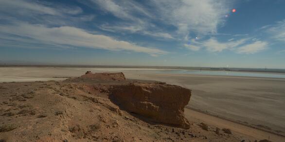
U.S. flag

An official website of the United States government

Salton Sea

Changes in regional water management practices have reduced freshwater inflow to the Salton Sea, changing what was once a popular vacation destination to a shrinking hypersaline lake.  As the lake bed dries to a dusty playa, air, water, and wildlife managers will depend on careful monitoring and research to inform critical decisions affecting the future of the lake and surrounding communities.

News

Geonarrative Investigates Geohazards of the Salton Sea

Geonarrative Investigates Geohazards of the Salton Sea

Publications

Irregular focal mechanisms observed at Salton Sea Geothermal Field: Possible influences of anthropogenic stress perturbations

At the Salton Sea Geothermal Field (SSGF), strain accumulation is released through seismic slip and aseismic deformation. Earthquake activity at the SSGF often occurs in swarm-like clusters, some with clear migration patterns. We have identified an earthquake sequence composed entirely of focal mechanisms representing an ambiguous style of faulting, where strikes are similar but deformation occurs
Authors
Aren Crandall-Bear, Andrew J. Barbour, Martin Schoenball

Punctuated sediment discharge during early Pliocene birth of the Colorado River: Evidence from regional stratigraphy, sedimentology, and paleontology

The Colorado River in the southwestern U.S. provides an excellent natural laboratory for studying the origins of a continent-scale river system, because deposits that formed prior to and during river initiation are well exposed in the lower river valley and nearby basinal sink. This paper presents a synthesis of regional stratigraphy, sedimentology, and micropaleontology from the southern Bouse Fo
Authors
Rebecca J. Dorsey, Brennan O’Connell, Kristin McDougall-Reid, Mindy B. Homan

Subsurface geometry of the San Andreas fault in southern California: Results from the Salton Seismic Imaging Project (SSIP) and strong ground motion expectations

The San Andreas fault (SAF) is one of the most studied strike‐slip faults in the world; yet its subsurface geometry is still uncertain in most locations. The Salton Seismic Imaging Project (SSIP) was undertaken to image the structure surrounding the SAF and also its subsurface geometry. We present SSIP studies at two locations in the Coachella Valley of the northern Salton trough. On our line 4, a
Authors
Gary S. Fuis, Klaus Bauer, Mark R. Goldman, Trond Ryberg, Victoria E. Langenheim, Daniel S. Scheirer, Michael J. Rymer, Joann M. Stock, John A. Hole, Rufus D. Catchings, Robert Graves, Brad T. Aagaard