

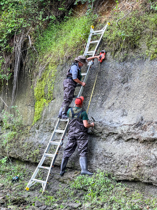
USGS Geologists Jean Self-Trail and Mercer Parker taking field notes, Prince George’s County
Mercer Parker
I am Geologist at the Florence Bascom Geoscience Center where I work under the Glaciated Regions Project - New England Regional Bedrock Mapping Task as a geologic mapper and carbonate petrologist.
May 2014 – Present United States Geological Survey, Florence Bascom Geoscience Center - Geologist
Perform preliminary petrographic analysis of rock and sediment samples.
Conduct field mapping and petrologic investigations for the Atlantic Subsurface Stratigraphic Initiative and Northeast Bedrock Mapping Project
Compile, organize, and produce digital images/files/data for use in publications.
Assist in organizing and leading field courses for students and professional geologists.
Diversity, Equity, Inclusion, and Accessibility (DEIA) recruitment
Science and Products
Appalachian Basin Geologic Mapping Project
The Appalachian Basin Geologic Mapping Project performs geologic mapping at local and regional scales, and geologic research in The Valley and Ridge and Appalachian Plateaus physiographic provinces. These provinces include parts of 11 states and mainly borders the Blue Ridge / Piedmont and North Interior Lowlands Provinces. Only one state has Valley and Ridge geology (NJ), two have Appalachian...

Geologists taking field notes
USGS Geologists Jean Self-Trail and Mercer Parker taking field notes, Prince George’s County
Geologists measuring and sampling the Paleocene Aquia Formation, Prince George’s County, Maryland
linkUSGS geologists Jean Self-Trail and Mercer Parker measuring and sampling the Paleocene Aquia Formation, Prince George’s County, Maryland
Geologists measuring and sampling the Paleocene Aquia Formation, Prince George’s County, Maryland
linkUSGS geologists Jean Self-Trail and Mercer Parker measuring and sampling the Paleocene Aquia Formation, Prince George’s County, Maryland
Science and Products
- Science
Appalachian Basin Geologic Mapping Project
The Appalachian Basin Geologic Mapping Project performs geologic mapping at local and regional scales, and geologic research in The Valley and Ridge and Appalachian Plateaus physiographic provinces. These provinces include parts of 11 states and mainly borders the Blue Ridge / Piedmont and North Interior Lowlands Provinces. Only one state has Valley and Ridge geology (NJ), two have Appalachian... - Multimedia
Geologists taking field notes
USGS Geologists Jean Self-Trail and Mercer Parker taking field notes, Prince George’s County
USGS Geologists Jean Self-Trail and Mercer Parker taking field notes, Prince George’s County
Geologists measuring and sampling the Paleocene Aquia Formation, Prince George’s County, MarylandGeologists measuring and sampling the Paleocene Aquia Formation, Prince George’s County, Maryland
linkUSGS geologists Jean Self-Trail and Mercer Parker measuring and sampling the Paleocene Aquia Formation, Prince George’s County, Maryland
Geologists measuring and sampling the Paleocene Aquia Formation, Prince George’s County, Maryland
linkUSGS geologists Jean Self-Trail and Mercer Parker measuring and sampling the Paleocene Aquia Formation, Prince George’s County, Maryland
- Publications