


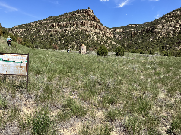
An example of successful perennial grass establishment on a reclaimed oil and gas well pad site in the Book Cliffs, Utah. Photo by Mike Duniway, SBSC, USGS.
Mike Duniway, Ph.D.
Dr. Michael (Mike) Duniway is a soil scientist focused on soils and soil processes in dryland ecosystems and the interactions between environmental and land-use drivers, vegetation, soils, and geomorphology. His areas of focus include restoration, ecohydrology, effects of land-use (grazing, energy, and recreation), dust production, plant-soil feedbacks, and soil mapping and interpretations.
Drylands are highly vulnerable to climate and land use changes: what ecosystem changes are in store?
Drylands are highly vulnerable to climate and land use changes: what ecosystem changes are in store?

Learning From the Past and Planning for the Future: Experience-Driven Insight Into Managing for Ecosystem Transformations Induced by Drought and Wildfire
Learning From the Past and Planning for the Future: Experience-Driven Insight Into Managing for Ecosystem Transformations Induced by Drought and Wildfire
In his research and outreach activities, Dr. Duniway seeks to provide information for land managers and owners to facilitate sustainable land-use activities. He works closely with federal agency partners (Bureau of Land Management, National Park Service, National Resource Conservation Service, US Fish and Wildlife Service, and others such as The Nature Conservancy's Canyonlands Research Center) in designing research studies, conducting technology transfer, and outreach activities. Some primary current research focuses include understanding the impacts of drought on Colorado Plateau landscapes, evaluating the recovery of oil and gas pads on the Colorado Plateau and opportunities for improved restoration practices, developing novel restoration techniques for highly disturbed lands using biological soil crusts and physical barriers, and basic research into the importance of soils for dryland ecosystem processes.
Science and Products
Filter Total Items: 21
Colorado Plateau Extreme Drought in Grassland Experiment (EDGE)
In drylands, short-term extreme droughts can have profound ecosystem effects, depending on the timing (seasonality) of drought and the sensitivities of the dominant plants and plant functional types. Past work suggests that cool season drought may disproportionately impact regionally important grass and shrub species. In this study, we are examining the impacts of extreme seasonal drought on...
Chronic Drought Impacts on Colorado Plateau ecosystems (Rain-Out Experiment)
In drylands, chronic reductions in water availability (press-drought) through reduced precipitation and increased temperatures may have profound ecosystem effects, depending on the sensitivities of the dominant plants and plant functional types. In this study, we are examining the impacts of moderate, but long-term chronic drought using a network of 40 drought shelters on the Colorado Plateau...
Oil and Gas Reclamation - About
What is reclamation? Reclamation means to assist in the repair or recovery of highly disturbed or degraded ecosystems to benefit native plants and animals by setting sites on a trajectory towards functioning habitats and ecological communities that are similar to surrounding, naturally occurring environments. During this process, the impacts of oil and gas development are minimized.
Southwest Energy Exploration, Development, and Reclamation (SWEDR)
Approximately 35% of the US and approximately 82% of DOI lands are “drylands” found throughout the western US. These lands contain oil, gas, oil shale, shale oil, and tar sand deposits and the exploration for and extraction of these resources has resulted in hundreds of thousands of operating and abandoned wells across the West. These arid and semi-arid lands have unique soil and plant communities...
New Tools for Modern Land Management Decisions
In an era of rapid land use changes and shifting climates, it is imperative that land managers and policymakers have actionable and current information available for decision processes. In this work, we seek to meet these needs through new data products and decision support tools built on digital soil mapping, new vegetation cover maps, agency inventory and monitoring data sets, and cutting-edge...
Climate Adaptation Strategies for Arid Grasslands
Helping National Parks in the 4-Corners region manage grasslands in a changing climate.
Biological Soil Crust ("Biocrust") Science
Biological soil crusts (biocrusts) are commonly found on the soil surface in arid and semi-arid ecosystems (collectively called drylands). Biocrusts can consist of mosses, cyanobacteria, lichens, algae, and microfungi, and they strongly interact with the soil. These organisms or consortium of disparate organisms, depending on the specific biocrust, are important to the functioning of ecosystems...
Developing a Decision Support Framework for Prioritizing Pinyon Juniper Forest Treatments on the Colorado Plateau
Across the western U.S., pinyon and juniper trees are expanding into sagebrush and grassland plant communities. This vegetation change has been perceived to have a significant impact on the economic value of these grasslands, which support activities such as livestock grazing and hunting, but expanding pinyon and juniper forests may also lead to increased risk of fire. Over the past several decade
Drought & Grazing Experiment: Understanding Impacts and Identifying Mitigation Strategies
Drylands (sometimes called ‘deserts’ or ‘arid and semi-arid' ecosystems) are defined by water scarcity. Understanding how land-use activities may effect dryland ecosystems and dryland ecological processes is a high priority for land conservation and management. Grazing by domestic livestock (typically cattle but also sheep and goats) is the most widespread land-use in drylands globally and a large...
Remote Sensing of Energy Development
Oil and gas development across the western United States has increased substantially in recent decades, including within the Colorado Plateau. The Colorado Plateau is a high desert region of grasslands, shrublands, and woodlands and is home to a large number of world-renowned national and tribal parks and monuments (e.g., Grand Canyon, Zion, Bryce, Arches, Canyonlands, Monument Valley, and Mesa...
Well Pad Reclamation and Research
Reclamation on lands impacted by energy development is complicated and extremely challenging in arid environments due to unstable soils, exotic species, and low and variable precipitation. The reclamation tactics employed by energy operators vary widely and outcomes can differ across plant communities and soil types. In order to address the knowledge gaps regarding how to successfully and...
Learning From the Past and Planning for the Future: Experience-Driven Insight Into Managing for Ecosystem Transformations Induced by Drought and Wildfire
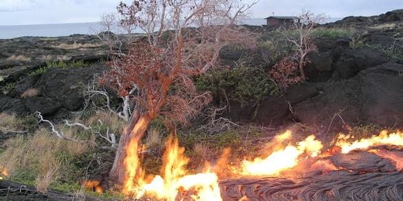
Drought and wildfire pose enormous threats to the integrity of natural resources that land managers are charged with protecting. Recent observations and modeling forecasts indicate that these stressors will likely produce catastrophic ecosystem transformations, or abrupt changes in the condition of plants, wildlife, and their habitats, in regions across the country in coming decades. In this p
An example of successful reclamation of a reclaimed oil or gas well pad site, Utah
An example of successful perennial grass establishment on a reclaimed oil and gas well pad site in the Book Cliffs, Utah. Photo by Mike Duniway, SBSC, USGS.

Ecological site group map for the Upper Colorado River Basin
An ecological site group map for the Upper Colorado River Basin that displays a quantitative soil-geomorphic framework in the Four Corners region, USA.
An ecological site group map for the Upper Colorado River Basin that displays a quantitative soil-geomorphic framework in the Four Corners region, USA.

Cathedral Valley, Capital Reef National Park, Utah
Cathedral Valley, Capital Reef National Park, Utah. Photo by Chris Benson, USGS.
Cathedral Valley, Capital Reef National Park, Utah. Photo by Chris Benson, USGS.

A panorama of Cathedral Valley, Capital Reef National Park, Utah
A panorama of Cathedral Valley, Capital Reef National Park, Utah. Photo by Chris Benson, USGS, 2021.
A panorama of Cathedral Valley, Capital Reef National Park, Utah. Photo by Chris Benson, USGS, 2021.

A pronghorn uses habitat with oil and gas development infrastructure, Utah
A pronghorn (Antilocapra americana) using habitat with oil and gas development near Vernal, Utah. Photo by Mike Duniway, SBSC, USGS.
A pronghorn (Antilocapra americana) using habitat with oil and gas development near Vernal, Utah. Photo by Mike Duniway, SBSC, USGS.

Canyonlands National Park panorama
A panoramic photo of the Colorado River Basin in Canyonlands National Park. Photo by Mike Duniway, Southwest Biological Science Center, USGS.
A panoramic photo of the Colorado River Basin in Canyonlands National Park. Photo by Mike Duniway, Southwest Biological Science Center, USGS.

Hydroseeding during oil and gas well pad reclamation
Hydroseeding for reclamation at an oil and gas well pad in the Uinta Basin, Utah. Hydroseeding involves spraying seeds, water, mulch and sometimes other materials over a disturbed area. Photo by Rebecca Mann, SBSC, USGS.
Hydroseeding for reclamation at an oil and gas well pad in the Uinta Basin, Utah. Hydroseeding involves spraying seeds, water, mulch and sometimes other materials over a disturbed area. Photo by Rebecca Mann, SBSC, USGS.

A map of Shay Mesa, Utah, showing an area of pinyon-juniper clearing treatments
A dynamic illustration of how pixel matching can be used for finding control points on a map of Shay Mesa, Utah, showing an area of pinyon-juniper clearing treatments. For more information, see the paper: What determines the effectiveness of Pinyon-Juniper clearing treatments?
A dynamic illustration of how pixel matching can be used for finding control points on a map of Shay Mesa, Utah, showing an area of pinyon-juniper clearing treatments. For more information, see the paper: What determines the effectiveness of Pinyon-Juniper clearing treatments?

A technician places a pin drop on a transect during oil and gas reclamation vegetation monitoring
linkA USGS technician places a pin drop on a transect during monitoring soil and vegetation outcomes on a reclaimed oil or gas pad near Grand Junction, Colorado. Photo by Mike Duniway, SBSC, USGS.
A technician places a pin drop on a transect during oil and gas reclamation vegetation monitoring
linkA USGS technician places a pin drop on a transect during monitoring soil and vegetation outcomes on a reclaimed oil or gas pad near Grand Junction, Colorado. Photo by Mike Duniway, SBSC, USGS.
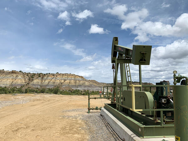
A pumpjack on an active oil or gas drilling site in New Mexico
A pumpjack on an active oil or gas drilling site near Farmington, New Mexico. Photo by Mike Duniway, USGS, SBSC.
A pumpjack on an active oil or gas drilling site near Farmington, New Mexico. Photo by Mike Duniway, USGS, SBSC.

30m resolution soil map for the Colorado River Basin, Four Corners region
30m resolution soil map for the Colorado River Basin, Four Corners region showing uncertainty in electrical connectivity.
30m resolution soil map for the Colorado River Basin, Four Corners region showing uncertainty in electrical connectivity.

Canyonlands National Park panorama
A panoramic photo of Canyonlands National Park, Utah. Photo by Mike Duniway, Southwest Biological Science Center, USGS.
A panoramic photo of Canyonlands National Park, Utah. Photo by Mike Duniway, Southwest Biological Science Center, USGS.

Active oil and gas pad near Canyonlands National Park
Active oil and gas pad on Bureau of Land Management lands near Canyonlands National Park, Utah.
Active oil and gas pad on Bureau of Land Management lands near Canyonlands National Park, Utah.

USGS and US Forest Service staff installing dust monitoring equipment
USGS and US Forest Service staff installing dust monitoring equipment at a uranium mine near Grand Canyon National Park.
USGS and US Forest Service staff installing dust monitoring equipment at a uranium mine near Grand Canyon National Park.

Dry conditions at cattle water sources in western Colorado
Dry conditions at cattle water sources in western Colorado.
Dry conditions at cattle water sources in western Colorado.

Cattle walking across biological soil crusts in southeastern Utah
Cattle walking across biological soil crusts in southeastern Utah.
Cattle walking across biological soil crusts in southeastern Utah.

Drilling for mineral resources near Canyonlands National Park, Utah
Drilling for mineral resources near Canyonlands National Park, Utah
Drilling for mineral resources near Canyonlands National Park, Utah

Four-wheel drive enthusiasts during Jeep Safari in Moab Utah
Four-wheel drive enthusiasts during Jeep Safari in Moab Utah.
Four-wheel drive enthusiasts during Jeep Safari in Moab Utah.
Science and Products
Filter Total Items: 21
Colorado Plateau Extreme Drought in Grassland Experiment (EDGE)
In drylands, short-term extreme droughts can have profound ecosystem effects, depending on the timing (seasonality) of drought and the sensitivities of the dominant plants and plant functional types. Past work suggests that cool season drought may disproportionately impact regionally important grass and shrub species. In this study, we are examining the impacts of extreme seasonal drought on...
Chronic Drought Impacts on Colorado Plateau ecosystems (Rain-Out Experiment)
In drylands, chronic reductions in water availability (press-drought) through reduced precipitation and increased temperatures may have profound ecosystem effects, depending on the sensitivities of the dominant plants and plant functional types. In this study, we are examining the impacts of moderate, but long-term chronic drought using a network of 40 drought shelters on the Colorado Plateau...
Oil and Gas Reclamation - About
What is reclamation? Reclamation means to assist in the repair or recovery of highly disturbed or degraded ecosystems to benefit native plants and animals by setting sites on a trajectory towards functioning habitats and ecological communities that are similar to surrounding, naturally occurring environments. During this process, the impacts of oil and gas development are minimized.
Southwest Energy Exploration, Development, and Reclamation (SWEDR)
Approximately 35% of the US and approximately 82% of DOI lands are “drylands” found throughout the western US. These lands contain oil, gas, oil shale, shale oil, and tar sand deposits and the exploration for and extraction of these resources has resulted in hundreds of thousands of operating and abandoned wells across the West. These arid and semi-arid lands have unique soil and plant communities...
New Tools for Modern Land Management Decisions
In an era of rapid land use changes and shifting climates, it is imperative that land managers and policymakers have actionable and current information available for decision processes. In this work, we seek to meet these needs through new data products and decision support tools built on digital soil mapping, new vegetation cover maps, agency inventory and monitoring data sets, and cutting-edge...
Climate Adaptation Strategies for Arid Grasslands
Helping National Parks in the 4-Corners region manage grasslands in a changing climate.
Biological Soil Crust ("Biocrust") Science
Biological soil crusts (biocrusts) are commonly found on the soil surface in arid and semi-arid ecosystems (collectively called drylands). Biocrusts can consist of mosses, cyanobacteria, lichens, algae, and microfungi, and they strongly interact with the soil. These organisms or consortium of disparate organisms, depending on the specific biocrust, are important to the functioning of ecosystems...
Developing a Decision Support Framework for Prioritizing Pinyon Juniper Forest Treatments on the Colorado Plateau
Across the western U.S., pinyon and juniper trees are expanding into sagebrush and grassland plant communities. This vegetation change has been perceived to have a significant impact on the economic value of these grasslands, which support activities such as livestock grazing and hunting, but expanding pinyon and juniper forests may also lead to increased risk of fire. Over the past several decade
Drought & Grazing Experiment: Understanding Impacts and Identifying Mitigation Strategies
Drylands (sometimes called ‘deserts’ or ‘arid and semi-arid' ecosystems) are defined by water scarcity. Understanding how land-use activities may effect dryland ecosystems and dryland ecological processes is a high priority for land conservation and management. Grazing by domestic livestock (typically cattle but also sheep and goats) is the most widespread land-use in drylands globally and a large...
Remote Sensing of Energy Development
Oil and gas development across the western United States has increased substantially in recent decades, including within the Colorado Plateau. The Colorado Plateau is a high desert region of grasslands, shrublands, and woodlands and is home to a large number of world-renowned national and tribal parks and monuments (e.g., Grand Canyon, Zion, Bryce, Arches, Canyonlands, Monument Valley, and Mesa...
Well Pad Reclamation and Research
Reclamation on lands impacted by energy development is complicated and extremely challenging in arid environments due to unstable soils, exotic species, and low and variable precipitation. The reclamation tactics employed by energy operators vary widely and outcomes can differ across plant communities and soil types. In order to address the knowledge gaps regarding how to successfully and...
Learning From the Past and Planning for the Future: Experience-Driven Insight Into Managing for Ecosystem Transformations Induced by Drought and Wildfire
Drought and wildfire pose enormous threats to the integrity of natural resources that land managers are charged with protecting. Recent observations and modeling forecasts indicate that these stressors will likely produce catastrophic ecosystem transformations, or abrupt changes in the condition of plants, wildlife, and their habitats, in regions across the country in coming decades. In this p
An example of successful reclamation of a reclaimed oil or gas well pad site, Utah
An example of successful perennial grass establishment on a reclaimed oil and gas well pad site in the Book Cliffs, Utah. Photo by Mike Duniway, SBSC, USGS.
An example of successful perennial grass establishment on a reclaimed oil and gas well pad site in the Book Cliffs, Utah. Photo by Mike Duniway, SBSC, USGS.
Ecological site group map for the Upper Colorado River Basin
An ecological site group map for the Upper Colorado River Basin that displays a quantitative soil-geomorphic framework in the Four Corners region, USA.
An ecological site group map for the Upper Colorado River Basin that displays a quantitative soil-geomorphic framework in the Four Corners region, USA.
Cathedral Valley, Capital Reef National Park, Utah
Cathedral Valley, Capital Reef National Park, Utah. Photo by Chris Benson, USGS.
Cathedral Valley, Capital Reef National Park, Utah. Photo by Chris Benson, USGS.
A panorama of Cathedral Valley, Capital Reef National Park, Utah
A panorama of Cathedral Valley, Capital Reef National Park, Utah. Photo by Chris Benson, USGS, 2021.
A panorama of Cathedral Valley, Capital Reef National Park, Utah. Photo by Chris Benson, USGS, 2021.
A pronghorn uses habitat with oil and gas development infrastructure, Utah
A pronghorn (Antilocapra americana) using habitat with oil and gas development near Vernal, Utah. Photo by Mike Duniway, SBSC, USGS.
A pronghorn (Antilocapra americana) using habitat with oil and gas development near Vernal, Utah. Photo by Mike Duniway, SBSC, USGS.
Canyonlands National Park panorama
A panoramic photo of the Colorado River Basin in Canyonlands National Park. Photo by Mike Duniway, Southwest Biological Science Center, USGS.
A panoramic photo of the Colorado River Basin in Canyonlands National Park. Photo by Mike Duniway, Southwest Biological Science Center, USGS.
Hydroseeding during oil and gas well pad reclamation
Hydroseeding for reclamation at an oil and gas well pad in the Uinta Basin, Utah. Hydroseeding involves spraying seeds, water, mulch and sometimes other materials over a disturbed area. Photo by Rebecca Mann, SBSC, USGS.
Hydroseeding for reclamation at an oil and gas well pad in the Uinta Basin, Utah. Hydroseeding involves spraying seeds, water, mulch and sometimes other materials over a disturbed area. Photo by Rebecca Mann, SBSC, USGS.
A map of Shay Mesa, Utah, showing an area of pinyon-juniper clearing treatments
A dynamic illustration of how pixel matching can be used for finding control points on a map of Shay Mesa, Utah, showing an area of pinyon-juniper clearing treatments. For more information, see the paper: What determines the effectiveness of Pinyon-Juniper clearing treatments?
A dynamic illustration of how pixel matching can be used for finding control points on a map of Shay Mesa, Utah, showing an area of pinyon-juniper clearing treatments. For more information, see the paper: What determines the effectiveness of Pinyon-Juniper clearing treatments?
A technician places a pin drop on a transect during oil and gas reclamation vegetation monitoring
linkA USGS technician places a pin drop on a transect during monitoring soil and vegetation outcomes on a reclaimed oil or gas pad near Grand Junction, Colorado. Photo by Mike Duniway, SBSC, USGS.
A technician places a pin drop on a transect during oil and gas reclamation vegetation monitoring
linkA USGS technician places a pin drop on a transect during monitoring soil and vegetation outcomes on a reclaimed oil or gas pad near Grand Junction, Colorado. Photo by Mike Duniway, SBSC, USGS.
A pumpjack on an active oil or gas drilling site in New Mexico
A pumpjack on an active oil or gas drilling site near Farmington, New Mexico. Photo by Mike Duniway, USGS, SBSC.
A pumpjack on an active oil or gas drilling site near Farmington, New Mexico. Photo by Mike Duniway, USGS, SBSC.
30m resolution soil map for the Colorado River Basin, Four Corners region
30m resolution soil map for the Colorado River Basin, Four Corners region showing uncertainty in electrical connectivity.
30m resolution soil map for the Colorado River Basin, Four Corners region showing uncertainty in electrical connectivity.
Canyonlands National Park panorama
A panoramic photo of Canyonlands National Park, Utah. Photo by Mike Duniway, Southwest Biological Science Center, USGS.
A panoramic photo of Canyonlands National Park, Utah. Photo by Mike Duniway, Southwest Biological Science Center, USGS.
Active oil and gas pad near Canyonlands National Park
Active oil and gas pad on Bureau of Land Management lands near Canyonlands National Park, Utah.
Active oil and gas pad on Bureau of Land Management lands near Canyonlands National Park, Utah.
USGS and US Forest Service staff installing dust monitoring equipment
USGS and US Forest Service staff installing dust monitoring equipment at a uranium mine near Grand Canyon National Park.
USGS and US Forest Service staff installing dust monitoring equipment at a uranium mine near Grand Canyon National Park.
Dry conditions at cattle water sources in western Colorado
Dry conditions at cattle water sources in western Colorado.
Dry conditions at cattle water sources in western Colorado.
Cattle walking across biological soil crusts in southeastern Utah
Cattle walking across biological soil crusts in southeastern Utah.
Cattle walking across biological soil crusts in southeastern Utah.
Drilling for mineral resources near Canyonlands National Park, Utah
Drilling for mineral resources near Canyonlands National Park, Utah
Drilling for mineral resources near Canyonlands National Park, Utah
Four-wheel drive enthusiasts during Jeep Safari in Moab Utah
Four-wheel drive enthusiasts during Jeep Safari in Moab Utah.
Four-wheel drive enthusiasts during Jeep Safari in Moab Utah.