
Mike Duniway, Ph.D.
Dr. Michael (Mike) Duniway is a soil scientist focused on soils and soil processes in dryland ecosystems and the interactions between environmental and land-use drivers, vegetation, soils, and geomorphology. His areas of focus include restoration, ecohydrology, effects of land-use (grazing, energy, and recreation), dust production, plant-soil feedbacks, and soil mapping and interpretations.
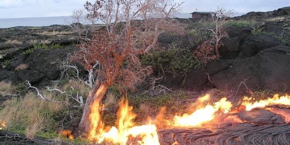
Drylands are highly vulnerable to climate and land use changes: what ecosystem changes are in store?

Learning From the Past and Planning for the Future: Experience-Driven Insight Into Managing for Ecosystem Transformations Induced by Drought and Wildfire
In his research and outreach activities, Dr. Duniway seeks to provide information for land managers and owners to facilitate sustainable land-use activities. He works closely with federal agency partners (Bureau of Land Management, National Park Service, National Resource Conservation Service, US Fish and Wildlife Service, and others such as The Nature Conservancy's Canyonlands Research Center) in designing research studies, conducting technology transfer, and outreach activities. Some primary current research focuses include understanding the impacts of drought on Colorado Plateau landscapes, evaluating the recovery of oil and gas pads on the Colorado Plateau and opportunities for improved restoration practices, developing novel restoration techniques for highly disturbed lands using biological soil crusts and physical barriers, and basic research into the importance of soils for dryland ecosystem processes.
Professional Experience
2011-Present: Research Ecologist, USGS Southwest Biological Science Center, Moab, UT
2010-2011: Research Soil Scientist, US Department of Agriculture Agricultural Research Service, Jornada, Las Cruces, NM
2006-2010: Research Soil Scientist (post doc), US Department of Agriculture Agricultural Research Service, Jornada, Las Cruces, NM
2012-Present: Adjunct Faculty, Utah State University, Logan, UT
2007-Present: Adjunct Faculty, NM State University, Las Cruces, NM
Education and Certifications
Ph.D., 2006 — Agronomy (Soil Science), New Mexico State University, Las Cruces, NM
B.S., 1994 — Environmental Resource Science, University of California, Davis, CA
Science and Products
Landsat time series analysis of fractional plant cover changes on abandoned energy development sites
Soil water dynamics at 15 locations distributed across a desert landscape: insights from a 27‐yr dataset
Insights from long-term ungrazed and grazed watersheds in a salt desert Colorado Plateau ecosystem
Identifying optimal remotely-sensed variables for ecosystem monitoring in Colorado Plateau drylands
Functional group, biomass, and climate change effects on ecological drought in semiarid grasslands
Future soil moisture and temperature extremes imply expanding suitability for rainfed agriculture in temperate drylands
Fine-resolution repeat topographic surveying of dryland landscapes using UAS-based structure-from-motion photogrammetry: Assessing accuracy and precision against traditional ground-based erosion measurements
Enhancing wind erosion monitoring and assessment for U.S. rangelands
Ecohydrological role of biological soil crusts across a gradient in levels of development
Climate change-induced vegetation shifts lead to more ecological droughts despite projected rainfall increases in many global temperate drylands
Potential human impacts of overlapping land-use and climate in a sensitive dryland: a case study of the Colorado Plateau, USA
Disturbance automated reference toolset (DART): Assessing patterns in ecological recovery from energy development on the Colorado Plateau
Non-USGS Publications**
**Disclaimer: The views expressed in Non-USGS publications are those of the author and do not represent the views of the USGS, Department of the Interior, or the U.S. Government.
Science and Products
- Science
Filter Total Items: 21
- Data
Filter Total Items: 31No Result Found
- Multimedia
No results found.
- Publications
Filter Total Items: 101
Landsat time series analysis of fractional plant cover changes on abandoned energy development sites
Oil and natural gas development in the western United States has increased substantially in recent decades as technological advances like horizontal drilling and hydraulic fracturing have made extraction more commercially viable. Oil and gas pads are often developed for production, and then capped, reclaimed, and left to recover when no longer productive. Understanding the rates, controls, and degAuthorsEric K. Waller, Miguel L. Villarreal, Travis B. Poitras, Travis W. Nauman, Michael C. DuniwaySoil water dynamics at 15 locations distributed across a desert landscape: insights from a 27‐yr dataset
Desert ecosystems are primarily limited by water availability. Within a climatic regime, topography, soil characteristics, and vegetation are expected to determine how the combined effects of precipitation, temperature, and evaporative demand of the atmosphere shape the spatial and temporal patterns of water within the soil profile and across a landscape. To forecast how desert landscapes may respAuthorsMichael C. Duniway, Matthew D. Petrie, Debra P. C. Peters, John P. Anderson, Keith Crossland, Jeffrey E. HerrickInsights from long-term ungrazed and grazed watersheds in a salt desert Colorado Plateau ecosystem
Dryland ecosystems cover over 41% of the earth’s land surface, and living within these important ecosystems are approximately 2 billion people, a large proportion of whom are subsistence agropastoralists. Improper grazing in drylands can negatively impact ecosystem productivity, soil conservation, hydrologic processes, downstream water quantity and quality, and ultimately human health and economicAuthorsMichael C. Duniway, Erika L. Geiger, Tamera J. Minnick, Susan L. Phillips, Jayne BelnapIdentifying optimal remotely-sensed variables for ecosystem monitoring in Colorado Plateau drylands
Water-limited ecosystems often recover slowly following anthropogenic or natural disturbance. Multitemporal remote sensing can be used to monitor ecosystem recovery after disturbance; however, dryland vegetation cover can be challenging to accurately measure due to sparse cover and spectral confusion between soils and non-photosynthetic vegetation. With the goal of optimizing a monitoring approachAuthorsTravis B. Poitras, Miguel L. Villarreal, Eric K. Waller, Travis W. Nauman, Mark E. Miller, Michael C. DuniwayFunctional group, biomass, and climate change effects on ecological drought in semiarid grasslands
Water relations in plant communities are influenced both by contrasting functional groups (grasses, shrubs) and by climate change via complex effects on interception, uptake and transpiration. We modelled the effects of functional group replacement and biomass increase, both of which can be outcomes of invasion and vegetation management, and climate change on ecological drought (soil water potentiAuthorsScott D. Wilson, Daniel R. Schlaepfer, John B. Bradford, William K. Lauenroth, Michael C. Duniway, Sonia A. Hall, Khishigbayar Jamiyansharav, Gensuo Jia, Ariuntsetseg Lkhagva, Seth M. Munson, David A. Pyke, Britta TietjenFuture soil moisture and temperature extremes imply expanding suitability for rainfed agriculture in temperate drylands
The distribution of rainfed agriculture is expected to respond to climate change and human population growth. However, conditions that support rainfed agriculture are driven by interactions among climate, including climate extremes, and soil moisture availability that have not been well defined. In the temperate regions that support much of the world’s agriculture, these interactions are complicAuthorsJohn B. Bradford, Daniel R. Schlaepfer, William K. Lauenroth, Charles B. Yackulic, Michael C. Duniway, Sonia A. Hall, Gensuo Jia, Khishigbayar Jamiyansharav, Seth M. Munson, Scott D. Wilson, Britta TietjenFine-resolution repeat topographic surveying of dryland landscapes using UAS-based structure-from-motion photogrammetry: Assessing accuracy and precision against traditional ground-based erosion measurements
Structure-from-motion (SfM) photogrammetry from unmanned aerial system (UAS) imagery is an emerging tool for repeat topographic surveying of dryland erosion. These methods are particularly appealing due to the ability to cover large landscapes compared to field methods and at reduced costs and finer spatial resolution compared to airborne laser scanning. Accuracy and precision of high-resolution dAuthorsJeffrey K. Gillian, Jason W. Karl, Ahmed Elaksher, Michael C. DuniwayEnhancing wind erosion monitoring and assessment for U.S. rangelands
On the GroundWind erosion is a major resource concern for rangeland managers because it can impact soil health, ecosystem structure and function, hydrologic processes, agricultural production, and air quality.Despite its significance, little is known about which landscapes are eroding, by how much, and when.The National Wind Erosion Research Network was established in 2014 to develop tools for monAuthorsNicholas P. Webb, Justin W. Van Zee, Jason W. Karl, Jeffrey E. Herrick, Ericha M. Courtright, Benjamin J. Billings, Robert C. Boyd, Adrian Chappell, Michael C. Duniway, Justin D. Derner, Jenny L. Hand, Emily Kachergis, Sarah E. McCord, Beth A. Newingham, Frederick B. Pierson, Jean L. Steiner, John Tatarko, Negussie H. Tedela, David Toledo, R. Scott Van PeltEcohydrological role of biological soil crusts across a gradient in levels of development
Though biological soil crusts (biocrusts) form abundant covers in arid and semiarid regions, their competing effects on soil hydrologic conditions are rarely accounted for in models. This study presents the modification of a soil water balance model to account for the presence of biocrusts at different levels of development (LOD) and their impact on one-dimensional hydrologic processes during warmAuthorsKristen M. Whitney, Enrique R. Vivoni, Michael C. Duniway, John B. Bradford, Sasha C. Reed, Jayne BelnapClimate change-induced vegetation shifts lead to more ecological droughts despite projected rainfall increases in many global temperate drylands
Drylands occur world-wide and are particularly vulnerable to climate change since dryland ecosystems depend directly on soil water availability that may become increasingly limited as temperatures rise. Climate change will both directly impact soil water availability, and also change plant biomass, with resulting indirect feedbacks on soil moisture. Thus, the net impact of direct and indirect climAuthorsBritta Tietjen, Daniel R. Schlaepfer, John B. Bradford, William K. Laurenroth, Sonia A. Hall, Michael C. Duniway, Tamara Hochstrasser, Gensuo Jia, Seth M. Munson, David A. Pyke, Scott D. WilsonPotential human impacts of overlapping land-use and climate in a sensitive dryland: a case study of the Colorado Plateau, USA
Climate and land-use interactions are likely to affect future environmental and socioeconomic conditions in drylands, which tend to be limited by water resources and prone to land degradation. We characterized the potential for interactions between land-use types and land-use and climate change in a model dryland system, the Colorado Plateau, a region with a history of climatic variability and lanAuthorsStella M. Copeland, John B. Bradford, Michael C. Duniway, Rudy SchusterDisturbance automated reference toolset (DART): Assessing patterns in ecological recovery from energy development on the Colorado Plateau
A new disturbance automated reference toolset (DART) was developed to monitor human land surface impacts using soil-type and ecological context. DART identifies reference areas with similar soils, topography, and geology; and compares the disturbance condition to the reference area condition using a quantile-based approach based on a satellite vegetation index. DART was able to represent 26–55% ofAuthorsTravis W. Nauman, Michael C. Duniway, Miguel L. Villarreal, Travis B. PoitrasNon-USGS Publications**
Browning, D.M., Duniway, M.C., Laliberte, A., and Rango, A., 2012, Hierarchical analysis of vegetation dynamics over 71 years: Soil-rainfall interactions in a Chihuahuan desert ecosystem: Ecological Applications, v. 22, p.909-926.Duniway, M., Karl, J., Schrader, S., Baquera, N., and Herrick, J., 2012, Rangeland and pasture monitoring: an approach to interpretation of high-resolution imagery focused on observer calibration for repeatability: Environmental Monitoring and Assessment, v. 184, p. 3789-3804.Karl, J., Duniway, M.C., Nusser, S.M., Opsomer, J.D., and Unnasch, R.S., 2012, Using Very-Large-Scale Aerial Imagery for Rangeland Monitoring and Assessment: Some Statistical Considerations: Rangeland Ecology & Management, v. 65, p. 330-339.Karl, J.W., Duniway, M.C., and Schrader, T.S., 2012, A Technique for Estimating Rangeland Canopy-Gap Size Distributions From High-Resolution Digital Imagery: Rangeland Ecology & Management, v. 65, p. 196-207.Browning, D.M., and Duniway, M.C., 2011, Digital soil mapping in the absence of field training data: a case study using terrain attributes and semiautomated soil signature derivation to distinguish ecological potential: Applied and Environmental Soil Science.Duniway, M.C., and Herrick, J.E., 2011, Disentangling road network impacts: the need for a holistic approach: Journal of Soil and Water Conservation, v. 66, p. 31A-36A.Peters, D.P.C., Lugo, A.E., Chapin, F.S., Pickett, S.T.A., Duniway, M.C., Rocha, A.V., Swanson, F.J., Laney, C., and Jones, J., 2011, Cross-system comparisons elucidate disturbance complexities and generalities: Ecosphere, v. 2, art. 81.Schrader, T.S., and Duniway, M.C., 2011, Image Interpreter Tool: An ArcGIS tool for estimating vegetation cover from high-resolution imagery: Rangelands, v. 33, p. 35-40.Duniway, M., Herrick, J., and Monger, H., 2010, Spatial and temporal variability of plant-available water in calcium carbonate-cemented soils and consequences for arid ecosystem resilience: Oecologia, v. 163, p. 215-226.Duniway, M.C., Bestelmeyer, B.T., and Tugel, A., 2010, Soil processes and properties that distinguish ecological sites and states: Rangelands, v. 32, p. 9-15.Duniway, M.C., Snyder, K.A., and Herrick, J.E., 2010, Spatial and temporal patterns of water availability in a grass–shrub ecotone and implications for grassland recovery in arid environments: Ecohydrology, v. 3, p. 55-67.Duniway, M.C., Herrick, J.E., and Monger, H.C., 2007, The high water-holding capacity of petrocalcic horizons: Soil Science Society of America Journal, v. 71, p. 812-819.Duniway, M.C., 2006, The functional role of petrocalcic horizons in desert ecosystems: spatial and temporal dynamics of plant water availability [Ph.D. Dissertation]: New Mexico State Univeristy, Las Cruces, New Mexico, USA.**Disclaimer: The views expressed in Non-USGS publications are those of the author and do not represent the views of the USGS, Department of the Interior, or the U.S. Government.
- Web Tools
- News