Grand Canyon Sandbar Monitoring

Since the completion of Glen Canyon Dam in 1963, the amount of sand supplied to Grand Canyon National Park has been reduced by more than 90 percent. The Paria River, a tributary to the Colorado River 15 miles downstream from the dam, is now the single most important supplier of sand to the Colorado River within the Park. This large reduction in sand supply has resulted in substantial decrease in the number and size of sandbars. Sandbars are important because they serve as campsites for river runner and hikers, provide important aquatic and riparian habitats, and are the source of sand that may help protect archaeological sites. The information collected by this project will be used to determine whether dam operations, including short-duration artificial floods, cause increases or decreases in sandbars and associated campsites in Grand Canyon National Park.


Sandbar Monitoring Data

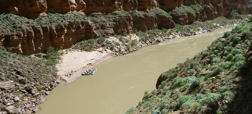
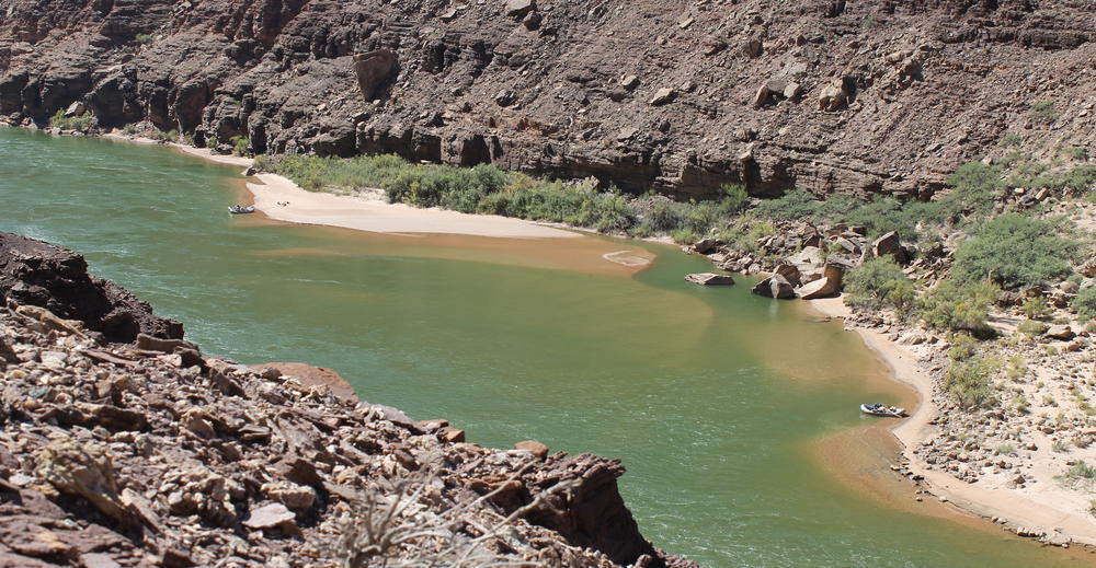
Currently, topographic maps are made at a set of monitoring sites annually using conventional survey equipment. These surveys are used to calculate the size of each sandbar in terms of the area of exposed sand and the volume of sand contained in the bar. Both of these calculations are relative to an elevation of interest.


Sites Map
View Data

References

Methods
  • Hazel, J.E., Jr., Grams, P.E., Schmidt, J.C., and Kaplinski, M., 2010, Sandbar response in Marble and Grand Canyons, Arizona, following the 2008 high-flow experiment on the Colorado River: U.S. Geological Survey Scientific Investigations Report 2010–5015, 52 p. http://pubs.usgs.gov/sir/2010/5015/.
Recent Publications
  • Butterfield, B.J., Grams, P.E., Durning, L.E., Hazel, J., Palmquist, E.C., Ralston, B.E., and Sankey, J.B., 2020, Associations between riparian plant morphological guilds and fluvial sediment dynamics along the regulated Colorado River in Grand Canyon: River Research and Applications. doi:10.1002/rra.3589. https://doi.org/10.1002/rra.3589
  • Grams, P.E., Tusso, R.B., and Buscombe, D., 2018, Automated Remote Cameras for Monitoring Alluvial Sandbars on the Colorado River in Grand Canyon, Arizona: U.S. Geological Survey Open-File Report 2018-1019, p. 61. doi:10.3133/ofr20181019. https://pubs.usgs.gov/of/2018/1019/ofr20181019.pdf
  • Hadley, D.R., Grams, P.E., and Kaplinski, M.A., 2018, Quantifying geomorphic and vegetation change at sandbar campsites in response to flow regulation and controlled floods, Grand Canyon National Park, Arizona: River Research and Applications, p. 1–11. doi:10.1002/rra.3349. https://doi.org/10.1002/rra.3349
  • Mueller, E.R., Grams, P.E., Hazel, J.E., and Schmidt, J.C., 2018, Variability in eddy sandbar dynamics during two decades of controlled flooding of the Colorado River in the Grand Canyon: Sedimentary Geology, v. 363, p. 181–199, doi:10.1016/j.sedgeo.2017.11.007. https://doi.org/10.1016/j.sedgeo.2017.11.007.
  • Grams P. E., 2013, A sand budget for Marble Canyon, Arizona -- implications for long-term monitoring of sand storage change, U.S. Geological Survey Fact Sheet 2013–3074, 4p., http://pubs.usgs.gov/fs/2013/3074.
  • Grams P. E., D. J. Topping, J. C. Schmidt, J. E. Hazel Jr., and M. Kaplinski, 2013, Linking morphodynamic response with sediment mass balance on the Colorado River in Marble Canyon: Issues of scale, geomorphic setting, and sampling design, J. Geophys. Res. Earth Surf., 118, 361–381, doi:10.1002/jgrf.20050. http://onlinelibrary.wiley.com/doi/10.1002/jgrf.20050/full.
US Geological Survey Data Release
  • Grams, P. E., Hazel, J. E., Jr., Kaplinski, M., Ross, R. P., Hamill, D., Hensleigh, J., Gushue, T, 2020, Long-term sandbar monitoring data along the Colorado River in Marble and Grand Canyons, Arizona. U.S. Geological Survey Data Release. https://doi.org/10.5066/P93F8JJK.

Additional Information
Point of Contact - Paul Grams Project Links

Terms of Use

The data presented in this website are collected and processed using standard USGS protocols and other established peer-reviewed methods, and subject to rigorous quality control. Nevertheless, minor edits of these data are possible.

The data are released on the condition that neither the USGS nor the U.S. Government may be held liable for any damages resulting from its authorized or unauthorized use.