



From Source to Streams
New national models estimate seasonal nutrients over 21 years in rivers across the U.S.
New national models estimate seasonal nutrients over 21 years in rivers across the U.S.
New Research, Development, and Innovation Program
The Hydrologic Instrumentation Facility (HIF) launches national research and development program
The Hydrologic Instrumentation Facility (HIF) launches national research and development program
Where surface water runs low, groundwater supplements water supply
1,000 Cameras and Counting
Growing network of webcams supports water science and safety
Growing network of webcams supports water science and safety
Water Resources Mission Area
Water information is fundamental to national and local economic well-being, protection of life and property, and effective management of the Nation’s water resources. The USGS works with partners to monitor, assess, conduct targeted research, and deliver information on a wide range of water resources and conditions including streamflow, groundwater, water quality, and water use and availability.
Message from the Associate Director
Message from the Associate Director

Learn more about the Mission Area from the Associate Director for Water Resources.
Water Data for the Nation
Water Data for the Nation

Water data collected at approximately 1.9 million sites across all 50 states.
News
Hydrologic Technician Job Opening in Richmond, VA
Hydrologic Technician Job Opening in Richmond, VA
From source to streams: New national models estimate seasonal nutrients over 21 years in rivers across the U.S.
From source to streams: New national models estimate seasonal nutrients over 21 years in rivers across the U.S.
The Hydrologic Instrumentation Facility (HIF) launches national research and development program
The Hydrologic Instrumentation Facility (HIF) launches national research and development program
Publications
Triple oxygen isotope compositions of isotopic reference waters: Implications for VSMOW-Scale and VSMOW-SLAP-Scale Δ′¹⁷O calibration Triple oxygen isotope compositions of isotopic reference waters: Implications for VSMOW-Scale and VSMOW-SLAP-Scale Δ′¹⁷O calibration
Triple oxygen isotope ratios of waters are commonly reported on the VSMOW–SLAP scale, whereas comparison with theoretical calculations and assessment of instrumental scale distortion require accurate constraints on the measured isotopic compositions of the primary isotopic reference materials (iRMs) themselves. In particular, the measured δ17OVSMOW and Δ′17OVSMOW values for SLAP and its...
U.S. Geological Survey Monitoring Milestones—Oe-151 at Woodgate, NY (433112075091501) U.S. Geological Survey Monitoring Milestones—Oe-151 at Woodgate, NY (433112075091501)
On July 9, 1926, monitoring well Oe-151 at Woodgate, New York (USGS ID 433112075091501) recorded its first groundwater data. Since then, the well has provided water data nearly continuously and has now reached a 100-year milestone for data collection. The well is part of the U.S. Geological Survey (USGS) Climate Response Network (CRN), which is a national network of wells selected to...
Science
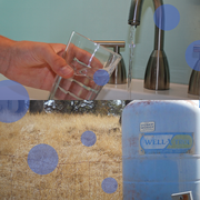
Unequal Access to Water: How Societal Factors Shape Vulnerability to Water Insecurity
Everyone needs access to clean water. For those with limited access, water insecurity has a daily impact on their lives. People may be more or less vulnerable to water insecurity due to a variety of factors. Our data visualizations and interactive charts allow you to explore this topic in detail.

Accessing Water Use Data
The USGS provides historic and recent water use data for the United States including the District of Columbia, Puerto Rico, and the U.S. Virgin Islands. This page provides an up-to-date guide to accessing, downloading, and using USGS water use data.

SPARROW modeling: Estimating nutrient, sediment, and dissolved solids transport
SPARROW (SPAtially Referenced Regression On Watershed attributes) models estimate the amount of a contaminant transported from inland watersheds to larger water bodies by linking monitoring data with information on watershed characteristics and contaminant sources. Interactive, online SPARROW mapping tools allow for easy access to explore relations between human activities, natural processes, and...