Data
Reference Data (All)
LPDAAC Data
Products
Web Map (Products)
Area Maps
Cropland Percent to Total Global Cropland
Cropland Percent to Country Land Area
Cropland per Capita
Cropland by Continent
Cropland Percent of Land Area by Continent
Final Map
Interactive Cropland Area Maps
Interactive Accuracy Maps
Information
About Global Croplands
FAQs
GFSAD30CE Info
Contacts
Documents
Download Data
Publications
GFSAD30 USGS Site
Search
Search
GFSAD30 Documents, Maps, and Helpful Links
Supporting Documents and Maps
Title
Document Link
Field Guide Procedures
PDF
Training Data Download Integer Key
PDF
Cropland Classification Instructions
PDF
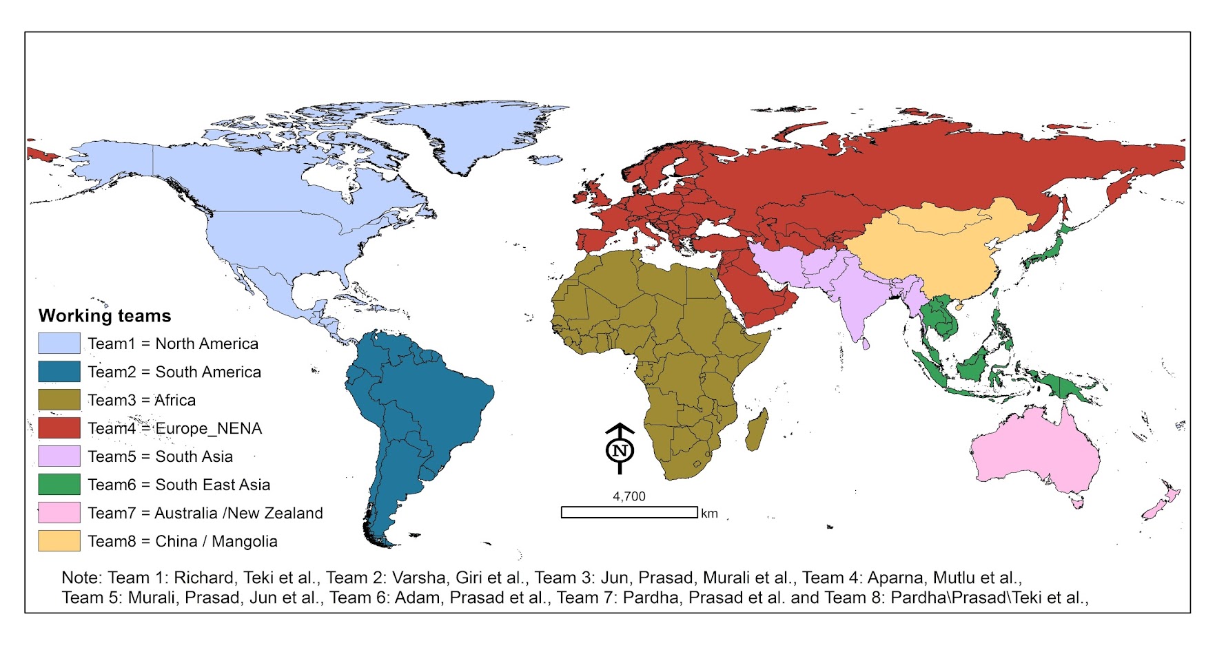
GFSAD Team Map
Map
Croplands Data Definitions
PDF
Current Achievements and Future Possibilities
PDF
Links to Global Country by Country Cropland Area Statistics: Various Sources
Websites
http://data.worldbank.org/indicator/AG.LND.AGRI.ZS
http://data.worldbank.org/indicator/AG.LND.AGRI.K2
http://data.worldbank.org/indicator/AG.LND.CROP.ZS
http://www.indexmundi.com/facts/indicators/AG.LND.CROP.ZS
http://www.indexmundi.com/facts/indicators/AG.LND.CROP.ZS
https://ourworldindata.org/land-use-in-agriculture/
http://beef2live.com/story-countries-arable-land-world-0-108929
http://www.tradingeconomics.com/kazakhstan/permanent-cropland-percent-of-land-area-wb-data.html
https://knoema.com/WBWDIGDF2016May/world-development-indicators-wdi-june-2016?tsId=2132770
http://www.tradingeconomics.com/india/permanent-cropland-percent-of-land-area-wb-data.html
http://www.fao.org/faostat/en/#home
Links to Irrigated Cropland Areas
Websites
http://world.bymap.org/IrrigatedLand.html
http://www.photius.com/rankings/geography/irrigated_land_2014_0.html
http://www.nationmaster.com/country-info/stats/Geography/Irrigated-land
http://www.fao.org/nr/water/aquastat/irrigationmap/index20.stm
http://www.fao.org/nr/water/aquastat/didyouknow/index3.stm
World Statistics
Website
http://world.bymap.org/