
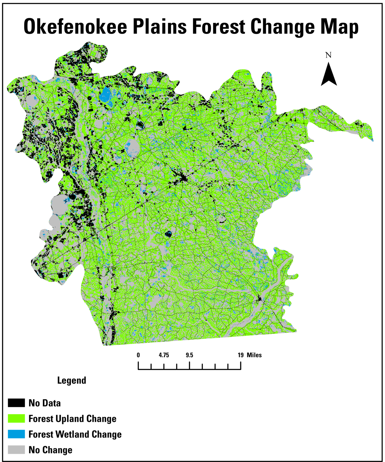
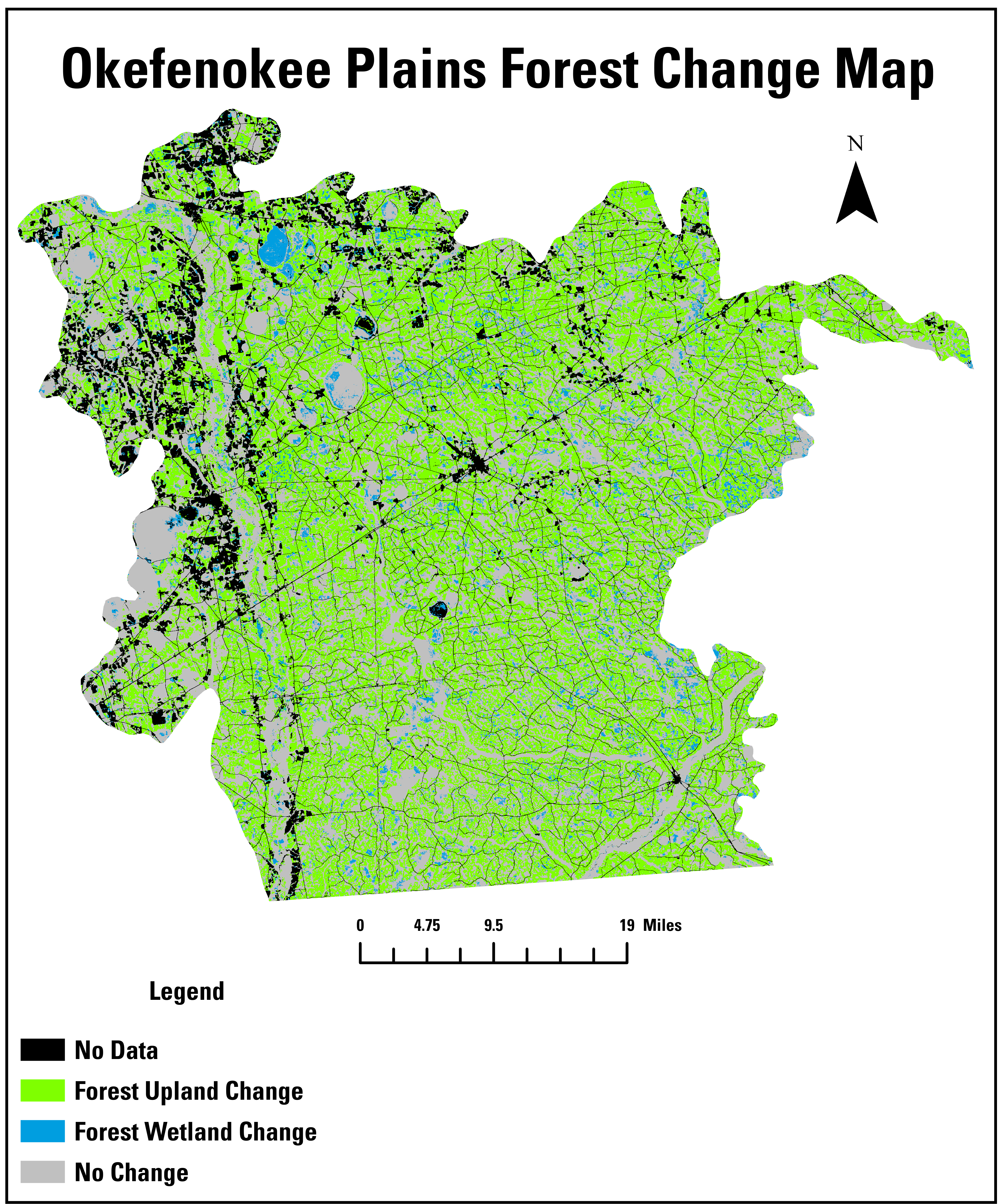
A map of forest change on the Okefenokee Plains from 1985-2024
Altered Content -
Annual NLCD, the source of this change information, is produced with AI techniques.
Detailed Description
This map of forest change on the Okefenokee Plains from 1985-2024 uses Annual National Land Cover Database (NLCD) data.
Sources/Usage
Public Domain.