
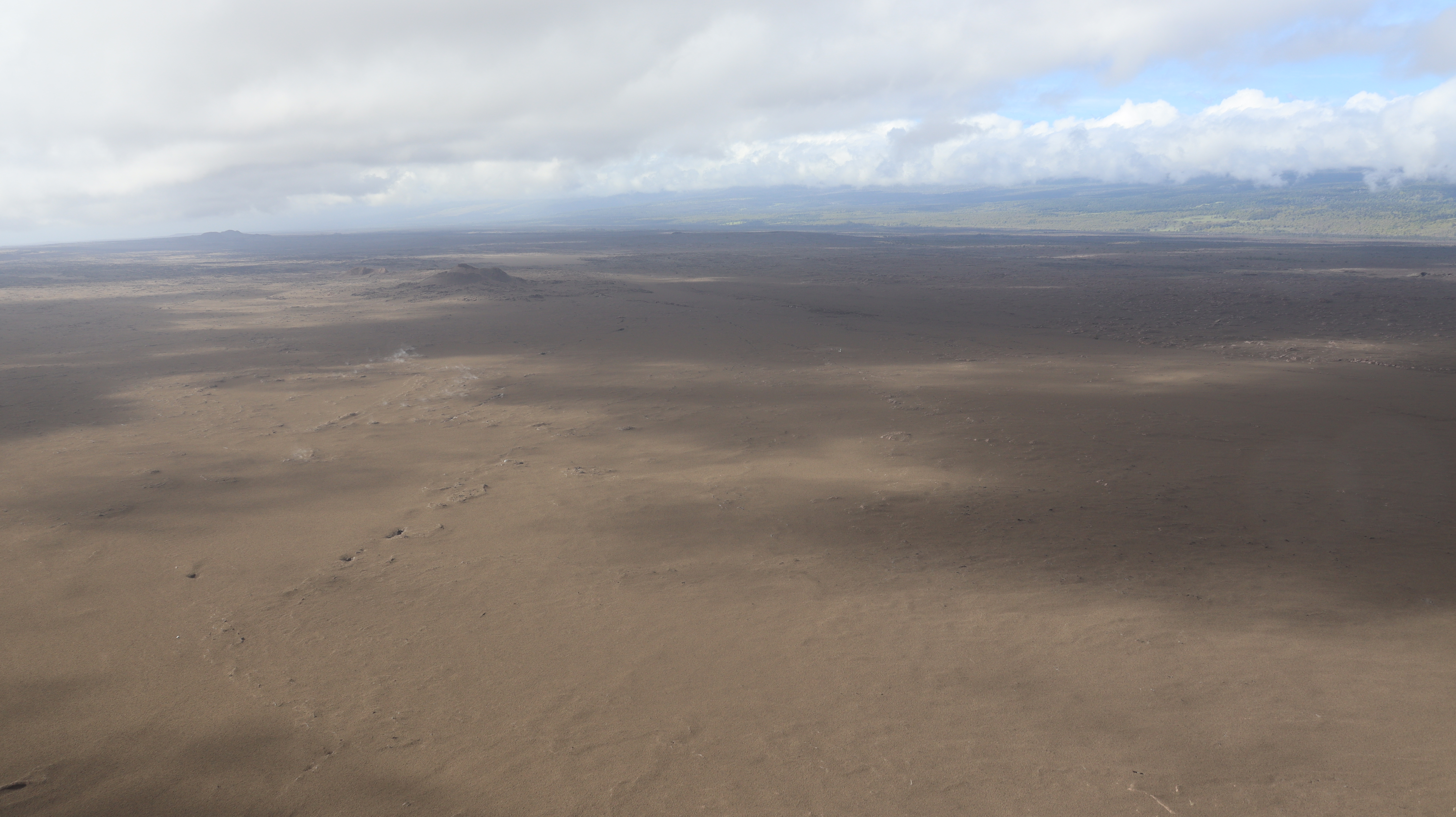
December 19, 2025 — Tephra covered landscape of the Southwest Rift Zone, Kīlauea

Detailed Description
This aerial view, captured during a USGS Hawaiian Volcano Observatory monitoring overflight on December 19, 2025, shows the Southwest Rift Zone of Kīlauea between the summit caldera and the prominent scoria cones of Puʻukoaʻe. This region of the volcano is covered by a nearly continuous blanket of fresh tephra deposited since December 23, 2024, when the episodic lava fountaining began within Halema‘uma‘u crater. USGS photo by D. Downs.
Sources/Usage
Public Domain.