
Energy Image Collage

Detailed Description
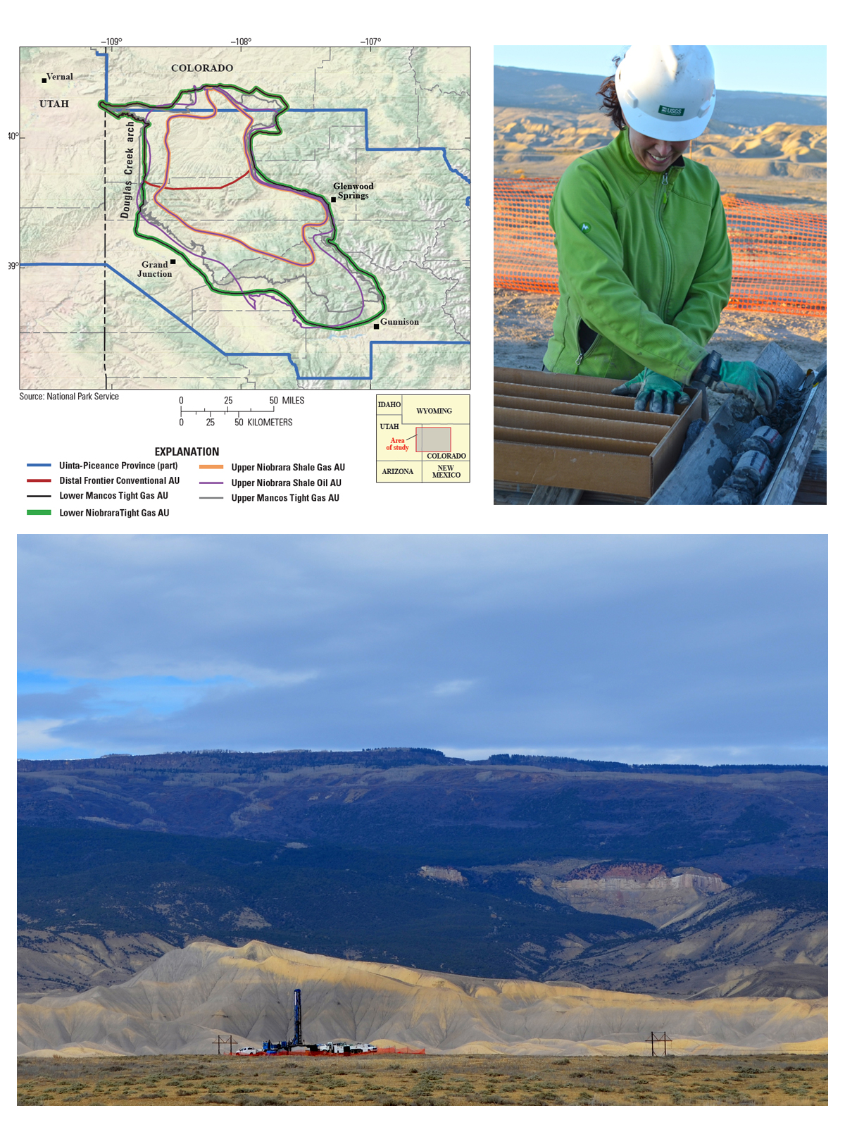
Top left: A map showing the Mancos Shale and the USGS assessment units within the formation. Top right: USGS scientist Sarah Hawkins, lead scientist for the Mancos Shale assessment, examines a core drilled by the USGS Core Research Center. This core provided valuable data for the assessment. Photograph credit: Joshua Hicks, USGS. Bottom: The USGS Core Research Center collaborated with the USGS Energy Resources Program to drill a core from the Mancos Shale to aid in the oil and gas assessment. Photograph credit: Joshua Hicks, USGS.
View high-resolution copies of individual images at the following website: https://www.usgs.gov/news/usgs-estimates-66-trillion-cubic-feet-natural…