
Walker Basin Hydro Mapper
About this tool
The Walker Basin Hydro Mapper provides a basin-wide view of real-time streamflow and reservoir storage capacity for the Walker River Basin in Nevada and California. This tool was developed to create a common operating picture for water users in the basin and to help monitor changes in instream flows.
Features
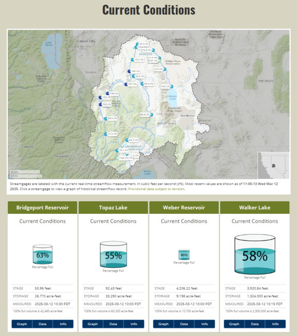
See Current Conditions
The interactive map displays data from USGS stream, lake, and atmospheric stations, as well as Natural Resources Conservation Service (NRCS) SNOTEL stations and current weather conditions.
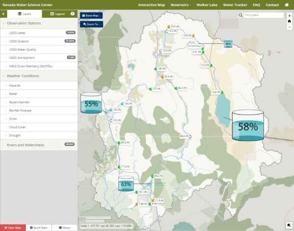
Visualize stage and storage information
Stage and storage data are provided, along with descriptive information for Bridgeport Reservoir, Topaz Lake, Weber Reservoir, and Walker Lake.
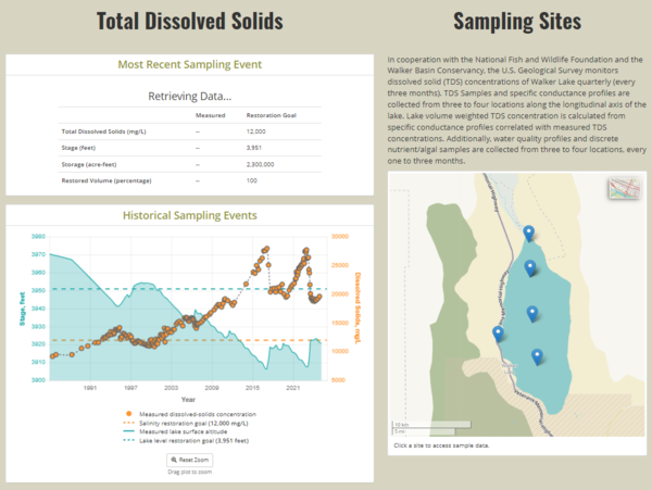
Visualize water quality profiles
Historical and recent water quality profiles, including total dissolved solids (TDS) concentrations for Walker Lake, are also available.
Related

Science in the Walker River Basin
Related