Database and web application for invasive carp telemetry data (FishTracks)
Four types of invasive carp fish species, are currently found in the United States: black, grass, silver, and bighead carps. These species are fast growing, prolific feeders that out-compete native fish species and drastically alter the natural ecosystems they invade. To prevent the spread of invasive carp into the Great Lakes, the multi-agency Asian Carp Regional Coordinating Committee (ACRCC) implements collective efforts to oversee and coordinate interagency research, prevention, monitoring, control, and removal of invasive carp. Detection and monitoring efforts include multi-agency surveillance using an acoustic telemetry array deployed throughout the Upper Mississippi River Basin.
Telemetry monitoring generates a large amount of data; dozens of telemetry receivers and hundreds of transmitter tags produce millions of detection records. In addition to the large amount of data being produced, the acoustic telemetry array deployed throughout the Upper Mississippi River Basin is managed by multiple agencies; partner agencies contribute data they collect to the FishTracks Telemetry Database for use by the larger partnership.
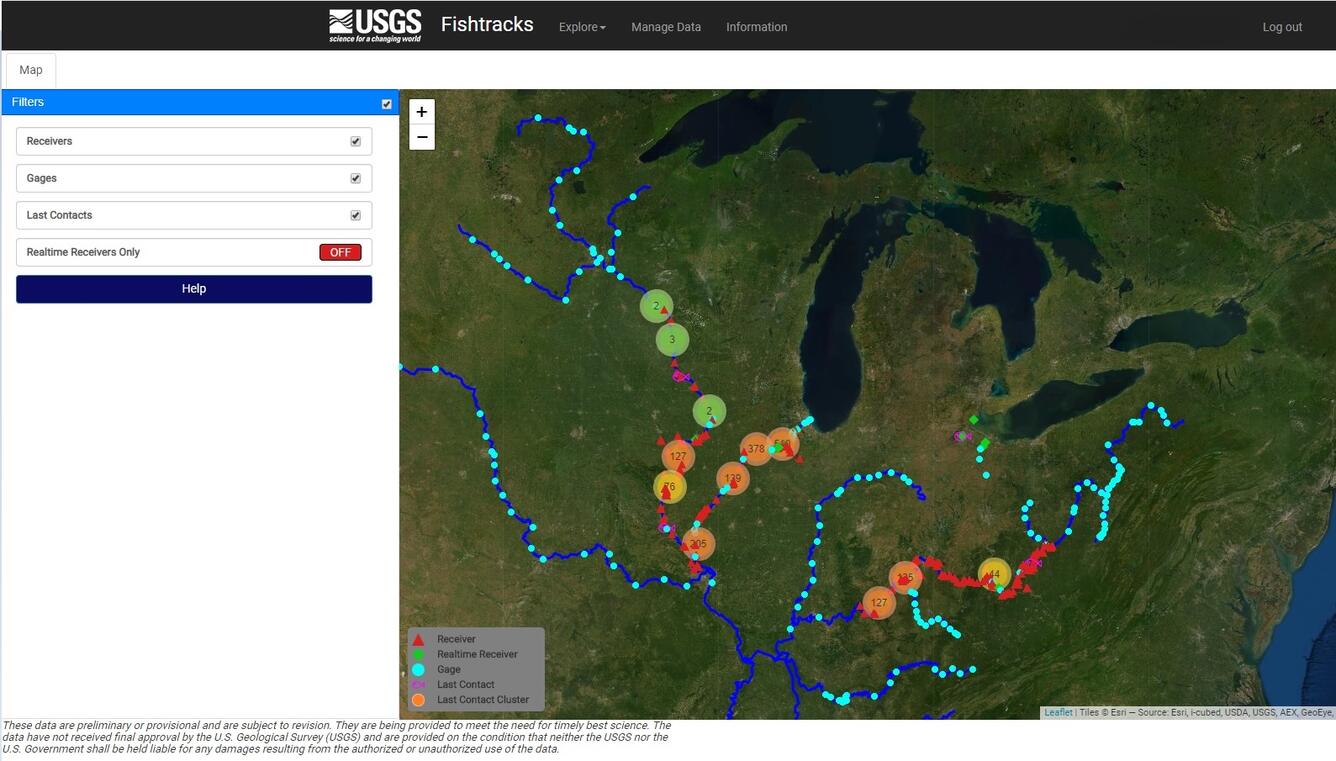
In support of these detection and monitoring efforts, this project provides centralized access to standardized invasive carp-related telemetry data in a scalable, query-able, downloadable database format (referred to as the FishTracks Telemetry Database, or FishTracks). Informational products from FishTracks facilitate data sharing, use, and analysis by providing monitoring agencies with automated reporting and visualization of telemetry data in a web interface. Data in the FishTracks Telemetry Database can be used to analyze the distribution and movement of invasive carp throughout the Upper Mississippi River Basin to inform removal efforts, to plan contingency response actions, and to parameterize population models for scenario planning and adaptive management.


**Agencies retain ownership of the datasets they contribute to FishTracks; sharing of these datasets beyond supporting the collective management objectives of the broader partnership is at the discretion of the original collecting agency.
**This effort is funded in part by the Great Lakes Restoration Initiative (GLRI).
Four types of invasive carp fish species, are currently found in the United States: black, grass, silver, and bighead carps. These species are fast growing, prolific feeders that out-compete native fish species and drastically alter the natural ecosystems they invade. To prevent the spread of invasive carp into the Great Lakes, the multi-agency Asian Carp Regional Coordinating Committee (ACRCC) implements collective efforts to oversee and coordinate interagency research, prevention, monitoring, control, and removal of invasive carp. Detection and monitoring efforts include multi-agency surveillance using an acoustic telemetry array deployed throughout the Upper Mississippi River Basin.
Telemetry monitoring generates a large amount of data; dozens of telemetry receivers and hundreds of transmitter tags produce millions of detection records. In addition to the large amount of data being produced, the acoustic telemetry array deployed throughout the Upper Mississippi River Basin is managed by multiple agencies; partner agencies contribute data they collect to the FishTracks Telemetry Database for use by the larger partnership.
In support of these detection and monitoring efforts, this project provides centralized access to standardized invasive carp-related telemetry data in a scalable, query-able, downloadable database format (referred to as the FishTracks Telemetry Database, or FishTracks). Informational products from FishTracks facilitate data sharing, use, and analysis by providing monitoring agencies with automated reporting and visualization of telemetry data in a web interface. Data in the FishTracks Telemetry Database can be used to analyze the distribution and movement of invasive carp throughout the Upper Mississippi River Basin to inform removal efforts, to plan contingency response actions, and to parameterize population models for scenario planning and adaptive management.


**Agencies retain ownership of the datasets they contribute to FishTracks; sharing of these datasets beyond supporting the collective management objectives of the broader partnership is at the discretion of the original collecting agency.
**This effort is funded in part by the Great Lakes Restoration Initiative (GLRI).

