
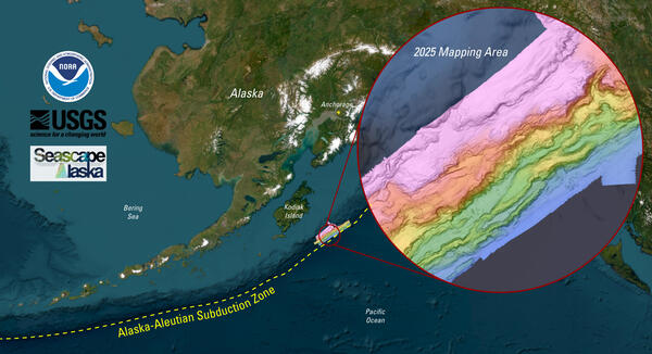
New seafloor mapping offshore Kodiak Island, Alaska, reveals extensive submarine landslides
In summer 2025, a research team led by the USGS worked with the NOAA ship Rainier to map a large swath of seafloor offshore of Kodiak Island, Alaska, along the Alaska-Aleutian Trench.
The total mapping area covers more than 6300km2 (~2400mi2), roughly the size of the state of Delaware. This work was the result of an ongoing partnership between NOAA and USGS as part of the Seascape Alaska campaign to increase regional mapping efforts through collaboration among state and federal agencies. The region is part of the USGS Coastal and Marine Hazards and Resources Program focus on Subduction Zone Hazards, including offshore earthquakes, landslides and tsunamis that affect coastal populations and infrastructure both locally and afar.
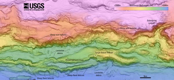
“These new data will allow us to evaluate the potential for tsunamigenic landslides that pose a major threat to coastal communities in Alaska,” said USGS Research Geologist, Jenna Hill, who spearheaded the mapping effort. “While people often think of the ground-shaking associated with large earthquakes along subduction zones like the Alaska-Aleutian Trench, cascading hazards such as submarine landslides and tsunamis can enhance the risk.”
The M9.2 Great Alaska Earthquake, the largest earthquake recorded in U.S. history, occurred in this region in 1964. More than 60% of the fatalities associated with this earthquake occurred as a result of submarine landslides, highlighting the need to better understand the sources and mechanisms of these failures.
Related

Coastal and Marine Geohazards of the U.S. West Coast and Alaska
Related