
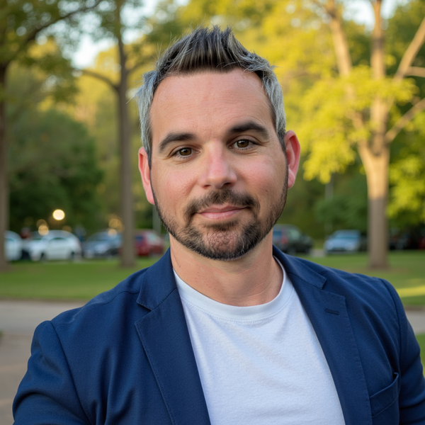
Photograph of Brett D. Johnston taken in Winter Garden, Florida, facing forward with a neutral expression.
Multimedia
Images
Picture of Brett D. Johnston
Photograph of Brett D. Johnston taken in Winter Garden, Florida, facing forward with a neutral expression.
USGS Coastal Change Experts Warn of Heightened Risks for Florida’s West Coast as Hurricane Milton Approaches in the aftermath of Helene
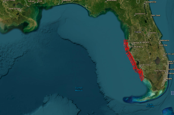
USGS Coastal Change Experts Warn of Heightened Risks for Florida’s West Coast as Hurricane Milton Approaches in the aftermath of HeleneScreenshot of the USGS Coastal Changes Hazards Portal, showing the forecasted coastal change along Florida's Western coast. Screenshot captured on 10/7/2024 at 3:00PM ET.
USGS Coastal Change Experts Warn of Heightened Risks for Florida’s West Coast as Hurricane Milton Approaches in the aftermath of Helene
USGS Coastal Change Experts Warn of Heightened Risks for Florida’s West Coast as Hurricane Milton Approaches in the aftermath of HeleneScreenshot of the USGS Coastal Changes Hazards Portal, showing the forecasted coastal change along Florida's Western coast. Screenshot captured on 10/7/2024 at 3:00PM ET.

USGS installs wave sensors in Florida before Hurricane Milton makes landfall
USGS installs wave sensors in Florida before Hurricane Milton makes landfallJulie Hobbs, a USGS hydrologic technician, installs a wave sensor near Venice, Fla., Monday, October 7, 2024, ahead of Hurricane Milton’s projected landfall in Florida’s Gulf Coast Wednesday. USGS photo by Sean Townsend.

USGS deploys wave sensors along Florida's coast ahead of Hurricane Helene
USGS deploys wave sensors along Florida's coast ahead of Hurricane HeleneJulie Hobbs, a USGS hydrologic technician, installs a wave sensor at Long Boat Key, Fla., Wednesday, Sept. 25, 2024 ahead of Hurricane Helene's projected landfall in Florida Thursday. (USGS photo by Tim Fiori)

USGS deploys wave sensors along Florida's coast ahead of Hurricane Helene
USGS deploys wave sensors along Florida's coast ahead of Hurricane HeleneTim Fiori, a USGS hydrologic technician, installs a wave sensor at Long Boat Key, Fla., Wednesday, Sept. 25, 2024 ahead of Hurricane Helene's projected landfall in Florida Thursday. (USGS photo by Julie Hobbs)

USGS deploys wave sensors along Florida's coast ahead of Hurricane Helene
USGS deploys wave sensors along Florida's coast ahead of Hurricane HeleneTim Fiori, a USGS hydrologic technician, installs a barometric pressure sensor at Venice, Fla., Wednesday, Sept. 25, 2024 ahead of Hurricane Helene's projected landfall in Florida Thursday. (USGS photo by Julie Hobbs)
Videos

Event Recording: Explore USGS Careers in Florida and the Caribbean – Science Support Panel
Event Recording: Explore USGS Careers in Florida and the Caribbean – Science Support PanelThree USGS Centers held this virtual event on February 23, 2023 to showcase various science career paths within USGS: the Caribbean-Florida Water Science Center, St.

Event Recording: Explore USGS Careers in Florida and the Caribbean – Research Panel
Event Recording: Explore USGS Careers in Florida and the Caribbean – Research PanelThree USGS Centers held this virtual event on February 23, 2023 to showcase various science career paths within USGS: the Caribbean-Florida Water Science Center, St.

Event Recording: Explore USGS Careers in Florida and the Caribbean – Technical Capabilities Panel
Event Recording: Explore USGS Careers in Florida and the Caribbean – Technical Capabilities PanelThree USGS Centers held this virtual event on February 23, 2023 to showcase various science career paths within USGS: the Caribbean-Florida Water Science Center, St.

Lake Okeechobee Sediment Transport Project
Suspended sediment from Lake Okeechobee might be a source of nutrients that helps trigger the growth and development of harmful algal blooms in the Caloosahatchee and St. Lucie Rivers.
Suspended sediment from Lake Okeechobee might be a source of nutrients that helps trigger the growth and development of harmful algal blooms in the Caloosahatchee and St. Lucie Rivers.

USGS Hurricane Preparedness
Before a hurricane, USGS Scientists undertake a data collection effort of a grand scale. They install a temporary mobile network of sensors along the coasts to collect additional data on the intensity of storm surge, one of the most dangerous elements of a hurricane.
Before a hurricane, USGS Scientists undertake a data collection effort of a grand scale. They install a temporary mobile network of sensors along the coasts to collect additional data on the intensity of storm surge, one of the most dangerous elements of a hurricane.

USGS Supports Broward Water Matters Day 2017
Caribbean-Florida Water Science Center, Davie Office, supported Broward County Watter Matters Day on March 11, 2017 as part of an outreach event to the public.
http://www.broward.org/WaterMatters/Pages/ProgramsWMD.aspx
Caribbean-Florida Water Science Center, Davie Office, supported Broward County Watter Matters Day on March 11, 2017 as part of an outreach event to the public.
http://www.broward.org/WaterMatters/Pages/ProgramsWMD.aspx
Webcams

Sand Key, Florida
Most recent time-averaged image from Sand Key, Florida. The images are used to examine a range of coastal processes including shoreline position, the presence of an offshore sandbar, and the extent of wave runup on the beach. Camera hosted by Dan's Island Condo.
Most recent time-averaged image from Sand Key, Florida. The images are used to examine a range of coastal processes including shoreline position, the presence of an offshore sandbar, and the extent of wave runup on the beach. Camera hosted by Dan's Island Condo.

Madeira Beach
A coastal camera located on Medeira Beach, Florida near the Shoreline Island Resort.
A coastal camera located on Medeira Beach, Florida near the Shoreline Island Resort.
Cypress Creek at County Line Rd. at Wesley Chapel (02303424)
Cypress Creek at County Line Rd. at Wesley Chapel (02303424)Live Watercam video at Cypress Creek at County Line Rd. at Wesley Chapel (02303424)
Cypress Creek at County Line Rd. at Wesley Chapel (02303424)
Cypress Creek at County Line Rd. at Wesley Chapel (02303424)Live Watercam video at Cypress Creek at County Line Rd. at Wesley Chapel (02303424)
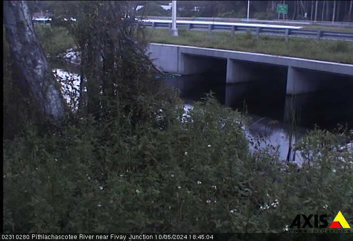
Pithlachascotee River near Fivay Junction (02310280)
Pithlachascotee River near Fivay Junction (02310280)Latest image from live Watercam video at Pithlachascotee River near Fivay Junction (02310280)
Pithlachascotee River near Fivay Junction (02310280)
Pithlachascotee River near Fivay Junction (02310280)Latest image from live Watercam video at Pithlachascotee River near Fivay Junction (02310280)
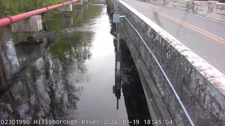
Hillsborough River above Crystal Springs near Zephyrhills (02301990)
Hillsborough River above Crystal Springs near Zephyrhills (02301990)Live Watercam video at Hillsborough River above Crystal Springs near Zephyrhills (02301990)
Hillsborough River above Crystal Springs near Zephyrhills (02301990)
Hillsborough River above Crystal Springs near Zephyrhills (02301990)Live Watercam video at Hillsborough River above Crystal Springs near Zephyrhills (02301990)
Trout Creek at Wesley Chapel (02303348)
Latest image from the live Watercam video at Trout Creek at Wesley Chapel (02303348)
Latest image from the live Watercam video at Trout Creek at Wesley Chapel (02303348)