
This is a photo of a dam in the lower Yakima River. Efforts to ameliorate the negative effects of diversion dams on aquatic species of concern are important in rivers where water withdrawal supports agricultural economies, and they are likely to become increasingly important with impending climate change.
Multimedia
Learn more about the Land Management Research Program through the multimedia below.
Images
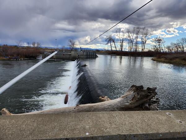
Dam in the lower Yakima River
This is a photo of a dam in the lower Yakima River. Efforts to ameliorate the negative effects of diversion dams on aquatic species of concern are important in rivers where water withdrawal supports agricultural economies, and they are likely to become increasingly important with impending climate change.
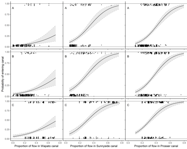
Nine Panel Plot of Fish Passage Entrainment vs Canal Flow
Nine Panel Plot of Fish Passage Entrainment vs Canal FlowEstimated relationship between entrainment probability and proportion of river flow entering canals at Wapato Dam, Sunnyside Dam, and Prosser Dam on the Yakima River, Washington. The relationships are shown at the mean total river flow for (A) yearling Chinook Salmon, (B) juvenile steelhead, and (C) subyearling Chinook Salmon.
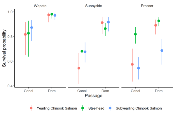
Survival Probabilities of Fish Through Canals Versus Dams
Survival Probabilities of Fish Through Canals Versus DamsSurvival probability estimates and 95% confidence intervals for yearling Chinook Salmon, juvenile steelhead, and subyearling Chinook Salmon at three diversion dams on the Yakima River, Washington.
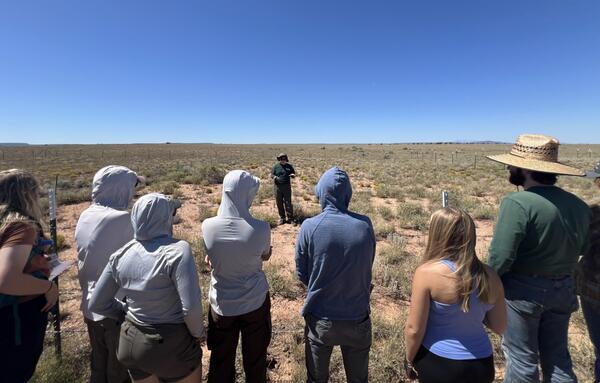
A USGS Ecologist gives a tour of a Northern Arizona RestoreNet site
A USGS Ecologist gives a tour of a Northern Arizona RestoreNet siteLaura Shriver, RAMPS coordinator, gives a tour of a Northern Arizona RestoreNet site to Northern Arizona University students. Photo by Jessica Archibald (Diablo Trust).
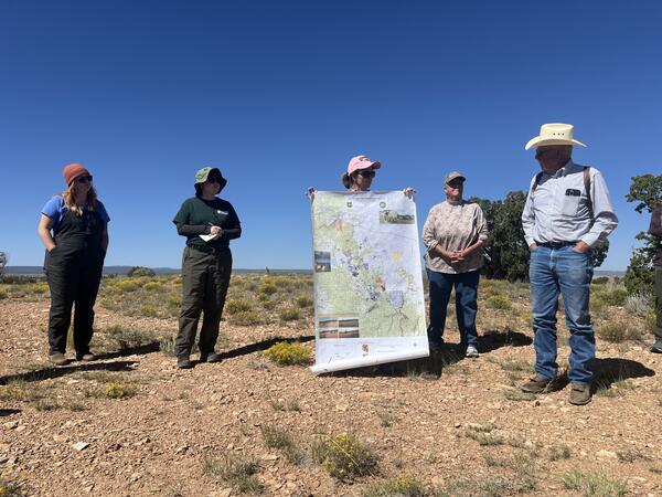
Researchers and ranchers discuss land management in Northern Arizona
Researchers and ranchers discuss land management in Northern ArizonaResearchers from the U.S. Geological Survey and University of Arizona collaborate with Diablo Trust ranchers on range improvement and restoration efforts on Northern Arizona rangelands. Photo by Jessica Archibald (Diablo Trust).
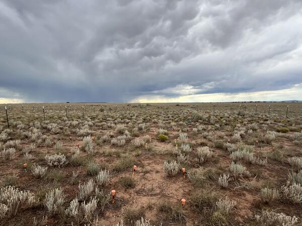
Monsoon season at a Northern Arizona RestoreNet site
Monsoon season at a Northern Arizona RestoreNet siteA RestoreNet site in Northern Arizona with late summer monsoon rain clouds in the background. Photo by Laura Shriver.
Monsoon season at a Northern Arizona RestoreNet site
Monsoon season at a Northern Arizona RestoreNet siteA RestoreNet site in Northern Arizona with late summer monsoon rain clouds in the background. Photo by Laura Shriver.
Videos

Collecting soil samples in a cheatgrass-invaded landscape
Collecting soil samples in a cheatgrass-invaded landscapeField technicians collect soil samples and monitor plants in an invasive grass dominated sagebrush steppe ecosystem in Colorado. The team measured carbon levels at two soil depths at undisturbed sites, sites that have been burned and invaded, areas that are unburned but invaded, and sites that were burned but not invaded.

Conservation Efforts Database — Registration
This video shows you how to register for access to the Conservation Efforts Database, update your user profile, and navigate the site’s resources.
This video shows you how to register for access to the Conservation Efforts Database, update your user profile, and navigate the site’s resources.
Conservation Efforts Database — Single Record Data Entry Step 1
Conservation Efforts Database — Single Record Data Entry Step 1This video is step 1 in a series of videos that show you how to enter data into the Conservation Efforts Database using the single record data entry method. Step 1 is the creation of a new conservation effort.
Conservation Efforts Database — Single Record Data Entry Step 2 (Public Lands)
Conservation Efforts Database — Single Record Data Entry Step 2 (Public Lands)This video is step 2 in a series of videos that show you how to enter data into the Conservation Efforts Database using the single record data entry method. Step 2 is data entry of location information. This video is for data entry of location information for conservation efforts on public lands.
Conservation Efforts Database — Single Record Data Entry Step 2 (Private Lands)
Conservation Efforts Database — Single Record Data Entry Step 2 (Private Lands)This video is step 2 in a series of five videos that show you how to enter data into the Conservation Efforts Database using the single record data entry method. Step 2 is data entry of location information. This video is for data entry of location information for conservation efforts on private lands.
Conservation Efforts Database — Single Record Data Entry Step 3: Activity Information – Cutthroat Trout Recovery Module
Conservation Efforts Database — Single Record Data Entry Step 3: Activity Information – Cutthroat Trout Recovery ModuleThis video is step 3 in a series of videos that show you how to enter data into the Conservation Efforts Database using the single record data entry method. Step 2 is data entry activity information. This video is for data entry of activity information related to Lahontan Cutthroat Trout conservation efforts.