


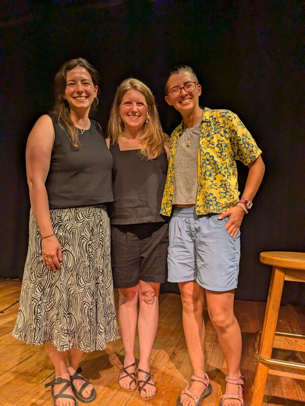
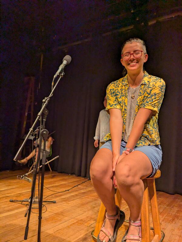
Non-profit organizations Transom Story Lab and Atlantic Public Media hosted a weekend-long science storytelling workshop called "Making Waves." It was attended by 11 scientists from scientific institutions throughout Woods Hole, Massachusetts, including USGS scientists Jin-Si Over, Ellen Lalk, and Sara Zeigler.
Multimedia
Explore images, videos, webcams, and more from the USGS St. Petersburg Coastal and Marine Science Center.
Images
Science Storytelling
Non-profit organizations Transom Story Lab and Atlantic Public Media hosted a weekend-long science storytelling workshop called "Making Waves." It was attended by 11 scientists from scientific institutions throughout Woods Hole, Massachusetts, including USGS scientists Jin-Si Over, Ellen Lalk, and Sara Zeigler.
Non-profit organizations Transom Story Lab and Atlantic Public Media hosted a weekend-long science storytelling workshop called "Making Waves." It was attended by 11 scientists from scientific institutions throughout Woods Hole, Massachusetts, including USGS scientists Jin-Si Over, Ellen Lalk, and Sara Zeigler.

Elevation data collected on a beach
USGS scientist collects elevation data during a walking survey at Madeira Beach, FL.
USGS scientist collects elevation data during a walking survey at Madeira Beach, FL.

Elevation data collected from a personal water craft
Elevation data collected from a personal water craftUSGS scientist collects elevation data from a personal water craft at Madeira Beach, FL.
Elevation data collected from a personal water craft
Elevation data collected from a personal water craftUSGS scientist collects elevation data from a personal water craft at Madeira Beach, FL.

Coral, Clam, Core, and Foram!
Cartoon created image of all the APPROACH proxies, a coral x-ray, sediment core, clam shell, and a foraminifera.
Cartoon created image of all the APPROACH proxies, a coral x-ray, sediment core, clam shell, and a foraminifera.

Dr. Donya Frank-Gilchrist visited the National Academies of Sciences, Engineering and Medicine during the Science and Innovation Diplomacy Workshop.
Dr. Donya Frank-Gilchrist visited the National Academies of Sciences, Engineering and Medicine during the Science and Innovation Diplomacy Workshop.Dr. Donya Frank-Gilchrist visited the National Academies of Sciences, Engineering and Medicine during the Science and Innovation Diplomacy Workshop, organized by the US Global Change Research and the Inter-American Institute for Global Change Research.
Videos

USGS Coastal and Marine Field Operations
To conduct the science needed to understand coastal and marine geohazards, support habitat and resource management, and monitor how these environments change over time, the USGS Coastal and Marine Hazards and Resources Program relies on engineering, mechanical, and electronics expertise for field operations along the coast, in the nearshore environment, and in the d
To conduct the science needed to understand coastal and marine geohazards, support habitat and resource management, and monitor how these environments change over time, the USGS Coastal and Marine Hazards and Resources Program relies on engineering, mechanical, and electronics expertise for field operations along the coast, in the nearshore environment, and in the d

GeoKids: Ella
USGS presents: GeoKids!
In this episode, meet Ella Doran, 8, and her mom, Kara. Kara is an oceanographer at the St. Petersburg Coastal and Marine Science Center in St. Petersburg, Florida. Kara speaks about her work on coastal change while she and Ella do a science experiment together.
USGS presents: GeoKids!
In this episode, meet Ella Doran, 8, and her mom, Kara. Kara is an oceanographer at the St. Petersburg Coastal and Marine Science Center in St. Petersburg, Florida. Kara speaks about her work on coastal change while she and Ella do a science experiment together.

Introduction to the USGS Coastal Science Navigator
Introduction to the USGS Coastal Science NavigatorThe Coastal Science Navigator is intended to help users discover USGS Coastal Change Hazards information, products, and tools relevant to their scientific or decision-making needs.
Introduction to the USGS Coastal Science Navigator
Introduction to the USGS Coastal Science NavigatorThe Coastal Science Navigator is intended to help users discover USGS Coastal Change Hazards information, products, and tools relevant to their scientific or decision-making needs.

PubTalk-03/2023: Coral Reef in Crisis - Science to Guide Reef Restoration for Ecosystem Recovery
PubTalk-03/2023: Coral Reef in Crisis - Science to Guide Reef Restoration for Ecosystem RecoveryCoral Reef in Crisis - Science to Guide Reef Restoration for Ecosystem Recovery
By Ilsa Kuffner, Research Marine Biologist
USGS St. Petersburg Coastal & Marine Science Center
Learn About:

Event Recording: Explore USGS Careers in Florida and the Caribbean – Science Support Panel
Event Recording: Explore USGS Careers in Florida and the Caribbean – Science Support PanelThree USGS Centers held this virtual event on February 23, 2023 to showcase various science career paths within USGS: the Caribbean-Florida Water Science Center, St.

Event Recording: Explore USGS Careers in Florida and the Caribbean – Technical Capabilities Panel
Event Recording: Explore USGS Careers in Florida and the Caribbean – Technical Capabilities PanelThree USGS Centers held this virtual event on February 23, 2023 to showcase various science career paths within USGS: the Caribbean-Florida Water Science Center, St.
Webcams

Sand Key, Florida
Most recent time-averaged image from Sand Key, Florida. The images are used to examine a range of coastal processes including shoreline position, the presence of an offshore sandbar, and the extent of wave runup on the beach. Camera hosted by Dan's Island Condo.
Most recent time-averaged image from Sand Key, Florida. The images are used to examine a range of coastal processes including shoreline position, the presence of an offshore sandbar, and the extent of wave runup on the beach. Camera hosted by Dan's Island Condo.

Madeira Beach
A coastal camera located on Medeira Beach, Florida near the Shoreline Island Resort.
A coastal camera located on Medeira Beach, Florida near the Shoreline Island Resort.

Time-averaged image at Madeira Beach, Florida, Camera 2
Time-averaged image at Madeira Beach, Florida, Camera 2Time-averaged images, which represent the time-mean of all the images collected during a video, are used to identify areas where waves are breaking, which show up as bright white bands in the image.

Most recent snapshot at Madeira Beach, Florida, Camera 2
Most recent snapshot at Madeira Beach, Florida, Camera 2Most recent snapshot from Camera 2 at Madeira Beach, Florida. Camera hosted by Shoreline Island Resort.
Most recent snapshot at Madeira Beach, Florida, Camera 2
Most recent snapshot at Madeira Beach, Florida, Camera 2Most recent snapshot from Camera 2 at Madeira Beach, Florida. Camera hosted by Shoreline Island Resort.

Snapshot image for Sand Key, Florida
A current view of the most recent snapshot from a webcam located in Sand Key, Florida.
A current view of the most recent snapshot from a webcam located in Sand Key, Florida.

Time-averaged image at Madeira Beach, Florida, Camera 1
Time-averaged image at Madeira Beach, Florida, Camera 1Time-averaged images, which represent the time-mean of all the images collected during a video, are used to identify areas where waves are breaking, which show up as bright white bands in the image.