
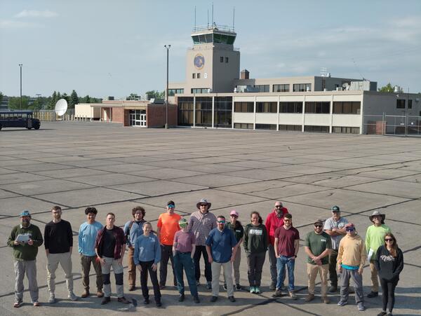
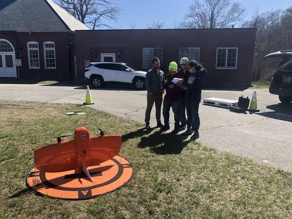
An introductory course for small uncrewed aircraft system (sUAS) pilots was held at the New York State Emergency Preparedness Training Facility in Oriskany, New York. Instructors from across the country, including Sandy Brosnahan (lead instructor) and Seth Ackerman of the USGS WHCMSC, collaborated to deliver the training.
Images
Woods Hole Coastal and Marine Science Center images
Filter Total Items: 1287
Drone pilot course
An introductory course for small uncrewed aircraft system (sUAS) pilots was held at the New York State Emergency Preparedness Training Facility in Oriskany, New York. Instructors from across the country, including Sandy Brosnahan (lead instructor) and Seth Ackerman of the USGS WHCMSC, collaborated to deliver the training.

Secrets of the Seep documentary
WFSU produced a documentary covering a research cruise offshore Oregon to Astoria Canyon (2023) and smaller campaigns to the Hydrate Ridge seep system (2024) to study the cycling dynamics of dissolved organic matter at methane seeps.
WFSU produced a documentary covering a research cruise offshore Oregon to Astoria Canyon (2023) and smaller campaigns to the Hydrate Ridge seep system (2024) to study the cycling dynamics of dissolved organic matter at methane seeps.

USGS Long Island Sound Webinar
The USGS hosted a webinar highlighting new USGS tools developed for use in Long Island Sound.
The USGS hosted a webinar highlighting new USGS tools developed for use in Long Island Sound.

Secrets of the Seep documentary
WFSU produced a documentary covering a research cruise offshore Oregon to Astoria Canyon (2023) and smaller campaigns to the Hydrate Ridge seep system (2024) to study the cycling dynamics of dissolved organic matter at methane seeps.
WFSU produced a documentary covering a research cruise offshore Oregon to Astoria Canyon (2023) and smaller campaigns to the Hydrate Ridge seep system (2024) to study the cycling dynamics of dissolved organic matter at methane seeps.

Long Island Sound SEABOSS Survey
A seafloor mapping survey in Long Island Sound took place in May with collaborators from the University of Connecticut and the University of New Haven. They are mapping the area’s geology and biota to identify seasonal changes from their previous survey in November 2024.
A seafloor mapping survey in Long Island Sound took place in May with collaborators from the University of Connecticut and the University of New Haven. They are mapping the area’s geology and biota to identify seasonal changes from their previous survey in November 2024.

Coastal Landscape Response
The Coastal Landscape Response assessment creates multidecadal predictions of where and when the coast is likely to adapt or inundate. Results are produced for four decades—the 2020s, 2030s, 2050s, and 2080s.
The Coastal Landscape Response assessment creates multidecadal predictions of where and when the coast is likely to adapt or inundate. Results are produced for four decades—the 2020s, 2030s, 2050s, and 2080s.
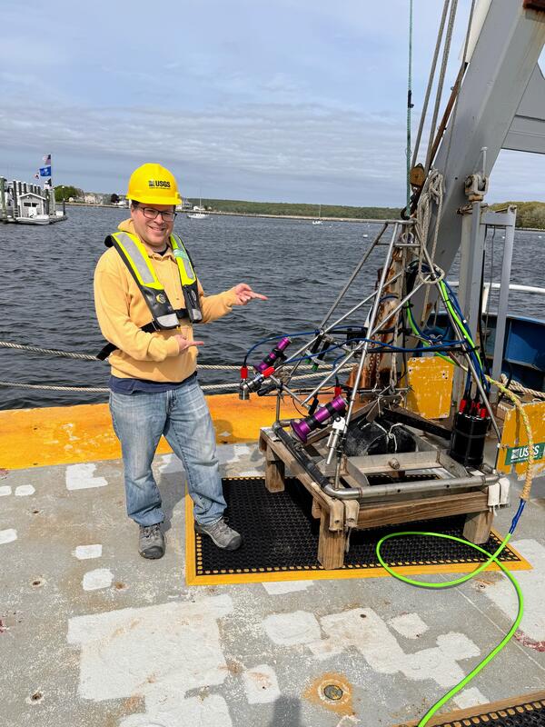
Long Island Sound SEABOSS Survey
A seafloor mapping survey in Long Island Sound took place in May with collaborators from the University of Connecticut and the University of New Haven. They are mapping the area’s geology and biota to identify seasonal changes from their previous survey in November 2024.
A seafloor mapping survey in Long Island Sound took place in May with collaborators from the University of Connecticut and the University of New Haven. They are mapping the area’s geology and biota to identify seasonal changes from their previous survey in November 2024.

CCL Outcomes for Wallops Joint Expeditionary Base
USGS Coastal Change Likelihood (CCL) outcomes are displayed for Wallops Joint Expeditionary Base in Virginia. Warm colors indicate areas of high expected coastal change and cool colors indicate areas with lower expected change.
USGS Coastal Change Likelihood (CCL) outcomes are displayed for Wallops Joint Expeditionary Base in Virginia. Warm colors indicate areas of high expected coastal change and cool colors indicate areas with lower expected change.
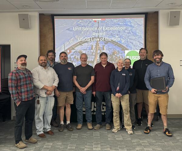
USGS Unit Award for Excellence of Service
The Extended Continental Shelf team was awarded the USGS Unit Award for Excellence of Service, an award that recognizes groups of employees who have worked together as a unit to achieve exceptional results. This team was part of a Federal interagency effort to identify the outer limits of the U.S.
The Extended Continental Shelf team was awarded the USGS Unit Award for Excellence of Service, an award that recognizes groups of employees who have worked together as a unit to achieve exceptional results. This team was part of a Federal interagency effort to identify the outer limits of the U.S.
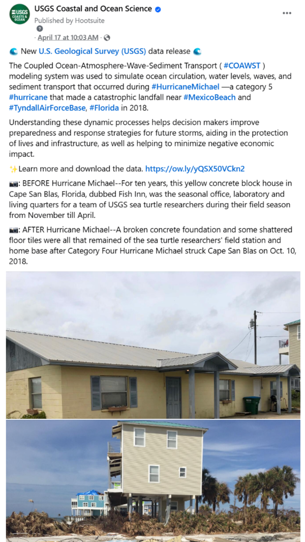
COAWST data release social media post
Social media post on USGS Coastal and Ocean Science Facebook page highlighting COAWST data release.
Warner, J.C., 2025, U.S. Geological Survey simulations of hydrodynamics and morphodynamics during Hurricane Michael (2018): U.S. Geological Survey data release, https://doi.org/10.5066/P14AGJAN.
Social media post on USGS Coastal and Ocean Science Facebook page highlighting COAWST data release.
Warner, J.C., 2025, U.S. Geological Survey simulations of hydrodynamics and morphodynamics during Hurricane Michael (2018): U.S. Geological Survey data release, https://doi.org/10.5066/P14AGJAN.
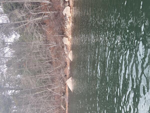
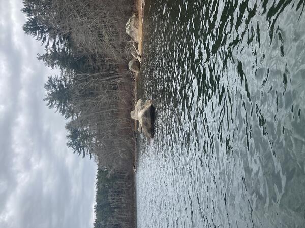
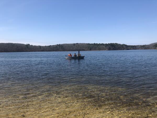
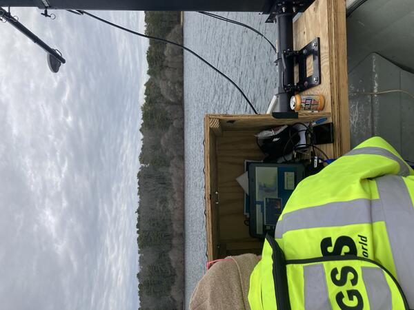
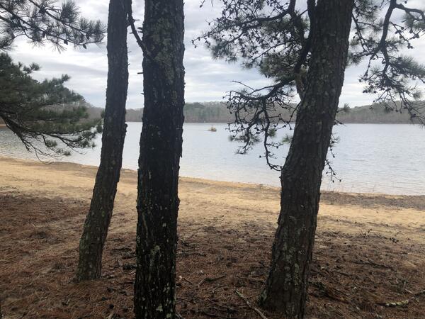
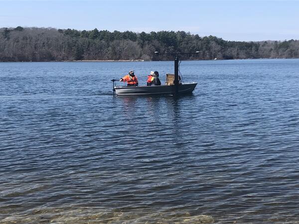
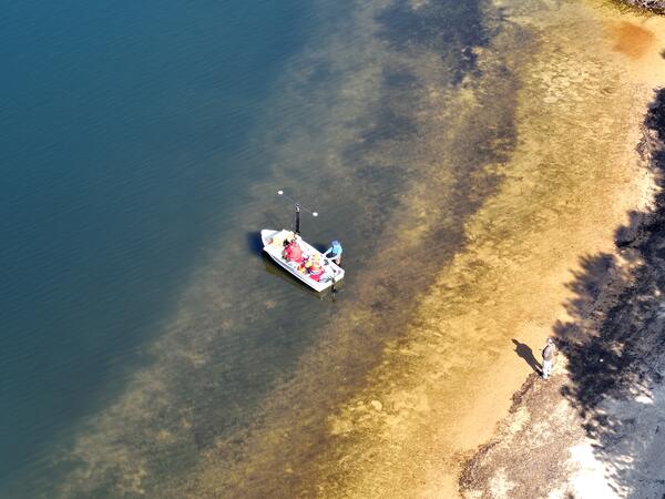
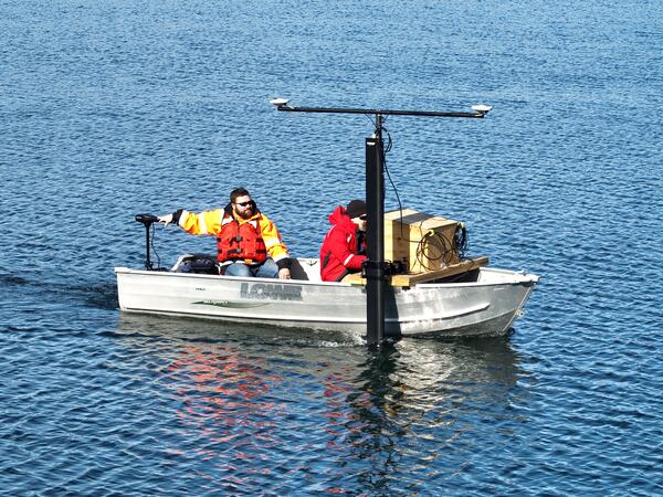
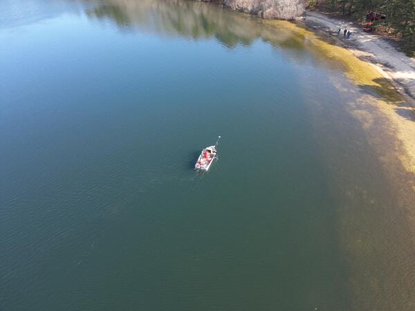
Long Pond mapping survey
USGS conducted a mapping survey of Long Pond in Falmouth, Massachusetts, at the request of the Town to determine total water volume of the reservoir, as well as the volumes available depending on fluctuating elevations of the water surface.
USGS conducted a mapping survey of Long Pond in Falmouth, Massachusetts, at the request of the Town to determine total water volume of the reservoir, as well as the volumes available depending on fluctuating elevations of the water surface.