
USGS conducted a mapping survey of Long Pond in Falmouth, Massachusetts, at the request of the Town to determine total water volume of the reservoir, as well as the volumes available depending on fluctuating elevations of the water surface.
Images
Woods Hole Coastal and Marine Science Center images
Filter Total Items: 1288
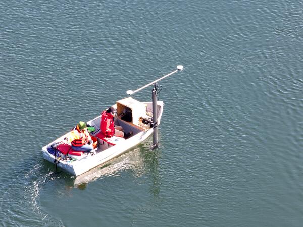
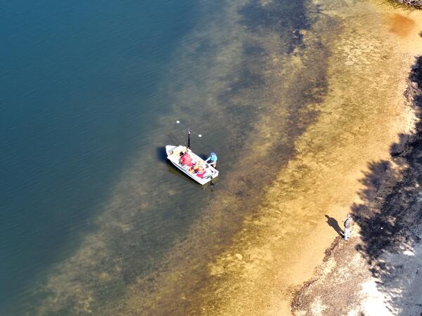
Long Pond mapping survey
USGS conducted a mapping survey of Long Pond in Falmouth, Massachusetts, at the request of the Town to determine total water volume of the reservoir, as well as the volumes available depending on fluctuating elevations of the water surface.
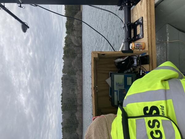
Long Pond mapping survey
USGS conducted a mapping survey of Long Pond in Falmouth, Massachusetts, at the request of the Town to determine total water volume of the reservoir, as well as the volumes available depending on fluctuating elevations of the water surface.
USGS conducted a mapping survey of Long Pond in Falmouth, Massachusetts, at the request of the Town to determine total water volume of the reservoir, as well as the volumes available depending on fluctuating elevations of the water surface.
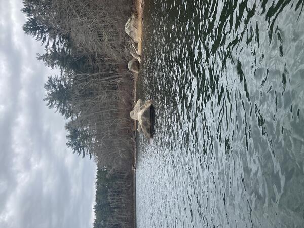
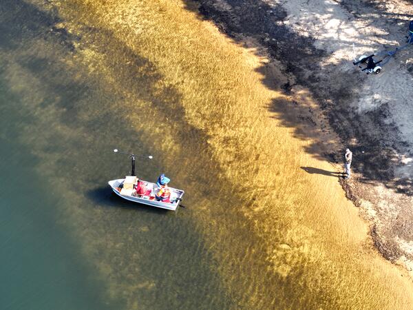
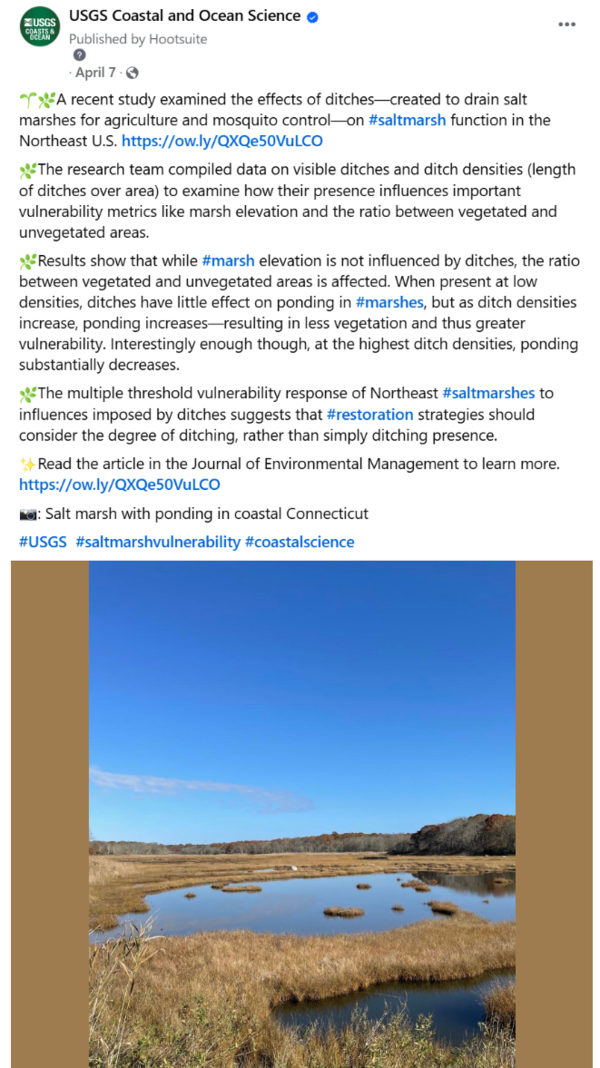
Salt marsh ditching social media post
Social media post on USGS Coastal and Ocean Science Facebook page highlighting a study examining the effects of ditches on salt marsh function in the Northeast U.S. https://doi.org/10.1016/j.jenvman.2025.124444
Social media post on USGS Coastal and Ocean Science Facebook page highlighting a study examining the effects of ditches on salt marsh function in the Northeast U.S. https://doi.org/10.1016/j.jenvman.2025.124444
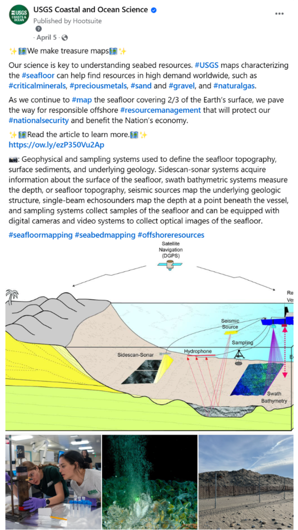
We Make Treasure Maps social media
Social media post on the USGS Coastal and Ocean Science Facebook account highlighting the science story titled, "We Make Treasure Maps: USGS Charts the Seafloor to Help Locate Critical Minerals, Precious Metals, and Other Vital Resources."&
Social media post on the USGS Coastal and Ocean Science Facebook account highlighting the science story titled, "We Make Treasure Maps: USGS Charts the Seafloor to Help Locate Critical Minerals, Precious Metals, and Other Vital Resources."&
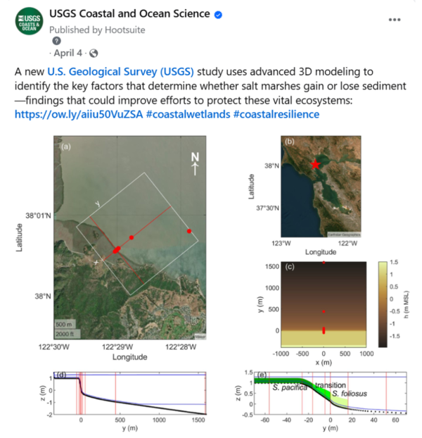
Salt marsh 3D modeling social media
Social media post on USGS Coastal and Ocean Science Facebook page highlighting a science story about a published study using 3D modeling to understand sediment dynamics in coastal marshes.
Social media post on USGS Coastal and Ocean Science Facebook page highlighting a science story about a published study using 3D modeling to understand sediment dynamics in coastal marshes.

Sand Hill Cove
Piles of sand for beach renourishment at Roger Wheeler State Beach, locally known as Sand Hill Cove, in Narragansett, Rhode Island.
Piles of sand for beach renourishment at Roger Wheeler State Beach, locally known as Sand Hill Cove, in Narragansett, Rhode Island.

Sand at build site
A pile of sand at a house construction site in Narragansett, Rhode Island neighborhood.
A pile of sand at a house construction site in Narragansett, Rhode Island neighborhood.
Presentations at Gulf of Maine Symposium
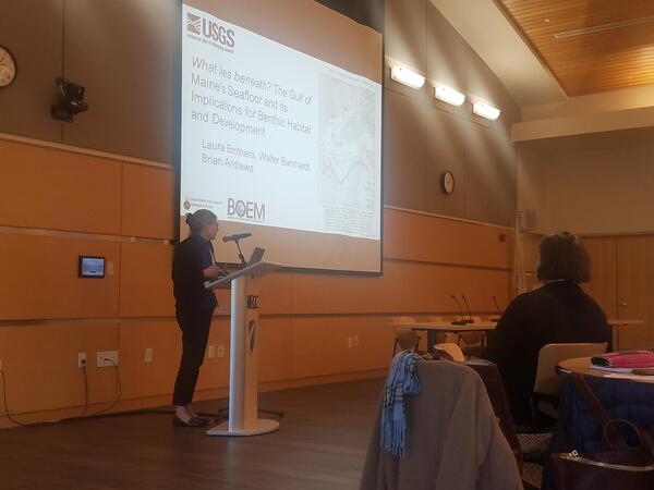
Laura Brothers and Neil Ganju presented at the Gulf of Maine Symposium in Haverhill, Massachusetts in April, where more than 150 monitoring program coordinators and researchers, data users, and policymakers gathered to learn about ongoing research in the Gulf of Maine.
Laura Brothers and Neil Ganju presented at the Gulf of Maine Symposium in Haverhill, Massachusetts in April, where more than 150 monitoring program coordinators and researchers, data users, and policymakers gathered to learn about ongoing research in the Gulf of Maine.
Local Geology Talk
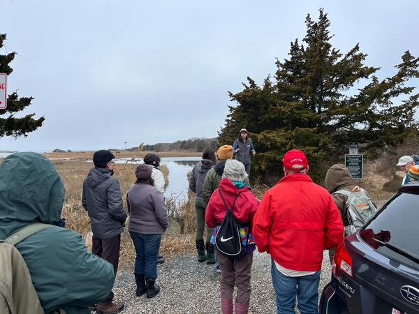
In March, Jin-Si Over gave a geology talk at Jonathan Bourne Public Library in Bourne, Massachusetts to about 40 people. Days later, there was a follow-up walk to identify rocks and minerals at Little Island Trust in Falmouth, Massachusetts with about 20 people.
In March, Jin-Si Over gave a geology talk at Jonathan Bourne Public Library in Bourne, Massachusetts to about 40 people. Days later, there was a follow-up walk to identify rocks and minerals at Little Island Trust in Falmouth, Massachusetts with about 20 people.
Researcher prepares a wingtra lidar flight
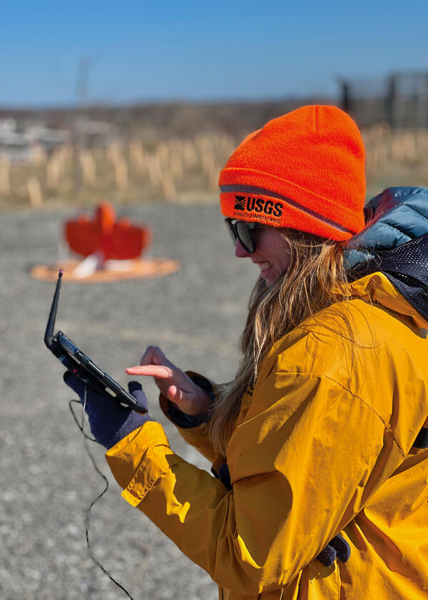
Jennifer Cramer is preparing a wingtra lidar flight at the Darby Creek landfill Superfund site (Philadelphia skyline is visible on the horizon) on March 27, 2025. sUAS, also known as a drone, is being used to model morphological changes in the tidal creek and adjacent landfill with lidar sensors, potential contaminated groundwater seeps are identified using th
Jennifer Cramer is preparing a wingtra lidar flight at the Darby Creek landfill Superfund site (Philadelphia skyline is visible on the horizon) on March 27, 2025. sUAS, also known as a drone, is being used to model morphological changes in the tidal creek and adjacent landfill with lidar sensors, potential contaminated groundwater seeps are identified using th

WHCMSC Newsletter
The Woods Hole Coastal and Marine Science Center Newsletter is distributed bimonthly, sharing recent communications activities on the web and beyond, journal articles and data releases, field activities, and other center happenings.
The Woods Hole Coastal and Marine Science Center Newsletter is distributed bimonthly, sharing recent communications activities on the web and beyond, journal articles and data releases, field activities, and other center happenings.
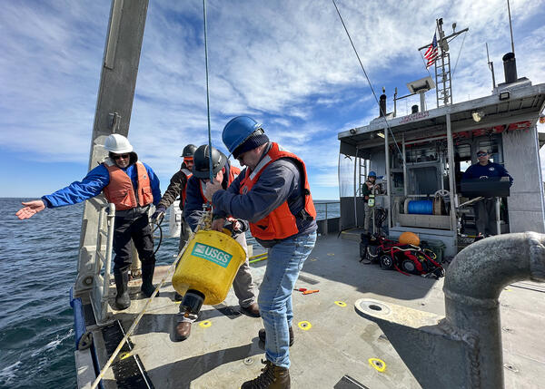
Researchers recover oceanographic instruments
Researchers Chris Sherwood, Bo Bales, Eric Marsjanik and Steve Suttles from the Woods Hole Coastal and Marine Science Center recover oceanographic instruments that measured waves, currents, and water levels off Cape Cod for three months this winter.
Researchers Chris Sherwood, Bo Bales, Eric Marsjanik and Steve Suttles from the Woods Hole Coastal and Marine Science Center recover oceanographic instruments that measured waves, currents, and water levels off Cape Cod for three months this winter.

DSAS bug fixed
A critical update was made to the latest version of DSAS (6.0.170) to fix a bug that was preventing rate calculation. Everything is operating as intended as of 3/5/25.
A critical update was made to the latest version of DSAS (6.0.170) to fix a bug that was preventing rate calculation. Everything is operating as intended as of 3/5/25.

Earthquake social media
Social media post on the USGS Coastal and Ocean Science Facebook account. The post highlights a recent study uses an innovative method to analyze significant earthquakes (M6.5+) in the northeast Caribbean to make future predictions.
Social media post on the USGS Coastal and Ocean Science Facebook account. The post highlights a recent study uses an innovative method to analyze significant earthquakes (M6.5+) in the northeast Caribbean to make future predictions.

#SoftwareSunday social media post
Social media post on USGS Coastal and Ocean Science Facebook account. The post is one in a series of Software Sunday posts highlighting downloadable software in the Coastal Science Navigator.
Social media post on USGS Coastal and Ocean Science Facebook account. The post is one in a series of Software Sunday posts highlighting downloadable software in the Coastal Science Navigator.

Valentine social media post
Social media post on USGS Coastal and Ocean Science Facebook account. The post is one in a series of Valentine's Day posts highlighting USGS coastal and ocean science.
Social media post on USGS Coastal and Ocean Science Facebook account. The post is one in a series of Valentine's Day posts highlighting USGS coastal and ocean science.

BOBSled
Scientists and technologists from the Woods Hole Coastal and Marine Science Center (WHCMSC) in Woods Hole, Massachusetts traveled to the Pacific Coastal and Marine Science Center (PCMSC) in Santa Cruz, California to learn about their seafloor imaging and sampling instrument—the Benthic Observation camera Sled, or BOBSled.
Scientists and technologists from the Woods Hole Coastal and Marine Science Center (WHCMSC) in Woods Hole, Massachusetts traveled to the Pacific Coastal and Marine Science Center (PCMSC) in Santa Cruz, California to learn about their seafloor imaging and sampling instrument—the Benthic Observation camera Sled, or BOBSled.

Coastal and ocean social media post
Social media post on USGS Coastal and Ocean Science Facebook account. The post highlights an article about USGS products that can be used for emergency management. https://www.usgs.gov/programs/cmhrp/news/approaching-storms
Social media post on USGS Coastal and Ocean Science Facebook account. The post highlights an article about USGS products that can be used for emergency management. https://www.usgs.gov/programs/cmhrp/news/approaching-storms