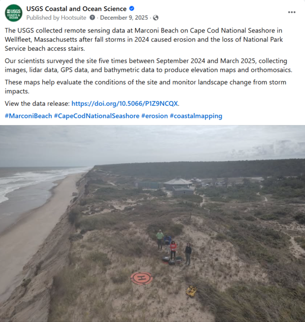
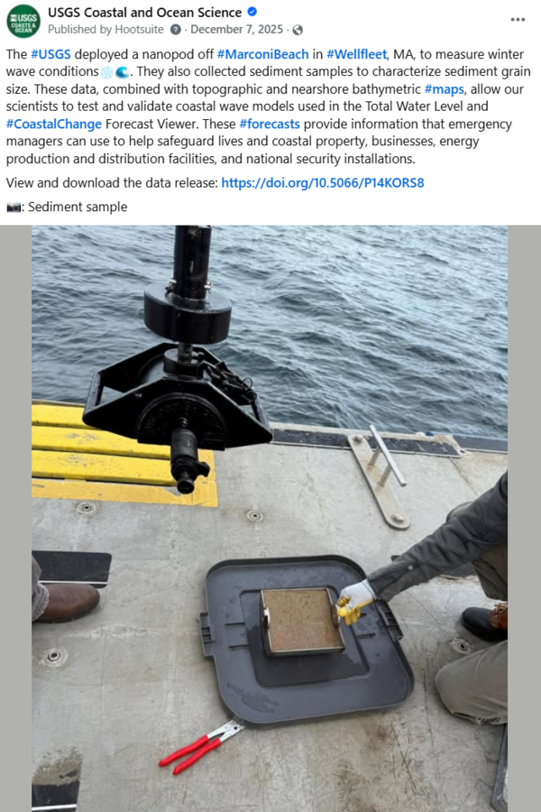
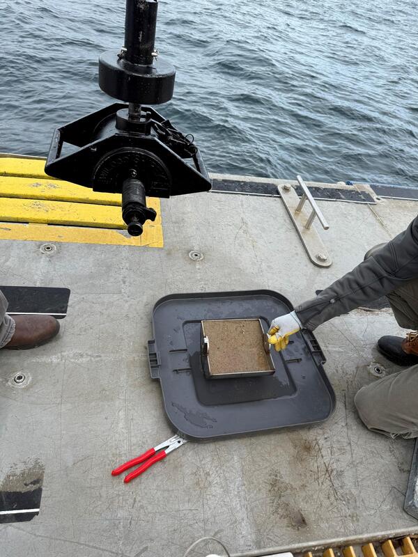
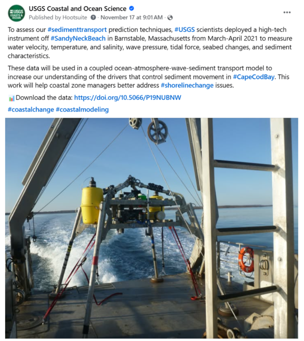
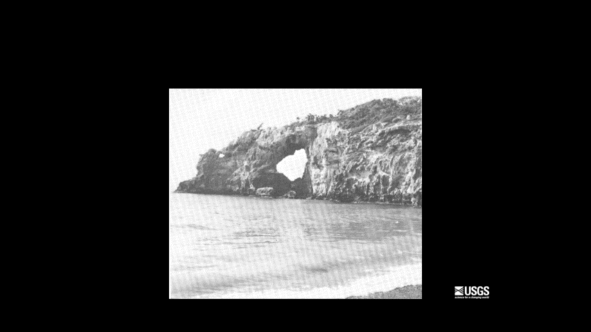
Shipek grab sampler and sediment sample. Image is included in USGS data release, "Grain-size analysis of sediment samples collected in the nearshore zone offshore of Marconi Beach, Wellfleet, MA, December 9, 2024."
Images
Woods Hole Coastal and Marine Science Center images
Shipek grab sampler and sediment sample. Image is included in USGS data release, "Grain-size analysis of sediment samples collected in the nearshore zone offshore of Marconi Beach, Wellfleet, MA, December 9, 2024."
To assess our #sedimenttransport prediction techniques, #USGS scientists deployed a high-tech instrument off #SandyNeckBeach in Barnstable, Massachusetts from March-April 2021 to measure water velocity, temperature, and salinity, wave pressure, tidal force, seabed changes, and sediment characteristics.
The USGS uses a nationwide network of coastal observing cameras (CoastCams) to monitor coastal conditions in near real-time and support research on a variety of coastal processes and hazards.
A new study introduces a cutting-edge biogeomorphic model (UBMorph) to help predict how #ChesapeakeBay #saltmarshes will change over time. Using UBMorph, researchers found that 404 square kilometers (37%) of vegetated #marsh area in Chesapeake Bay could be lost by 2110.
Social Media: Shoreline Change of Long Island Sound
Social Media: Shoreline Change of Long Island SoundA new #datarelease contains a GIS compilation of vector shorelines and associated #shorelinechange data from the 1800s to the 2010s for the coast of Long Island Sound, #NewYork and #Connecticut.
Social Media: Shoreline Change of Long Island Sound
Social Media: Shoreline Change of Long Island SoundA new #datarelease contains a GIS compilation of vector shorelines and associated #shorelinechange data from the 1800s to the 2010s for the coast of Long Island Sound, #NewYork and #Connecticut.
Woods Hole Coastal and Marine Science Center staff with Dave Applegate (USGS Chief Scientist and Acting Associate Director, USGS Natural Hazards Mission Area), Jonathan Godt (Program Coordinator, USGS Landslide Hazards Program), and Emily Himmelstoss (Associate Program Coordinator for Science, USGS Coastal and Marine Hazards and Resources Program) during a special v
ROV pilots Raeylynn Heinz and Alex Wick (both from OSU OOI) celebrate as their ROV and the OBS surface in Skilak Lake.
The USGS Aerial Imaging and Mapping Group (AIMG) collaborated with the Wampanoag Tribe of Gay Head (Aquinnah), the Town of Aquinnah, and the Aquinnah Police Department to collect high-resolution data of the Gay Head Cliffs.
View from the remotely operated vehicle (ROV) after attaching a recovery line to the ocean bottom seismograph 190 meters deep in Skilak Lake, Alaska.
Jin-Si Over at the 2025 Woods Hole Science Stroll on August 9, 2025. During this free event, a variety of booths line the streets, docks, and Waterfront Park to deliver hands-on science activities, games, demonstrations, and more to visitors of all ages.
Enjoying the microscope station where visitors could look at foraminifera, tiny microfossils that live in marine environments. Scientists at the USGS use foraminifera to determine the age of sediment found many meters below the seafloor and to learn more about past climate conditions.
Marie Bartlett showing off our replica sediment core at the Woods Hole Science Stroll.
Meagan Eagle used a gas analyzer and respiration chamber to demonstrate the role of salt marshes in carbon sequestration.
Seth Ackerman showing off one of our drones at the 2025 Woods Hole Science Stroll on August 9, 2025. During this free event, a variety of booths line the streets, docks, and Waterfront Park to deliver hands-on science activities, games, demonstrations, and more to visitors of all ages.
The USGS booth at the 2025 Woods Hole Science Stroll on August 9, 2025. During this free event, a variety of booths line the streets, docks, and Waterfront Park to deliver hands-on science activities, games, demonstrations, and more to visitors of all ages.
We setup a shake table that moves in different directions, at varying frequencies to demonstrate the power of earthquakes. People built structures out of Legos to put on the shake table to test how buildings, bridges, and other infrastructure would behave during a real seismic event.
Zafer Defne discussed discussed ocean and coastal dynamics with attendees and provided details about the COAWST modeling system. The COAWST model allows many sophisticated models to work together to accurately simulate physical processes during a storm.
Marie Bartlett at the 2025 Woods Hole Science Stroll on August 9, 2025. During this free event, a variety of booths line the streets, docks, and Waterfront Park to deliver hands-on science activities, games, demonstrations, and more to visitors of all ages.