
USGS Geographer Jin-Si Over talking about drones and how they are used to map short- and long-term changes in coastal environments at the Woods Hole Science Stroll.
Images
Woods Hole Coastal and Marine Science Center images
Filter Total Items: 1287

Woods Hole Science Stroll 2024
USGS Geographer Jin-Si Over talking about drones and how they are used to map short- and long-term changes in coastal environments at the Woods Hole Science Stroll.

Woods Hole Science Stroll 2024
USGS Oceanographer Zafer Defne discussing operational ocean and coastal dynamics forecasts at the Woods Hole Science Stroll.
USGS Oceanographer Zafer Defne discussing operational ocean and coastal dynamics forecasts at the Woods Hole Science Stroll.

Woods Hole Science Stroll 2024
USGS Geologist Marie Bartlett talking about foraminifera, tiny microfossils that live in marine environments, while a little girl looks at them through the microscope.
USGS Geologist Marie Bartlett talking about foraminifera, tiny microfossils that live in marine environments, while a little girl looks at them through the microscope.

Puerto Rico beach
Scenic photo of Domes Beach in Rincon, Puerto Rico. Photo credit: Emily Himmelstoss.
Scenic photo of Domes Beach in Rincon, Puerto Rico. Photo credit: Emily Himmelstoss.

Mapping Nantucket Sound
USGS Marine Operations Manager Chuck Worley conducting fieldwork to study the geologic framework of Nantucket Sound.
USGS Marine Operations Manager Chuck Worley conducting fieldwork to study the geologic framework of Nantucket Sound.

U.S. Coastal Wetland Synthesis Applications Webpage Image
U.S. Coastal Wetland Synthesis Applications Webpage ImageThe USGS is assessing the physical condition of coastal wetlands and their response to external forces, using field observations and remote-sensing data. The U.S.
U.S. Coastal Wetland Synthesis Applications Webpage Image
U.S. Coastal Wetland Synthesis Applications Webpage ImageThe USGS is assessing the physical condition of coastal wetlands and their response to external forces, using field observations and remote-sensing data. The U.S.

Distinguished Service Award - Carolyn Ruppel
Distinguished Service Award for USGS Research Geophysicist Carolyn Ruppel, presented on May 8, 2024.
Distinguished Service Award for USGS Research Geophysicist Carolyn Ruppel, presented on May 8, 2024.
Collecting Shoreline and Volumetric Data
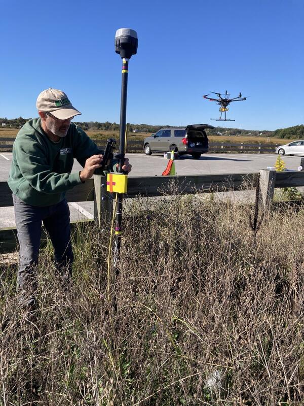
From June through December, WHCMSC scientists are collecting shoreline and volumetric data at a beach in Sandwich, Massachusetts following a 2023 U.S. Army Corps of Engineers beach nourishment. The data will be useful for various purposes. Chris Sherwood is interested in comparing how the different measuring techniques work on different types of vegetation.
From June through December, WHCMSC scientists are collecting shoreline and volumetric data at a beach in Sandwich, Massachusetts following a 2023 U.S. Army Corps of Engineers beach nourishment. The data will be useful for various purposes. Chris Sherwood is interested in comparing how the different measuring techniques work on different types of vegetation.

Southeast Region Refuges
The Southeast Region Refuges tab of the U.S. Coastal Wetlands Synthesis Applications geonarrative. A FWS and USGS collaboration.
The Southeast Region Refuges tab of the U.S. Coastal Wetlands Synthesis Applications geonarrative. A FWS and USGS collaboration.

U.S. Coastal Wetland Synthesis Applications geonarrative
U.S. Coastal Wetland Synthesis Applications geonarrativeThe U.S. Coastal Wetlands Synthesis Applications geonarrative. The U.S. Geological Survey (USGS) is assessing the physical condition of coastal wetlands and how they may change in response to storms, sea-level rise, and human activity.

Ernest F. Hollings ACE Basin National Wildlife Refuge
Ernest F. Hollings ACE Basin National Wildlife RefugeErnest F. Hollings ACE Basin National Wildlife Refuge in South Carolina shown in the pop-out of the U.S. Coastal Wetlands Synthesis Applications geonarrative.
Ernest F. Hollings ACE Basin National Wildlife Refuge
Ernest F. Hollings ACE Basin National Wildlife RefugeErnest F. Hollings ACE Basin National Wildlife Refuge in South Carolina shown in the pop-out of the U.S. Coastal Wetlands Synthesis Applications geonarrative.

Southeast Region Application
The Southeast Region Refuge tab of the U.S. Coastal Wetlands Synthesis Applications geonarrative, showing the application section. This is a FWS and USGS collaboration.
The Southeast Region Refuge tab of the U.S. Coastal Wetlands Synthesis Applications geonarrative, showing the application section. This is a FWS and USGS collaboration.

Ernest F. Hollings ACE Basin National Wildlife Refuge
Ernest F. Hollings ACE Basin National Wildlife RefugeErnest F. Hollings ACE Basin National Wildlife Refuge in South Carolina shown in the pop-out of the U.S. Coastal Wetlands Synthesis Applications geonarrative.
Ernest F. Hollings ACE Basin National Wildlife Refuge
Ernest F. Hollings ACE Basin National Wildlife RefugeErnest F. Hollings ACE Basin National Wildlife Refuge in South Carolina shown in the pop-out of the U.S. Coastal Wetlands Synthesis Applications geonarrative.

Salt marsh with ponding in coastal Connecticut.
Photograph of a salt marsh with ponding in coastal Connecticut taken during estuarine research field work.
Photograph of a salt marsh with ponding in coastal Connecticut taken during estuarine research field work.

Unveiling Earthquake History at Skilak Lake, Alaska
Unveiling Earthquake History at Skilak Lake, AlaskaTim Kane (WHOI) on the float rig supporting the OBS on Skilak Lake, Alaska. This is part of a USGS effort, in collaboration with partners from the Woods Hole Oceanographic Institution Ocean Bottom Seismic Instrument Center, to create a record of past earthquakes from Skilak Lake on the Kenai Peninsula of Alaska.

Unveiling Earthquake History at Skilak Lake, Alaska
Unveiling Earthquake History at Skilak Lake, AlaskaBrian Andrews (USGS) pulling in Hannah Brewer (WHOI) during fieldwork on Skilak Lake, Alaska to create a record of past earthquakes from Skilak Lake on the Kenai Peninsula of Alaska. In May 2024, they deployed two seismographs on the bottom of the lake and eight seismographs on land around the lake. Each instrument will collect data there for about 1 year.

Unveiling Earthquake History at Skilak Lake, Alaska
Unveiling Earthquake History at Skilak Lake, AlaskaSkilak Lake, Alaska. A team of USGS scientists, in collaboration with partners from the Woods Hole Oceanographic Institution Ocean Bottom Seismic Instrument Center, are aiming to create a record of past earthquakes from Skilak Lake on the Kenai Peninsula of Alaska.

Unveiling Earthquake History at Skilak Lake, Alaska
Unveiling Earthquake History at Skilak Lake, AlaskaBrian Andrews (USGS), Nathan Miller (USGS), and Rob Witter (USGS) installing post-hole seismometers and attaching a station box containing electronics and batteries.
Unveiling Earthquake History at Skilak Lake, Alaska
Unveiling Earthquake History at Skilak Lake, AlaskaBrian Andrews (USGS), Nathan Miller (USGS), and Rob Witter (USGS) installing post-hole seismometers and attaching a station box containing electronics and batteries.

Unveiling Earthquake History at Skilak Lake, Alaska
Unveiling Earthquake History at Skilak Lake, AlaskaThe float rig supporting the OBS is towed to the deployment site on Skilak Lake. Hannah Brewer (WHOI) is on board. This is part of a USGS effort, in collaboration with partners from the Woods Hole Oceanographic Institution Ocean Bottom Seismic Instrument Center, to create a record of past earthquakes from Skilak Lake on the Kenai Peninsula of Alaska.

Unveiling Earthquake History at Skilak Lake, Alaska
Unveiling Earthquake History at Skilak Lake, AlaskaThe R/V Lutris on Skilak Lake, Alaska. A team of USGS scientists, in collaboration with partners from the Woods Hole Oceanographic Institution Ocean Bottom Seismic Instrument Center, are aiming to create a record of past earthquakes from Skilak Lake on the Kenai Peninsula of Alaska.