
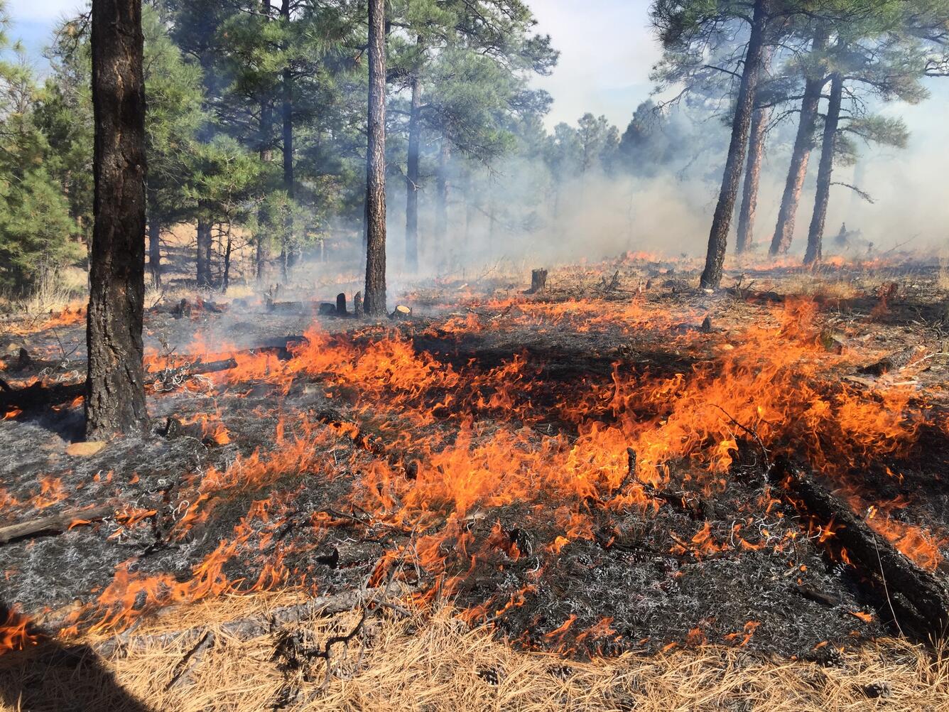
Hotter and drier conditions are making wildfires more intense and destructive across the United States. Science from the USGS Ecosystems Land Change Science Program informs local to national reduction of wildfire hazards, which saves money in avoided losses and fire suppression costs, as well as saves human lives.
The USGS provides timely information to fire and land managers to make decisions before, during and after wildfires and are widely used by private, state, and federal land managers across the nation.
Scientists from the Land Change Science Program in the USGS Ecosystems Mission Area are at the cutting edge of understanding the history, causes, and impacts of wildfire across the United States.
Learn more about how program science supports wildfire risk reduction and response.
Protecting Communities from Wildfire
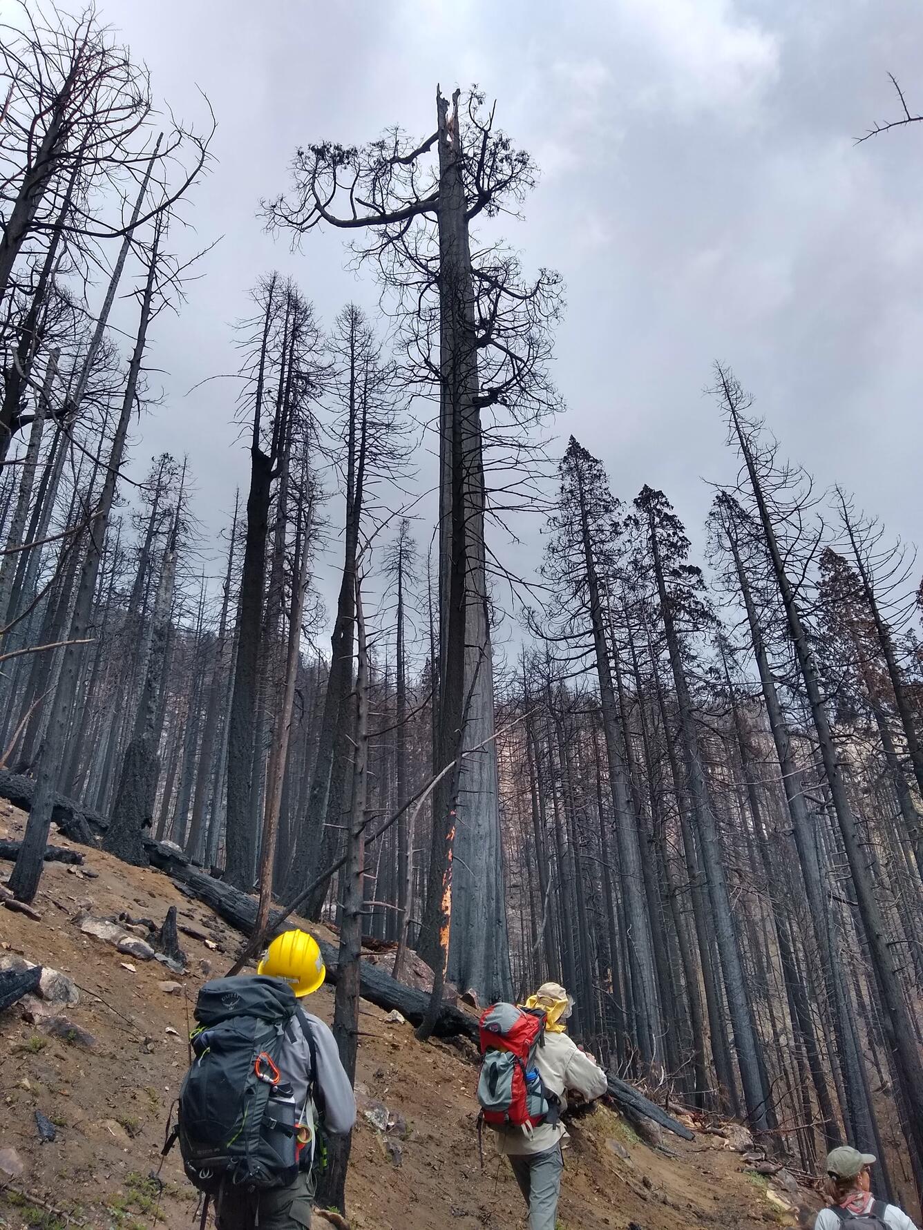
Drought and intense wildfires are killing forests and threatening the ecosystem services they provide, like water supplies, in the Southern Rockies and the Western U.S.
USGS researchers from Fort Collins Science Center's New Mexico Landscapes Field Station use long-term and place-based data to understand impacts of wildfires and wildfire management on forests and society. They are studying a variety of indicators of forest resilience, from tree-ring growth to 30 years of repeated field measurements, which helps them understand how trees are affected by drought, wildfire, and fire management.
Additionally, these researchers are collaborating with local managers and Tribes to co-produce science that informs natural resource managers to make decisions that will support forests and reduce wildfire risk. For example, their research informed local management plans and actions related to wildfire hazard, fuels reduction, and post-fire flooding including: the Santa Fe National Forest Fire and Forest Management Plans and City of Santa Fe Hazard Planning.
As a result, the local managers were successful at stopping the 2020 En Medio fire from burning into Santa Fe, protecting public safety, and causing only minimal post-fire flooding which saved the community millions in avoided losses of property and the drinking water supply.
Saving an Iconic Species after Wildfire
USGS science is used by National Park Service managers to make management decisions in Sequoia and Kings Canyon National Parks, where recent wildfires have killed large giant sequoias. The iconic species draws over 1.5 million tourists and sightseers to these two national parks each year bringing in important recreation and tourism dollars to the region amounting to \$196 million dollars for both parks together in 2022.
USGS researchers from Western Ecological Research Center and Geology, Energy, Minerals, and Geophysics Science Center are helping NPS land managers determine which areas are most likely to support successful sequoia seedling regeneration and to identify the most effective sequoia replanting strategies following wildfire.
This information is critical for informing park responses to wildfires, so that giant sequoia groves can persist into the future and impress generations to come.
Responding to State’s Needs to Protect Its Citizens
Policy makers and land managers need to know what is possible under future land use, wildfire, and climate scenarios, in order to inform today’s land management decisions.
USGS researchers from Western Geographic Science Center partnered with the State of California and others to simulate potential future fire severity in the state from now through 2100. They looked at fire under a variety of land management, urban development, and future climate scenarios.
The researchers used the USGS Land Use and Carbon Scenario Simulator (LUCAS) model to make the projections. The LUCAS model is spatially explicit and tracks past and potential future changes in land use, land cover, land management, and disturbance (including wildfire and other processes). The model calculates what the impacts of those changes could be on the amount of ecosystem carbon – including wildfire fuels – on the landscape.
By understanding how different management decisions might impact future fire severity, land managers and other decision makers in California can choose options that help reduce fire risks to communities.

Improving Assessments of Wildfire Impact
After a wildfire, land managers need timely information about its impact to develop treatment strategies. USGS researchers from Western Geographic Science Center are investigating the utility of instantaneous satellite-derived estimates of fire intensity – called fire radiative power (FRP) – to assess wildfire impact. Fire radiative power is a measurement of the rate at which a fire is emitting radiative energy. A higher FRP indicates faster fuel consumption and a more vigorous fire.
In a recent study published in the International Journal of Wildland Fire, the researchers found that fire intensity is a promising diagnostic and predictive indicator of fire behavior and post-fire effects. In their study, they combined 20 years of satellite data collected across Alaska with information about vegetation type and past fire extents in order to understand how FRP relates to factors known to influence fire dynamics. The researchers found that different ecosystem types with different amounts of above-ground fuel (tundra versus forests) show distinct FRP characteristics.
This study will assist land managers who want to complement and enhance estimates of fire severity with satellite estimates of fire intensity.
Helping Partners Understand and Adapt to Changing Forests
Whereas the immediate impacts of wildfire on forests, including tree mortality and landcover change, can be readily apparent, the long-term consequences are less certain and depend on the ability of forests to withstand and recover from disturbance.
To help land managers select strategies that maintain forests’ services to people, even as fire size and severity increase, USGS researchers from Geoscience and Environmental Change Science Center are combining long-term data and models to understand why ecosystems changed in the past. They are using this understanding to help project the consequences of changing environmental conditions - like fire and droughts – into the future for the Southern Rocky Mountain region.
The researchers use natural archives including lake sediments and tree rings that record how forests responded to prehistorical and more recent human impacts, fire events, droughts, and past climate changes over millennia. This information helps identify the most important drivers of long-term change and to understand what factors enable forests to withstand and recover from disturbances.
The researchers are combining these paleoecological data that document past changes with a forest landscape model (LANDIS-II) that simulates tree establishment, growth, death, and fire impacts. After evaluating model performance with evidence from the past, the models can be confidently applied to project future changes under different climate and fire regime scenarios. This approach allows land managers to make informed decisions to ensure forests in the region remain resilient to disturbance and continue to provide important services.

Fire Impacts on Pollutant Exposure Through Time
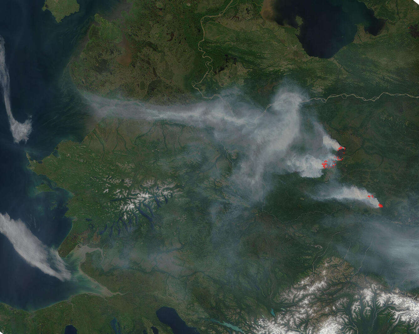
Smoke plumes from forest fires can travel semi-hemispheric distances and affect air quality and ecosystems thousands of kilometers from their source.
USGS researchers from Geoscience and Environmental Change Science Center study past fire history - including the transport and deposition of pollutants from wildfire smoke - in order to provide insights for current and future fire management.
Recently, the researchers collected ice cores from the Juneau Icefield north of Juneau, Alaska to examine records of past wildfire in the region. They studied the material preserved in the core layers and determined that wildfire aerosols were deposited in the area in the past and impacted the icefield. Moreover, the presence of chemicals from hardwood fires, coupled with satellite data of smoke transport, suggests that fires as far away as East Asia affect the Juneau Icefield. The research team is expanding this work to create a detailed fire history for the past 1,000 years from the Mt. Hunter, Denali National Park ice core as well.
These studies will assist fire managers in Alaska put recent fire activity and air quality issues in historical context and help them plan to adapt to increasingly intense fires in the present.

Hotter and drier conditions are making wildfires more intense and destructive across the United States. Science from the USGS Ecosystems Land Change Science Program informs local to national reduction of wildfire hazards, which saves money in avoided losses and fire suppression costs, as well as saves human lives.
The USGS provides timely information to fire and land managers to make decisions before, during and after wildfires and are widely used by private, state, and federal land managers across the nation.
Scientists from the Land Change Science Program in the USGS Ecosystems Mission Area are at the cutting edge of understanding the history, causes, and impacts of wildfire across the United States.
Learn more about how program science supports wildfire risk reduction and response.
Protecting Communities from Wildfire
Drought and intense wildfires are killing forests and threatening the ecosystem services they provide, like water supplies, in the Southern Rockies and the Western U.S.
USGS researchers from Fort Collins Science Center's New Mexico Landscapes Field Station use long-term and place-based data to understand impacts of wildfires and wildfire management on forests and society. They are studying a variety of indicators of forest resilience, from tree-ring growth to 30 years of repeated field measurements, which helps them understand how trees are affected by drought, wildfire, and fire management.
Additionally, these researchers are collaborating with local managers and Tribes to co-produce science that informs natural resource managers to make decisions that will support forests and reduce wildfire risk. For example, their research informed local management plans and actions related to wildfire hazard, fuels reduction, and post-fire flooding including: the Santa Fe National Forest Fire and Forest Management Plans and City of Santa Fe Hazard Planning.
As a result, the local managers were successful at stopping the 2020 En Medio fire from burning into Santa Fe, protecting public safety, and causing only minimal post-fire flooding which saved the community millions in avoided losses of property and the drinking water supply.
Saving an Iconic Species after Wildfire
USGS science is used by National Park Service managers to make management decisions in Sequoia and Kings Canyon National Parks, where recent wildfires have killed large giant sequoias. The iconic species draws over 1.5 million tourists and sightseers to these two national parks each year bringing in important recreation and tourism dollars to the region amounting to \$196 million dollars for both parks together in 2022.
USGS researchers from Western Ecological Research Center and Geology, Energy, Minerals, and Geophysics Science Center are helping NPS land managers determine which areas are most likely to support successful sequoia seedling regeneration and to identify the most effective sequoia replanting strategies following wildfire.
This information is critical for informing park responses to wildfires, so that giant sequoia groves can persist into the future and impress generations to come.
Responding to State’s Needs to Protect Its Citizens
Policy makers and land managers need to know what is possible under future land use, wildfire, and climate scenarios, in order to inform today’s land management decisions.
USGS researchers from Western Geographic Science Center partnered with the State of California and others to simulate potential future fire severity in the state from now through 2100. They looked at fire under a variety of land management, urban development, and future climate scenarios.
The researchers used the USGS Land Use and Carbon Scenario Simulator (LUCAS) model to make the projections. The LUCAS model is spatially explicit and tracks past and potential future changes in land use, land cover, land management, and disturbance (including wildfire and other processes). The model calculates what the impacts of those changes could be on the amount of ecosystem carbon – including wildfire fuels – on the landscape.
By understanding how different management decisions might impact future fire severity, land managers and other decision makers in California can choose options that help reduce fire risks to communities.
Improving Assessments of Wildfire Impact
After a wildfire, land managers need timely information about its impact to develop treatment strategies. USGS researchers from Western Geographic Science Center are investigating the utility of instantaneous satellite-derived estimates of fire intensity – called fire radiative power (FRP) – to assess wildfire impact. Fire radiative power is a measurement of the rate at which a fire is emitting radiative energy. A higher FRP indicates faster fuel consumption and a more vigorous fire.
In a recent study published in the International Journal of Wildland Fire, the researchers found that fire intensity is a promising diagnostic and predictive indicator of fire behavior and post-fire effects. In their study, they combined 20 years of satellite data collected across Alaska with information about vegetation type and past fire extents in order to understand how FRP relates to factors known to influence fire dynamics. The researchers found that different ecosystem types with different amounts of above-ground fuel (tundra versus forests) show distinct FRP characteristics.
This study will assist land managers who want to complement and enhance estimates of fire severity with satellite estimates of fire intensity.
Helping Partners Understand and Adapt to Changing Forests
Whereas the immediate impacts of wildfire on forests, including tree mortality and landcover change, can be readily apparent, the long-term consequences are less certain and depend on the ability of forests to withstand and recover from disturbance.
To help land managers select strategies that maintain forests’ services to people, even as fire size and severity increase, USGS researchers from Geoscience and Environmental Change Science Center are combining long-term data and models to understand why ecosystems changed in the past. They are using this understanding to help project the consequences of changing environmental conditions - like fire and droughts – into the future for the Southern Rocky Mountain region.
The researchers use natural archives including lake sediments and tree rings that record how forests responded to prehistorical and more recent human impacts, fire events, droughts, and past climate changes over millennia. This information helps identify the most important drivers of long-term change and to understand what factors enable forests to withstand and recover from disturbances.
The researchers are combining these paleoecological data that document past changes with a forest landscape model (LANDIS-II) that simulates tree establishment, growth, death, and fire impacts. After evaluating model performance with evidence from the past, the models can be confidently applied to project future changes under different climate and fire regime scenarios. This approach allows land managers to make informed decisions to ensure forests in the region remain resilient to disturbance and continue to provide important services.
Fire Impacts on Pollutant Exposure Through Time
Smoke plumes from forest fires can travel semi-hemispheric distances and affect air quality and ecosystems thousands of kilometers from their source.
USGS researchers from Geoscience and Environmental Change Science Center study past fire history - including the transport and deposition of pollutants from wildfire smoke - in order to provide insights for current and future fire management.
Recently, the researchers collected ice cores from the Juneau Icefield north of Juneau, Alaska to examine records of past wildfire in the region. They studied the material preserved in the core layers and determined that wildfire aerosols were deposited in the area in the past and impacted the icefield. Moreover, the presence of chemicals from hardwood fires, coupled with satellite data of smoke transport, suggests that fires as far away as East Asia affect the Juneau Icefield. The research team is expanding this work to create a detailed fire history for the past 1,000 years from the Mt. Hunter, Denali National Park ice core as well.
These studies will assist fire managers in Alaska put recent fire activity and air quality issues in historical context and help them plan to adapt to increasingly intense fires in the present.