



Where we WERC
Our scientists conduct studies from the deserts of the Mojave to the diverse ecosystems of the Great Basin
Our scientists conduct studies from the deserts of the Mojave to the diverse ecosystems of the Great Basin
Our Scientists at WERC
Ecologists collecting field samples to detect contaminants in the environment
Ecologists collecting field samples to detect contaminants in the environment
Western Ecological Research Center (WERC)
The Western Ecological Research Center (WERC) is a USGS Ecosystems Mission Area operation serving primarily California and Nevada. WERC scientists work closely with Federal, State, academic, and other collaborators to address a diverse array of high-profile topics. Topics include research on effects of wildfire, sea level rise, drought, energy development and more on federal Trust species.

WERC Quick Links
WERC Quick Links
Check out our most up-to-date data, events and science.
News
A Tale of Two Islands and the Future of an Ocean Sentinel Seabird
A Tale of Two Islands and the Future of an Ocean Sentinel Seabird
EcoNews - Vol. 7 | Issue 2
EcoNews - Vol. 7 | Issue 2
Causal Analysis of Fire Regime Drivers
Causal Analysis of Fire Regime Drivers
Publications
Estimating greater sage-grouse population sizes within Oregon, 2017–24 Estimating greater sage-grouse population sizes within Oregon, 2017–24
We fit a binomial mixture (N-mixture) model to lek (breeding area) count data to estimate annual population sizes of greater sage-grouse (Centrocercus urophasianus; sage-grouse) within Oregon between 2017 and 2024. Population estimates were delineated among 24 priority areas for conservation, and additional sources of information were considered, including male-to-female sex ratios, lek...
Estimating greater sage-grouse population sizes within the state of Oregon, USA 2017–2024 Estimating greater sage-grouse population sizes within the state of Oregon, USA 2017–2024
We fit an N-mixture model to lek (breeding area) count data to estimate annual population sizes of greater sage-grouse (Centrocercus urophasianus; sage-grouse) within the state of Oregon, USA between 2017–2024. Population estimates were delineated among 24 Priority Areas for Conservation (PACs) and considered additional sources of information including male-to-female sex ratios, lek...
Effects of rice idling on occupancy dynamics and survival of giant gartersnakes (Thamnophis gigas) in the Sacramento Valley, California, 2016–24 Effects of rice idling on occupancy dynamics and survival of giant gartersnakes (Thamnophis gigas) in the Sacramento Valley, California, 2016–24
The giant gartersnake (Thamnophis gigas) is a semi-aquatic species of snake endemic to marshes and sloughs in the Central Valley of California. Because the Central Valley has lost a substantial amount of wetland habitat, giant gartersnake populations are typically found in aquatic habitats associated with rice (Oryza sativa) agriculture. Therefore, changes to the amount and location of...
Science

Heat Stress in Alaska's Pacific Salmon
Alaska's freshwater spans a wide range of summer water temperatures, from ice-cold glacier water to warm rivers that routinely reach stressful levels for salmon, exceeding 18°C/64°F and even surpassing 21°C/70°F. Pacific salmon population trends are also varied and include declines in many Chinook salmon populations. Salmon declines are kitchen table issues because salmon fishing is key to the...
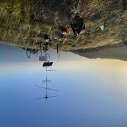
Movements and Migratory Stopovers Among Birds in the Western U.S. Using Networked Weather Radar and Motus Wildlife Tracking Data
USGS scientists from the Wetland and Aquatic Research Center and the Western Ecological Research Center are collaborating to synthesize data on migratory bird use of Bureau of Land Management lands in the western U.S. to support permitting decisions.
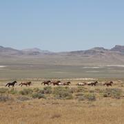
Science for management of America’s iconic wild horses and burros
Wild horses and burros are iconic wildlife of the western USA as well as a complicated management issue on tribal, state, and federal lands. Due to their history as domesticated animals, these wild equids – also called “free-roaming” or “feral” equids – can reproduce quickly, and have few natural predators, allowing their populations to grow rapidly if not managed. When populations are too large...