
Understanding long-term drivers of vegetation change and stability in the Southern Rocky Mountains with paleoecological data and ecological models
Drought and fire are powerful disturbance agents that can trigger rapid and lasting changes in the forests of western North America. Over the last decade, increases in fire size and severity coincided with warming, drought, and earlier snowmelt, factors that projected climatic changes are likely to exacerbate. However, recent observations are brief relative to the lifespans of trees and include limited examples of rare events that can shape forest structure for decades (e.g., sustained droughts, extensive fires, episodic regeneration). Therefore, developing management strategies to maintain the ecosystem services provided by western forests requires long-term data. This project combines two research techniques that provide understanding of ecosystem change in the Southern Rocky Mountains beyond the decadal scale – paleoecology and ecological modeling. Paleoecology provides long-term data needed to calibrate and evaluate models. In turn, models that are calibrated with long-term data may be used to confidently project the long-term consequences of changing environmental conditions, and to evaluate management strategies needed to maintain ecosystem services in a warming climate
Statement of Problem
The immediate impacts of drought and wildfire, including tree mortality and land cover change can be readily apparent. However, the long-term consequences are less certain and depend on the ability of forests to withstand and recover from disturbance. Understanding what comes after disturbance requires long-term data to document factors that (1) promote long-term ecological resiliency and (2) identify thresholds for ecological change. This understanding may then be used to anticipate the consequences of environmental change and better manage forests to mitigate risk and maintain ecosystem services in a changing world.
Why this Research is Important
Long-term data are crucial for understanding the causes of ecological change and for improving models capable of projecting future impacts. For example, in the Southern Rocky Mountains, an extraordinary density of tree-ring records documents links among climate, humans, and fire frequencies over centuries. However, the tree-ring record fades beyond 600-1000 years and interactions operating over longer time scales remain uncertain. Therefore, the tree-ring record does not extend to the warmer intervals of the past that affected fire regimes and human populations (e.g., Medieval Climate Anomaly from ~700-1000 years before present), and may provide analogues for a warmer future with varying levels of management intensity. Sedimentary records of Holocene climate, fire, and vegetation can help fill this research void.
Objective(s)
- Apply existing tree-ring data (i.e., demographies, climatologies, fire records) and forest inventory records to quantify thresholds for tree establishment and mortality, and apply this understanding with the LANDIS-II dynamic vegetation model to project impacts of changing climate and disturbance on forests in the Southern Rocky Mountains.
- Extend quantitative understanding of the interactions among climate, fire, humans, and vegetation in the Southern Rocky Mountains beyond the limits of the tree-ring record (~600 years) to include warmer and drier intervals and periods with variable human population.

Methods:
1. Simulations of vegetation dynamics in the Southern Rocky Mountains
The LANDIS-II model
LANDIS-II is a dynamic forest landscape model that simulates interactions among ecosystem processes, climate change, and disturbance to understand vegetation and carbon dynamics in temperate forests. The base model tracks tree cohorts and seed dispersal across a gridded landscape (e.g., 25 - 250 m grid cells).
Model Calibration
We are applying tree-ring inferred demographic data (dates of tree establishment and mortality) from the Jemez Mountains and forest inventory data from the western US to calibrate thresholds in water availability for seedling establishment and drought mortality in the LANDIS-II model.
Model evaluation with simulations under past climate
Model performance will be evaluated by simulating vegetation dynamics of the Jemez Mountains from 1600 AD to the present, with an emphasis on constraining interactions between fire and drought at the lower treeline. Species-specific drought thresholds for seedling establishment and overstory mortality will be used to simulate lower treeline dynamics. Model output will be evaluated in comparison to well-known shifts in lower treeline, widespread drought-related mortality events, and observed post-disturbance regeneration success. Climate scenarios will be developed by combining paleoclimatic records (i.e., tree-ring inferred water balance) and weather station data.
Model application to future climate scenarios
In an integrative final phase, simulations will be extended to the ecoregion scale to simulate climate change impacts on wildfire, vegetation dynamics, land cover, and forest carbon stocks in the Southern Rocky Mountains.
Significance of work
A key advantage of forest landscape models is the fine-scale, representation of ecological processes in individual cells (e.g., 25 - 250 m grid cells). This fine resolution provides information at a scale relevant to human observation and management decisions. Model landscapes can upscale ecological information to regional or ecoregional scales. This work addresses important challenges for projecting vegetation change in the Southern Rocky Mountains where climate-driven changes in landcover are ongoing. Fire is an important driver of change in the region, but drought-related mortality and drought limits on regeneration are widespread. Therefore, accurate representation of drought impacts on forest dynamics is crucial to developing reliable projections. Records of Holocene vegetation, fire frequencies, and human occupation of the study region (see below) will be used to place future vegetation projections in a historical context and evaluate the realism of vegetation simulated in warmer and drier conditions.
2. Extending the record of interactions among climate, fire, humans, and vegetation in the Southern Rocky Mountains at Santa Fe Lake, NM

Sediment coring
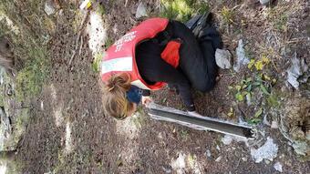
Santa Fe Lake is the southernmost natural lake in the Rocky Mountains and is part of a protected watershed that provides drinking water to the city of Santa Fe. Two overlapping sediment cores of organic-rich sediment were extracted from the deepest part of Santa Fe Lake in September 2020 with a Livingstone piston corer. Approximately 5 m of sediment were obtained for each core, and coring proceeded to the base of the sediment, which was marked by sand. An age-depth model will be developed for the cores using isotopic dating techniques (i.e., 210Pb and AMS 14C), and we expect the cores to span the Holocene period (i.e., last ~10,000 years).
Vegetation analysis
Sediment will be sampled for pollen analysis at ~250-year resolution to produce an outline of Holocene vegetation dynamics. This overview will establish a timeline of vegetational change and identify focal periods for contiguous high-resolution analyses. In a second step, two periods, provisionally the Medieval Climate Anomaly and Holocene thermal maximum, will be sampled contiguously for high-resolution analysis (10 to 20-year resolution).
Reconstruction of local and regional fire activity
Macroscopic charcoal will be extracted from the full sedimentary series at 1 cm intervals as a proxy for local fires. Significant peaks of charcoal accumulation will be identified to distinguish local fire episodes from background input. Temporal resolution will depend on sediment accumulation rates. Regional changes in fire activity will be reconstructed using the abundance of levoglucosan, a molecular biomarker produced by biomass burning, and with microscopic charcoal on pollen slides.
Documentation of human presence
Evidence of human activity at Santa Fe Lake will be obtained by extracting fecal sterols from the full sedimentary series. Fecal sterols provide direct evidence of human presence in the watershed and can be compared to proxies for vegetation and fire (i.e., pollen, charcoal, and levoglucosan) to infer human impacts on the surrounding landscape. Temporal resolution will follow that used for pollen analysis.
Statistical analyses
Quantitative time-series analyses (e.g., cross-correlations of charcoal vs. pollen, fecal sterols vs. charcoal) of the high-resolution sections will detect past influences of fire on vegetation, and human impacts on fire regimes. These analyses will provide new quantitative understanding of the long-term drivers of vegetation and disturbance in the surrounding region.
Significance of work
This project will document long-term changes in vegetation, fire frequencies, and human activity in the Santa Fe Lake watershed and surrounding region. The data will be used to understand fire as a driver of Holocene vegetation dynamics in the Southern Rocky Mountains using time-series analysis. Importantly, inclusion of fecal sterols as a vegetation-independent proxy for local human activity represents a novel approach to understanding the role of humans as long-term drivers of vegetation change and stability. Whereas previous efforts in the Southern Rocky Mountains qualitatively linked changes in sedimentary charcoal and pollen to archaeological records, this project will quantify relationships among humans, fire, and vegetation with data from the same sedimentary series. The Southwestern US, with its abundance of archaeological sites that document millennia of occupation by complex societies presents an ideal setting for such analyses. Pre-European-settlement impacts of native Americans on fire regimes and vegetation dynamics are widely assumed, but poorly documented beyond the historical record. Time-series analysis will quantify the long-term role of humans as a driver of fire activity, and fire as a driver of vegetation dynamics. Such information is critical to broadening understanding of long-term vegetation change and stability in protected landscapes and will serve as a needed independent evaluation of the ecological principals that have emerged from the dense tree-ring network of the Southwestern US.
Below are other science projects associated with this project.

Effects of disturbance and drought on the forests and hydrology of the Southern Rocky Mountains

Terrestrial Records of Holocene Climate Change: Fire, climate and humans
Drought and fire are powerful disturbance agents that can trigger rapid and lasting changes in the forests of western North America. Over the last decade, increases in fire size and severity coincided with warming, drought, and earlier snowmelt, factors that projected climatic changes are likely to exacerbate. However, recent observations are brief relative to the lifespans of trees and include limited examples of rare events that can shape forest structure for decades (e.g., sustained droughts, extensive fires, episodic regeneration). Therefore, developing management strategies to maintain the ecosystem services provided by western forests requires long-term data. This project combines two research techniques that provide understanding of ecosystem change in the Southern Rocky Mountains beyond the decadal scale – paleoecology and ecological modeling. Paleoecology provides long-term data needed to calibrate and evaluate models. In turn, models that are calibrated with long-term data may be used to confidently project the long-term consequences of changing environmental conditions, and to evaluate management strategies needed to maintain ecosystem services in a warming climate
Statement of Problem
The immediate impacts of drought and wildfire, including tree mortality and land cover change can be readily apparent. However, the long-term consequences are less certain and depend on the ability of forests to withstand and recover from disturbance. Understanding what comes after disturbance requires long-term data to document factors that (1) promote long-term ecological resiliency and (2) identify thresholds for ecological change. This understanding may then be used to anticipate the consequences of environmental change and better manage forests to mitigate risk and maintain ecosystem services in a changing world.
Why this Research is Important
Long-term data are crucial for understanding the causes of ecological change and for improving models capable of projecting future impacts. For example, in the Southern Rocky Mountains, an extraordinary density of tree-ring records documents links among climate, humans, and fire frequencies over centuries. However, the tree-ring record fades beyond 600-1000 years and interactions operating over longer time scales remain uncertain. Therefore, the tree-ring record does not extend to the warmer intervals of the past that affected fire regimes and human populations (e.g., Medieval Climate Anomaly from ~700-1000 years before present), and may provide analogues for a warmer future with varying levels of management intensity. Sedimentary records of Holocene climate, fire, and vegetation can help fill this research void.
Objective(s)
- Apply existing tree-ring data (i.e., demographies, climatologies, fire records) and forest inventory records to quantify thresholds for tree establishment and mortality, and apply this understanding with the LANDIS-II dynamic vegetation model to project impacts of changing climate and disturbance on forests in the Southern Rocky Mountains.
- Extend quantitative understanding of the interactions among climate, fire, humans, and vegetation in the Southern Rocky Mountains beyond the limits of the tree-ring record (~600 years) to include warmer and drier intervals and periods with variable human population.
Methods:
1. Simulations of vegetation dynamics in the Southern Rocky Mountains
The LANDIS-II model
LANDIS-II is a dynamic forest landscape model that simulates interactions among ecosystem processes, climate change, and disturbance to understand vegetation and carbon dynamics in temperate forests. The base model tracks tree cohorts and seed dispersal across a gridded landscape (e.g., 25 - 250 m grid cells).
Model Calibration
We are applying tree-ring inferred demographic data (dates of tree establishment and mortality) from the Jemez Mountains and forest inventory data from the western US to calibrate thresholds in water availability for seedling establishment and drought mortality in the LANDIS-II model.
Model evaluation with simulations under past climate
Model performance will be evaluated by simulating vegetation dynamics of the Jemez Mountains from 1600 AD to the present, with an emphasis on constraining interactions between fire and drought at the lower treeline. Species-specific drought thresholds for seedling establishment and overstory mortality will be used to simulate lower treeline dynamics. Model output will be evaluated in comparison to well-known shifts in lower treeline, widespread drought-related mortality events, and observed post-disturbance regeneration success. Climate scenarios will be developed by combining paleoclimatic records (i.e., tree-ring inferred water balance) and weather station data.
Model application to future climate scenarios
In an integrative final phase, simulations will be extended to the ecoregion scale to simulate climate change impacts on wildfire, vegetation dynamics, land cover, and forest carbon stocks in the Southern Rocky Mountains.
Significance of work
A key advantage of forest landscape models is the fine-scale, representation of ecological processes in individual cells (e.g., 25 - 250 m grid cells). This fine resolution provides information at a scale relevant to human observation and management decisions. Model landscapes can upscale ecological information to regional or ecoregional scales. This work addresses important challenges for projecting vegetation change in the Southern Rocky Mountains where climate-driven changes in landcover are ongoing. Fire is an important driver of change in the region, but drought-related mortality and drought limits on regeneration are widespread. Therefore, accurate representation of drought impacts on forest dynamics is crucial to developing reliable projections. Records of Holocene vegetation, fire frequencies, and human occupation of the study region (see below) will be used to place future vegetation projections in a historical context and evaluate the realism of vegetation simulated in warmer and drier conditions.
2. Extending the record of interactions among climate, fire, humans, and vegetation in the Southern Rocky Mountains at Santa Fe Lake, NM
Sediment coring
Santa Fe Lake is the southernmost natural lake in the Rocky Mountains and is part of a protected watershed that provides drinking water to the city of Santa Fe. Two overlapping sediment cores of organic-rich sediment were extracted from the deepest part of Santa Fe Lake in September 2020 with a Livingstone piston corer. Approximately 5 m of sediment were obtained for each core, and coring proceeded to the base of the sediment, which was marked by sand. An age-depth model will be developed for the cores using isotopic dating techniques (i.e., 210Pb and AMS 14C), and we expect the cores to span the Holocene period (i.e., last ~10,000 years).
Vegetation analysis
Sediment will be sampled for pollen analysis at ~250-year resolution to produce an outline of Holocene vegetation dynamics. This overview will establish a timeline of vegetational change and identify focal periods for contiguous high-resolution analyses. In a second step, two periods, provisionally the Medieval Climate Anomaly and Holocene thermal maximum, will be sampled contiguously for high-resolution analysis (10 to 20-year resolution).
Reconstruction of local and regional fire activity
Macroscopic charcoal will be extracted from the full sedimentary series at 1 cm intervals as a proxy for local fires. Significant peaks of charcoal accumulation will be identified to distinguish local fire episodes from background input. Temporal resolution will depend on sediment accumulation rates. Regional changes in fire activity will be reconstructed using the abundance of levoglucosan, a molecular biomarker produced by biomass burning, and with microscopic charcoal on pollen slides.
Documentation of human presence
Evidence of human activity at Santa Fe Lake will be obtained by extracting fecal sterols from the full sedimentary series. Fecal sterols provide direct evidence of human presence in the watershed and can be compared to proxies for vegetation and fire (i.e., pollen, charcoal, and levoglucosan) to infer human impacts on the surrounding landscape. Temporal resolution will follow that used for pollen analysis.
Statistical analyses
Quantitative time-series analyses (e.g., cross-correlations of charcoal vs. pollen, fecal sterols vs. charcoal) of the high-resolution sections will detect past influences of fire on vegetation, and human impacts on fire regimes. These analyses will provide new quantitative understanding of the long-term drivers of vegetation and disturbance in the surrounding region.
Significance of work
This project will document long-term changes in vegetation, fire frequencies, and human activity in the Santa Fe Lake watershed and surrounding region. The data will be used to understand fire as a driver of Holocene vegetation dynamics in the Southern Rocky Mountains using time-series analysis. Importantly, inclusion of fecal sterols as a vegetation-independent proxy for local human activity represents a novel approach to understanding the role of humans as long-term drivers of vegetation change and stability. Whereas previous efforts in the Southern Rocky Mountains qualitatively linked changes in sedimentary charcoal and pollen to archaeological records, this project will quantify relationships among humans, fire, and vegetation with data from the same sedimentary series. The Southwestern US, with its abundance of archaeological sites that document millennia of occupation by complex societies presents an ideal setting for such analyses. Pre-European-settlement impacts of native Americans on fire regimes and vegetation dynamics are widely assumed, but poorly documented beyond the historical record. Time-series analysis will quantify the long-term role of humans as a driver of fire activity, and fire as a driver of vegetation dynamics. Such information is critical to broadening understanding of long-term vegetation change and stability in protected landscapes and will serve as a needed independent evaluation of the ecological principals that have emerged from the dense tree-ring network of the Southwestern US.
Below are other science projects associated with this project.
Effects of disturbance and drought on the forests and hydrology of the Southern Rocky Mountains