
Tracking the Bad Guys: Toxic Algal Blooms
Every few days, a fleet of satellites orbiting 700 kilometers above the Earth scans the continental United States to help keep Americans safe. But these eyes in the sky aren’t seeking terrorists or enemy combatants: they scrutinize lakes to locate problems of the microbial variety, namely cyanobacteria.


Cyanobacteria inhabit water in every corner of the world. These microorganisms possess the qualities of algae and bacteria, and under certain environmental conditions, cyanobacteria multiply rapidly, creating harmful algal blooms (cyanoHABs). During blooms, cyanobacteria produce toxins, such as microcystins, in amounts that can kill wildlife and pets and can even cause illness or death in humans.
Algal blooms can generate foul tastes and odors in source and drinking waters and make swimming areas unappealing. Aesthetic problems caused by nearshore accumulations, along with health risks, have hurt local economies through depressed real-estate values and reduced tourism.

Scientists surveyed 1,161 U.S. lakes and found that cyanobacteria were the dominant algae in 76 percent of the surveyed locations. Furthermore, 32 percent of lakes contained toxins produced by cyanobacteria.
Collaborative research was carried out by the U.S. Geological Survey (USGS) and the Environmental Protection Agency (EPA), and the findings were published in the National Lakes Assessment (NLA). The USGS is technically adept at assessing cyanobacteria—their efforts included creating and applying analytical methods for measuring the concentrations of algal toxins in water.
The EPA’s Office of Science and Technology (OST) develops and implements health advisories, along with criteria and regulations for the Nation’s waters. “We use the NLA data to understand the occurrence of microcystins in lakes in the United States when developing the drinking water health advisories,” said Lesley D’Anglada, a senior microbiologist with the OST. “As the only nationwide assessment of cyanotoxin occurrence in surface water systems, the NLA provides us the big picture of the problem in the United States.”
While agencies routinely sample cyanobacteria, there are over 275,000 lakes in the continental United States, leaving a large number of lakes unmonitored. As a result, resource allocation is a constant struggle for agency managers.


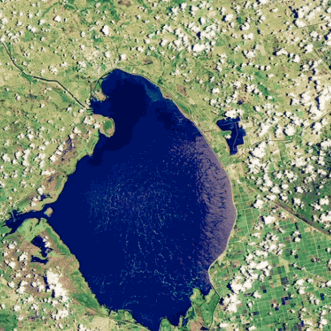
Satellites continuously searching for the characteristic blue-green swirls of cyanobacteria can make decisions easier by prioritizing at-risk waterbodies.
Improved information is the goal of a new interagency effort called “CyAN,” or the Cyanobacteria Assessment Network. Since 2015, the USGS has collaborated with the EPA, the National Aeronautics and Space Administration (NASA), and the National Oceanic and Atmospheric Administration (NOAA) to transform satellite imagery into information that water managers can use to protect ecological systems and human health from freshwater contamination.
The interagency team analyzes lake images from multiple satellites, including two USGS-operated Landsat satellites and a new European Space Agency satellite named Sentinel-3.


The satellite images are compared with those taken by two decommissioned satellites, including a Landsat satellite originally launched in 1984.
“Water managers are typically interested in knowing the frequency of bloom events that occur, what is the extent of those events, and what is the duration,” said Blake Schaeffer, a research physical scientist with the EPA National Exposure Research Laboratory. “We can answer those questions by looking back at historical archives.”
These efforts help local water managers craft an optimal prevention strategy for each body of water and monitor success after implementation. At the local level, bloom prevention can include diverting runoff to avoid an influx of nutrients, which act as a buffet for algae, or planting rows of vegetation in areas of high runoff to slow and absorb nutrients.
At the national level, the EPA cites both the CyAN Project and the NLA as critical programs for understanding harmful algal blooms and their potential to foul drinking and recreational bodies of water. The CyAN Project is part of the White House’s plan for expanding monitoring and forecasting capabilities to ensure the United States has sustainable water resources.


For more information on cyanobacteria, please contact Geoffrey Plumlee, USGS Associate Director for Environmental Health, at gplumlee@usgs.gov.
For more information on Landsat, please contact Virginia Burkett, USGS Associate Director for Climate and Land Use Change, at virginia_burkett@usgs.gov.
Read more stories about USGS science in action.
