
Using Artificial Intelligence to Estimate Traffic to Improve Planning and Access to Colorado’s Public Lands
This project applies data-driven, machine‑learning methods to estimate average annual daily traffic on roads that connect people to Colorado’s public lands, where traffic data are sparse or nonexistent. Expanding on successful applications in Wyoming, the approach uses socioeconomic, land-use, roadway, and accessibility data to uniquely model traffic patterns from 2015 to 2025. These predictions will help decision makers better plan for recreation access, infrastructure investments, and conservation.
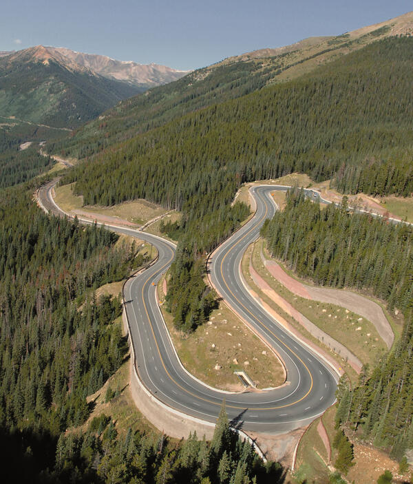
Federal and state agencies require reliable traffic data to support transportation planning, recreation access, and natural resource management. However, Colorado roads that access federal lands, like most western States, lack traffic volume data because collecting new data is prohibitively expensive. This lack of coverage limits evaluation of proposed projects and constrains planning decisions. To address this gap, USGS is adapting a Wyoming-based, machine-learning, traffic framework for Colorado, producing comprehensive average annual daily traffic (AADT) predictions across all road segments.
Adaptations required for predicting traffic in Colorado:
- Colorado’s transportation network is more complex, with higher road density and more interconnected systems.
- Large population gradients, including major metropolitan areas, strongly influence long‑distance recreation and commuter travel.
- The recreation landscape is more diverse and heavily used, with high visitation to National Parks, National Forests, state parks, ski areas, trail systems, and mountain corridors.
- Like Wyoming, Colorado is shaped by energy development, freight corridors, and resource‑extraction roads, but urban passenger traffic dominates statewide travel patterns.
Research Implications
Understanding the where, when, duration, and degree of traffic helps transportation planners allocate limited funding efficiently, improve access to public lands, and evaluate land management actions. Traffic modeling will help organizations evaluate proposed projects based on their effects on recreation travel demand and public‑land access, thereby promoting public lands outdoor recreation experiences.
The resulting traffic estimates provide agencies with better tools to prioritize transportation investments, especially in areas with limited data, and to address challenges such as habitat fragmentation, effective road closures, and traffic restrictions. These insights support responsible stewardship of natural resources, contribute to economic growth, and help reduce delays in policy decisions through stronger scientific information.
This work will also improve understanding of how people access public lands and supports evaluation of project impacts on recreation, conservation, and natural‑resource management. The resulting data products also strengthen planning for wildlife conservation, habitat connectivity, and land‑use change. The Colorado framework will serve as a scalable model for regional and national applications across the West.

Methods
We are working closely with partners to develop workflows and software that assemble statewide datasets on roads, traffic counts, socioeconomic factors, land use, and transportation access. To make annual traffic predictions, we will use artificial intelligence and machine learning methods supporting data‑driven decision‑making. Machine learning can exploit hundreds of transportation properties, demographic data, and other information to estimate traffic where traffic counter data is otherwise unavailable. We will calibrate and validate annual traffic models using observed counts and explanatory data related to recreation, natural resource use, population growth, and freight movement, leveraging high-performance computing resources. Final models will yield traffic estimates across all local roads and generate annual AADT summaries from 2015 to 2025.
Funders
This project is funded by the Federal Highway Administration (FHWA) and its Federal Lands Highway programs.
Partners
This work is co-produced with federal and state partners to ensure that data products directly support land management decisions and transportation planning needs. Ongoing collaboration with Federal Highway Administration (FHWA), Federal Lands Highway (FLH) programs, Colorado Department of Transportation (CDOT), the National Park Service (NPS), and federal land agencies will guide the development, validation, and delivery of the model.


Estimating road age and traffic volume for disturbance assessments in Wyoming

Road Ecology
This project applies data-driven, machine‑learning methods to estimate average annual daily traffic on roads that connect people to Colorado’s public lands, where traffic data are sparse or nonexistent. Expanding on successful applications in Wyoming, the approach uses socioeconomic, land-use, roadway, and accessibility data to uniquely model traffic patterns from 2015 to 2025. These predictions will help decision makers better plan for recreation access, infrastructure investments, and conservation.
Federal and state agencies require reliable traffic data to support transportation planning, recreation access, and natural resource management. However, Colorado roads that access federal lands, like most western States, lack traffic volume data because collecting new data is prohibitively expensive. This lack of coverage limits evaluation of proposed projects and constrains planning decisions. To address this gap, USGS is adapting a Wyoming-based, machine-learning, traffic framework for Colorado, producing comprehensive average annual daily traffic (AADT) predictions across all road segments.
Adaptations required for predicting traffic in Colorado:
- Colorado’s transportation network is more complex, with higher road density and more interconnected systems.
- Large population gradients, including major metropolitan areas, strongly influence long‑distance recreation and commuter travel.
- The recreation landscape is more diverse and heavily used, with high visitation to National Parks, National Forests, state parks, ski areas, trail systems, and mountain corridors.
- Like Wyoming, Colorado is shaped by energy development, freight corridors, and resource‑extraction roads, but urban passenger traffic dominates statewide travel patterns.
Research Implications
Understanding the where, when, duration, and degree of traffic helps transportation planners allocate limited funding efficiently, improve access to public lands, and evaluate land management actions. Traffic modeling will help organizations evaluate proposed projects based on their effects on recreation travel demand and public‑land access, thereby promoting public lands outdoor recreation experiences.
The resulting traffic estimates provide agencies with better tools to prioritize transportation investments, especially in areas with limited data, and to address challenges such as habitat fragmentation, effective road closures, and traffic restrictions. These insights support responsible stewardship of natural resources, contribute to economic growth, and help reduce delays in policy decisions through stronger scientific information.
This work will also improve understanding of how people access public lands and supports evaluation of project impacts on recreation, conservation, and natural‑resource management. The resulting data products also strengthen planning for wildlife conservation, habitat connectivity, and land‑use change. The Colorado framework will serve as a scalable model for regional and national applications across the West.
Methods
We are working closely with partners to develop workflows and software that assemble statewide datasets on roads, traffic counts, socioeconomic factors, land use, and transportation access. To make annual traffic predictions, we will use artificial intelligence and machine learning methods supporting data‑driven decision‑making. Machine learning can exploit hundreds of transportation properties, demographic data, and other information to estimate traffic where traffic counter data is otherwise unavailable. We will calibrate and validate annual traffic models using observed counts and explanatory data related to recreation, natural resource use, population growth, and freight movement, leveraging high-performance computing resources. Final models will yield traffic estimates across all local roads and generate annual AADT summaries from 2015 to 2025.
Funders
This project is funded by the Federal Highway Administration (FHWA) and its Federal Lands Highway programs.
Partners
This work is co-produced with federal and state partners to ensure that data products directly support land management decisions and transportation planning needs. Ongoing collaboration with Federal Highway Administration (FHWA), Federal Lands Highway (FLH) programs, Colorado Department of Transportation (CDOT), the National Park Service (NPS), and federal land agencies will guide the development, validation, and delivery of the model.
Estimating road age and traffic volume for disturbance assessments in Wyoming