
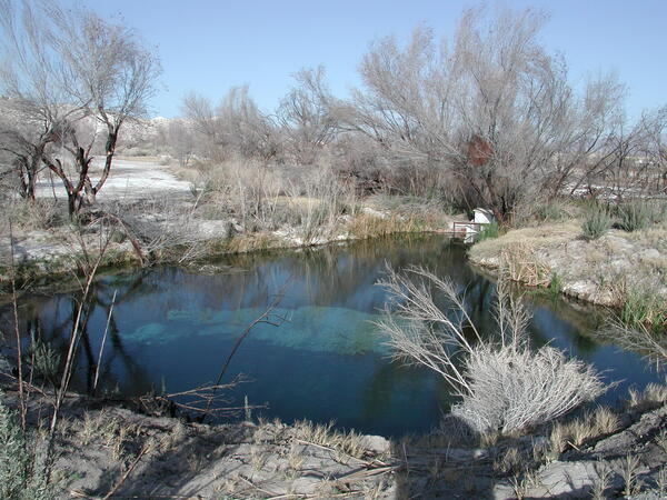
The National Park Service, Nye County, U.S. Fish and Wildlife Service, and USGS Nevada Water Science Center (NVWSC) have established a water-level and spring discharge monitoring network in the southern Amargosa Desert to identify long-term trends and monitor potential impacts of activities on groundwater resources. The Amargosa Integrated Monitoring Network (AIMN) continues the long-term groundwater and spring discharge data collection that took place from 1992 to 2009 as part of the Yucca Mountain project.
AIMN Network Description
Each agency in the AIMN is collecting water-level and/or spring discharge data at selected sites. Data are submitted to the NVWSC, quality assured by NVWSC, and archived in USGS National Water Information System (NWIS). Data collected by the AIMN from 2011 to 2016 have been quality assured and entered into NWIS. NVWSC is also providing measurement protocol, field calibration of measuring instruments, and technical advice as needed.
The AIMN stretches from the southeast corner of the Nevada National Security Site to Furnace Creek in Death Valley and consists of 44 wells and 10 springs.

The following tables identify the sites monitored by each agency.
| Type of Data Collected | USGS Site Name (includes link to NWIS data) | Frequency of Measurements |
|---|---|---|
| Water-level | Devils Hole (AM-4) | Monthly |
| Water-level | GF-1 (AM-9) | Monthly |
| Water-level | GF-2A shallow (AM-10) | Monthly |
| Water-level | GF-2B deep (AM-11) | Monthly |
| Water-level | GF-3 (AM-12) | Monthly |
| Water-level | Inyo-BLM #1 | Quarterly |
| Water-level | NvSpMW-2 (aka Nevares Spring Monitoring Well #2) | Monthly |
| Water-level | Travertine Point 1 (DV-3) | Quarterly |
| Water-level | TXSPRGSNCLN-2DP | Monthly |
| Water-level | TXSPRGSNCLN-2INT | Monthly |
| Water-level | TXSPRGSNCLN-2SH | Monthly |
| Type of Data Collected | USGS Site Name (includes link to NWIS data) | Frequency of Measurements |
|---|---|---|
| Water-level | Amargosa Desert 3a (AD-3a) | Quarterly |
| Water-level | Amargosa Desert 7a (AD-7a) | Quarterly |
| Water-level | Amargosa Desert 9a (AD-9a) or nearby well | Quarterly |
| Water-level | Death Valley Junction Well (AD-14) | Quarterly |
| Water-level | GS-1 Well (AD-12) | Quarterly |
| Water-level | NA-9 Well (AD-10) (deep) | Quarterly |
| Water-level | NA-9 Shallow Well | Quarterly |
| Water-level | TW-5 (RV-1) | Quarterly |
| Water-level | USBLM Well (AD-5) | Quarterly |
| Type of Data Collected | USGS Site Name (includes link to NWIS data) | Frequency of Measurements |
|---|---|---|
| Water-level | Ash Meadows 3 Well (AM-3) | Quarterly |
| Discharge | Big Spring (AM-8) | Quarterly |
| Discharge | Crystal Pool Spring (AM-5a) | Quarterly |
| Discharge | Fairbanks Spring (AM-1a) | Quarterly |
| Discharge | Five Springs Well (AM-2) | Quarterly |
| Discharge | Jack Rabbit Spring | Quarterly |
| Discharge | King Pool Spring | Quarterly |
| Discharge | Longstreet Spring | Quarterly |
| Discharge | FWS - POINT OF ROCKS OUTFLOW BLW POINT OF ROCKS (aka Point of Rocks Spring) | Quarterly |
| Water-level | Point of Rocks North Well (AM-6) | Quarterly |
| Water-level | Point of Rocks South Well (AM-7) | Quarterly |
| Water-level | Reed 11 Well (aka Fairbanks Well) | Instantaneous - Quarterly |
| Discharge | Rogers Spring | Quarterly |
| Water-level | Rogers Spring Well (AM-1) | Quarterly |
| Water-level | Soda Spring Well | Instantaneous - Quarterly |
| Water-level | Spring Meadows 12 (aka Deep Well) | Instantaneous - Quarterly |
| Water-level | USFWS Peterson Well | Instantaneous - Quarterly |
| Type of Data Collected | USGS Site Name (includes link to NWIS data) | Frequency of Measurements |
|---|---|---|
| Water-level | Amargosa Desert 8 (AD-8) | Quarterly |
| Water-level | BGMW- 1 | Annually |
| Water-level | BGMW- 2 | Annually |
| Water-level | BGMW- 3 | Annually |
| Water-level | BGMW- 4 | Annually |
| Water-level | BGMW- 5 | Annually |
| Water-level | BGMW- 6 | Annually |
| Water-level | BGMW- 8 | Annually |
| Water-level | BGMW- 9 | Annually |
| Water-level | BGMW-11 | Annually |
| Water-level | BGMW-13 | Annually |
| Water-level | GS-3 Well (AD-11) | Annually |
| Water-level | GS-3 Well Shallow | Annually |
| Water-level | NA-6 Well BGMW-10 (AD-1) (deep) | Quarterly |
| Water-level | NA-6 Shallow Well | Quarterly |
| Discharge | Navel Spring (DV-2) | Quarterly |
| Water-level | USW VH-1 (CF-2) | Quarterly |
The National Park Service, Nye County, U.S. Fish and Wildlife Service, and USGS Nevada Water Science Center (NVWSC) have established a water-level and spring discharge monitoring network in the southern Amargosa Desert to identify long-term trends and monitor potential impacts of activities on groundwater resources. The Amargosa Integrated Monitoring Network (AIMN) continues the long-term groundwater and spring discharge data collection that took place from 1992 to 2009 as part of the Yucca Mountain project.
AIMN Network Description
Each agency in the AIMN is collecting water-level and/or spring discharge data at selected sites. Data are submitted to the NVWSC, quality assured by NVWSC, and archived in USGS National Water Information System (NWIS). Data collected by the AIMN from 2011 to 2016 have been quality assured and entered into NWIS. NVWSC is also providing measurement protocol, field calibration of measuring instruments, and technical advice as needed.
The AIMN stretches from the southeast corner of the Nevada National Security Site to Furnace Creek in Death Valley and consists of 44 wells and 10 springs.
The following tables identify the sites monitored by each agency.
| Type of Data Collected | USGS Site Name (includes link to NWIS data) | Frequency of Measurements |
|---|---|---|
| Water-level | Devils Hole (AM-4) | Monthly |
| Water-level | GF-1 (AM-9) | Monthly |
| Water-level | GF-2A shallow (AM-10) | Monthly |
| Water-level | GF-2B deep (AM-11) | Monthly |
| Water-level | GF-3 (AM-12) | Monthly |
| Water-level | Inyo-BLM #1 | Quarterly |
| Water-level | NvSpMW-2 (aka Nevares Spring Monitoring Well #2) | Monthly |
| Water-level | Travertine Point 1 (DV-3) | Quarterly |
| Water-level | TXSPRGSNCLN-2DP | Monthly |
| Water-level | TXSPRGSNCLN-2INT | Monthly |
| Water-level | TXSPRGSNCLN-2SH | Monthly |
| Type of Data Collected | USGS Site Name (includes link to NWIS data) | Frequency of Measurements |
|---|---|---|
| Water-level | Amargosa Desert 3a (AD-3a) | Quarterly |
| Water-level | Amargosa Desert 7a (AD-7a) | Quarterly |
| Water-level | Amargosa Desert 9a (AD-9a) or nearby well | Quarterly |
| Water-level | Death Valley Junction Well (AD-14) | Quarterly |
| Water-level | GS-1 Well (AD-12) | Quarterly |
| Water-level | NA-9 Well (AD-10) (deep) | Quarterly |
| Water-level | NA-9 Shallow Well | Quarterly |
| Water-level | TW-5 (RV-1) | Quarterly |
| Water-level | USBLM Well (AD-5) | Quarterly |
| Type of Data Collected | USGS Site Name (includes link to NWIS data) | Frequency of Measurements |
|---|---|---|
| Water-level | Ash Meadows 3 Well (AM-3) | Quarterly |
| Discharge | Big Spring (AM-8) | Quarterly |
| Discharge | Crystal Pool Spring (AM-5a) | Quarterly |
| Discharge | Fairbanks Spring (AM-1a) | Quarterly |
| Discharge | Five Springs Well (AM-2) | Quarterly |
| Discharge | Jack Rabbit Spring | Quarterly |
| Discharge | King Pool Spring | Quarterly |
| Discharge | Longstreet Spring | Quarterly |
| Discharge | FWS - POINT OF ROCKS OUTFLOW BLW POINT OF ROCKS (aka Point of Rocks Spring) | Quarterly |
| Water-level | Point of Rocks North Well (AM-6) | Quarterly |
| Water-level | Point of Rocks South Well (AM-7) | Quarterly |
| Water-level | Reed 11 Well (aka Fairbanks Well) | Instantaneous - Quarterly |
| Discharge | Rogers Spring | Quarterly |
| Water-level | Rogers Spring Well (AM-1) | Quarterly |
| Water-level | Soda Spring Well | Instantaneous - Quarterly |
| Water-level | Spring Meadows 12 (aka Deep Well) | Instantaneous - Quarterly |
| Water-level | USFWS Peterson Well | Instantaneous - Quarterly |
| Type of Data Collected | USGS Site Name (includes link to NWIS data) | Frequency of Measurements |
|---|---|---|
| Water-level | Amargosa Desert 8 (AD-8) | Quarterly |
| Water-level | BGMW- 1 | Annually |
| Water-level | BGMW- 2 | Annually |
| Water-level | BGMW- 3 | Annually |
| Water-level | BGMW- 4 | Annually |
| Water-level | BGMW- 5 | Annually |
| Water-level | BGMW- 6 | Annually |
| Water-level | BGMW- 8 | Annually |
| Water-level | BGMW- 9 | Annually |
| Water-level | BGMW-11 | Annually |
| Water-level | BGMW-13 | Annually |
| Water-level | GS-3 Well (AD-11) | Annually |
| Water-level | GS-3 Well Shallow | Annually |
| Water-level | NA-6 Well BGMW-10 (AD-1) (deep) | Quarterly |
| Water-level | NA-6 Shallow Well | Quarterly |
| Discharge | Navel Spring (DV-2) | Quarterly |
| Water-level | USW VH-1 (CF-2) | Quarterly |