
Current Water Conditions - Georgia, North Carolina, and South Carolina
Active
By South Atlantic Water Science Center (SAWSC)
April 21, 2025
Water Data for the Nation: Current Water Conditions ("Real-time") in Georgia, North Carolina, and South Carolina.
WaterWatch: View maps, graphs, and tables describing real-time, recent, and past streamflow conditions for the United States.
Predefined Water Data links by state and topic
| State | Streamflow | Lake/Reservoir | Precipitation | Groundwater | Water Quality |
|---|---|---|---|---|---|
| Georgia | Streamflow | Lakes/Reservoirs | Precipitation | Groundwater | Water Quality |
| North Carolina | Streamflow | Lakes/Reservoirs | Precipitation | Groundwater | Water Quality |
| South Carolina | Streamflow | Lakes/Reservoirs | Precipitation | Groundwater | Water Quality |
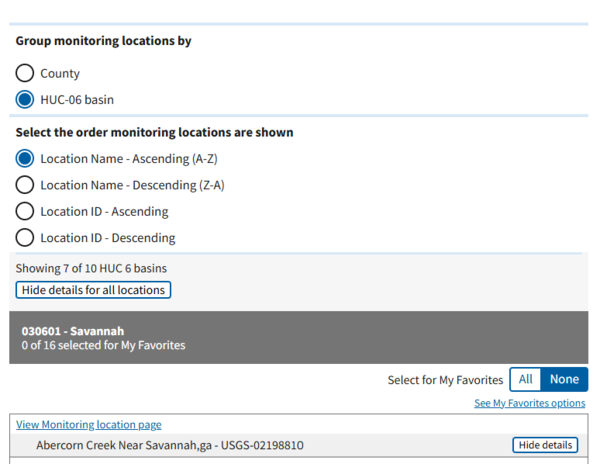
Predefined Water Data links sorted by HUC-06/County
Media
Sources/Usage: Public Domain. View Media Details
Hydrologic Unit Codes (HUC) Explained
| State | Streamflow | Gage Height | Precipitation | Groundwater | Water Quality |
|---|---|---|---|---|---|
| Georgia | Streamflow | Gage Height | Precipitation | Groundwater | Water Quality |
| North Carolina | Streamflow | Gage Height | Precipitation | Groundwater | Water Quality |
| South Carolina | Streamflow | Gage Height | Precipitation | Groundwater | Water Quality |
Map-based system
- National Water Dashboard: Georgia | North Carolina | South Carolina
- Legacy NWISmapper
South Atlantic Cumulative Precipitation Maps:
Georgia Cumulative Rainfall Map
Georgia Cumulative Rainfall Map
North Carolina Cumulative Rainfall Map
North Carolina Cumulative Rainfall Map
South Carolina Cumulative Rainfall Map
South Carolina Cumulative Rainfall Map
South Atlantic Web Cameras:
State specific information:
- GA Groundwater Conditions • NC Current and Peak Stage Bar Graphs
- USGS Flood Inundation mapping
- U.S. Drought Monitor - Southeast
(The U.S. Drought Monitor is jointly produced by the National Drought Mitigation Center at the University of Nebraska-Lincoln, the United States Department of Agriculture, and the National Oceanic and Atmospheric Administration. Map courtesy of NDMC.)
WaterAlert
- WaterAlert: allows users to set notification thresholds for any USGS real-time stream or raingage, water-quality, or groundwater monitoring site and then sends emails or text messages to subscribers whenever the threshold conditions are met, as often as every hour.
Release Date: 9/26/2016
Water Data for the Nation: Current Water Conditions ("Real-time") in Georgia, North Carolina, and South Carolina.
WaterWatch: View maps, graphs, and tables describing real-time, recent, and past streamflow conditions for the United States.
Predefined Water Data links by state and topic
| State | Streamflow | Lake/Reservoir | Precipitation | Groundwater | Water Quality |
|---|---|---|---|---|---|
| Georgia | Streamflow | Lakes/Reservoirs | Precipitation | Groundwater | Water Quality |
| North Carolina | Streamflow | Lakes/Reservoirs | Precipitation | Groundwater | Water Quality |
| South Carolina | Streamflow | Lakes/Reservoirs | Precipitation | Groundwater | Water Quality |
Predefined Water Data links sorted by HUC-06/County
Media
Sources/Usage: Public Domain. View Media Details
Hydrologic Unit Codes (HUC) Explained
| State | Streamflow | Gage Height | Precipitation | Groundwater | Water Quality |
|---|---|---|---|---|---|
| Georgia | Streamflow | Gage Height | Precipitation | Groundwater | Water Quality |
| North Carolina | Streamflow | Gage Height | Precipitation | Groundwater | Water Quality |
| South Carolina | Streamflow | Gage Height | Precipitation | Groundwater | Water Quality |
Map-based system
- National Water Dashboard: Georgia | North Carolina | South Carolina
- Legacy NWISmapper
South Atlantic Cumulative Precipitation Maps:
Georgia Cumulative Rainfall Map
Georgia Cumulative Rainfall Map
North Carolina Cumulative Rainfall Map
North Carolina Cumulative Rainfall Map
South Carolina Cumulative Rainfall Map
South Carolina Cumulative Rainfall Map
South Atlantic Web Cameras:
State specific information:
- GA Groundwater Conditions • NC Current and Peak Stage Bar Graphs
- USGS Flood Inundation mapping
- U.S. Drought Monitor - Southeast
(The U.S. Drought Monitor is jointly produced by the National Drought Mitigation Center at the University of Nebraska-Lincoln, the United States Department of Agriculture, and the National Oceanic and Atmospheric Administration. Map courtesy of NDMC.)
WaterAlert
- WaterAlert: allows users to set notification thresholds for any USGS real-time stream or raingage, water-quality, or groundwater monitoring site and then sends emails or text messages to subscribers whenever the threshold conditions are met, as often as every hour.
Release Date: 9/26/2016