



From Debris to Dwelling: How Dredged Sediment Is Shaping Salmon Habitat
How can human-built features and natural processes interact to support ecological goals?
A boat drifts into shallow waters, its wake pushing softly against an island that did not exist about a decade ago. To the untrained eye it’s just sand and silt. But to the scientists who have spent seasons returning to this place and collecting data, it has become something more: a question.
How will this newly formed habitat affect juvenile salmon?
The island is made of dredge material—sediment scoured from the ship navigation channel. Every year, large amounts of sediment are removed from river channels to keep ships moving. Instead of randomly disposing of it, the Army Corps of Engineers and other resource managers are now asking: Can this sediment be strategically placed in the ecosystem in a way that helps juvenile salmon?
Nature Rebuilt
The constructed islands are designed to mimic shallow habitat young salmon rely on for rest and feeding during migration. As the sediment settles into place, the river reshapes it—carving new contours and depositing organic matter that lets wild grass take root.
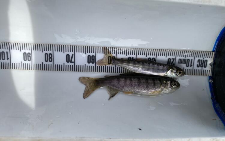
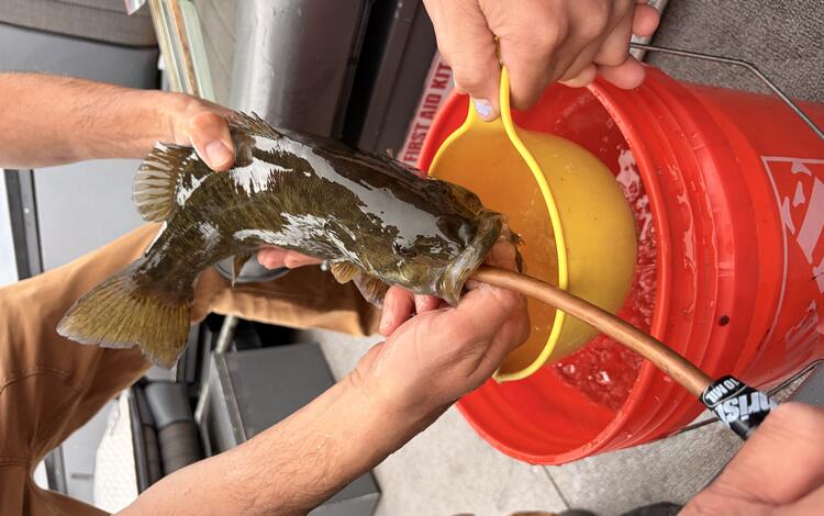
USGS Western Fisheries Research Center scientists are tracking how young salmon and their prey and predator species respond to these developing environments by mapping the changing terrain, examining vegetation, and capturing and tracking the fish that are using it. The goal is to determine whether this dredge deposit approach provides a net benefit for young salmon: creating more places where they can rest, eat, and grow during their migration out to the ocean.

Examining the Woodland Islands
Over the past century, the construction of dams and dikes has altered the natural flow patterns within the Lower Columbia River. Consequently, 75% of its tidal habitat has disappeared, primarily due to decreased sediment deposition. This habitat loss has had a detrimental impact on fish populations that rely on shallow water estuarine habitats for essential activities such as feeding and resting.
In 2020, 225,000 cubic yards of sediment from routine dredging of St. Helens Bar were hydraulically pumped, placed, and graded along the Washington side of the Lower Columbia River, between river miles 86 and 84.5. Compost was added above water to enhance soil composition, and native riparian and upland grasses, shrubs, and saplings were planted through early 2023.
At the “Woodland Islands” where four small landmasses and a side channel were created, USGS scientists are now examining how fish communities are using this new habitat. Researchers are documenting species presence, abundance, and behavior, and comparing these findings to nearby non-dredge material sites with similar characteristics. As the Woodland Islands mature, longer-term monitoring will offer a deeper look at ecological patterns that appear over time.
A New Project in the Lower Columbia River
A complementary USGS Western Fisheries Research Center effort is examining potential sites in the Lower Columbia River for new habitat prior to planned dredge sediment deposition. The Army Corps of Engineers has identified 5 potential deposition sites. USGS scientists are visiting these sites to document existing habitat conditions and determine which locations offer the greatest potential for expanding juvenile salmon habitat while accommodating dredging activities needed to maintain safe and reliable navigation.
This data will help scientists understand where dredged sediment can form beneficial habitat and will help determine how the dredge material placement site performs relative to prior habitat conditions. The Army Corps of Engineers plans to deposit the new dredge material in the Lower Columbia River beginning in 2027.
Where Engineering and Ecology Meet
Together, these projects illustrate how human-built features and natural processes may interact to support ecological goals. Dredged sediment creates the initial structure; river dynamics refine it; and the salmon will ultimately reveal the value of these projects.
Habitat restoration is an ongoing dialogue between design and adaptation, construction and observation, intention and response. Each season of monitoring adds nuance to our understanding of how engineered landscapes integrate into the river’s broader habitat mosaic.
Findings from these sites will help guide future dredge sediment placement across the Pacific Northwest. By examining how juvenile salmon interact with evolving habitat, the USGS WFRC and our partners inform strategies to support species recovery while maintaining essential navigation pathways.