
NEW TNMCorps Mapping Challenge for City / Town Halls in Georgia & South Carolina!
Our mission to revisit some of the earlier states that participated in city halls challenges continues with a new challenge focusing on city / town halls in Georgia and South Carolina! It’s not quite the Outer Banks, but it still makes for an excuse to visit the beach!
Contents
- Base Map
- What does each point color mean?
- Remaining Communities
- Tips & Tricks
- Interested in collecting elsewhere?
- Questions?
Base Map
Much work has already been done; however, there are still several municipalities that don’t yet have a point within their boundaries. See our spatial analysis for tips on remaining communities.
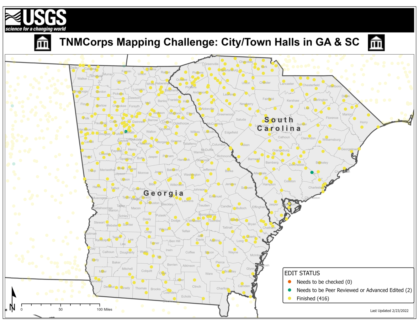
What does each point color mean?
These colors are part of our tiered editing process and signal to other editors that a point has passed through the upper tiers and does not need to be edited again. Our November 2018 newsletter has an article titled Editor Roles and Point Colors that describes this process further.

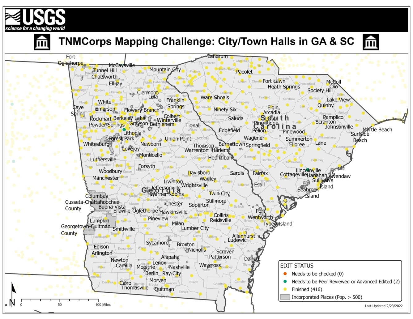
Remaining Communities
If you’ve been following us since we first launched city halls as a feature type, you may recall that Georgia and South Carolina were some of the earlier states to have their own designated challenge. You may also recall that, as city halls have progressed, we started providing volunteers with hints about remaining communities towards the end of each challenge. However, since we didn’t start providing this information until later in the game, we’re revisiting these earlier states to capture any city / town halls that may have been omitted during the original challenges.
To identify these communities, we overlaid US Census’s Incorporated Places dataset with all the city / town hall features collected to date. The results help us identify communities that do not yet have a city / town hall point within their corporate boundaries. We then limited the results to communities with a population greater than 500 since larger communities are more likely to have their own designated city hall. The map below highlights communities that may still need to have a city / town hall point collected.
NOTE that this does not mean every one of these communities is missing a point. It is possible that some of these communities do not have a building that fits our definition of a city / town hall while others may have already been collected but their city / town hall falls outside their corporate boundary.
Please help us research these communities and determine if a city / town hall exists!
Tips and tricks for this challenge:
Local Government: Incorporated vs. Unincorporated
- Georgia’s local government consists of cities, towns, consolidated city-counties, and consolidated cities.
- Cities and towns are legal equivalents in Georgia.
- South Carolina’s local government consists of cities and towns.
- Cities and towns are also legal equivalents in South Carolina.
- See the Cities vs. Towns vs. Villages article in our September 2019 newsletter for more information on the different types of governing bodies.
Possible Sources
Remember to confirm items in a list with an authoritative source (e.g., the city or village’s website) before updating the map. See the How to Spot an Authoritative (Re)Source article in our November 2017 newsletter for why this is important.
- The Municipal Association of South Carolina contains a directory of local governments in South Carolina with corresponding addresses and city websites.
- The Georgia Municipal Association contains a similar list of local governments in Georgia with addresses and websites.
- Wikipedia also lists communities for Georgia and South Carolina.
Smaller communities may not always have their own website and instead may use Facebook or other social media platforms for their virtual communications. See the newsletter article titled Social Media as an Authoritative Source (July 2020) for tips on using social media to update points.
Proper Point Placement
Our November 2018 newsletter includes an article on aerial interpretation for city/town hall structures. This article walks you through how to identify which building to place a point on when examining aerial imagery.
Interested in collecting city/town halls elsewhere?
Our volunteers are AWESOME and have helped us to compile a dataset of these features throughout the entire U.S., so most of the city/town halls have already been collected. However, as noted above, we plan to revisit some of the earlier states to make sure all eligible features have been collected. See the newsletter article titled Mapping Challenge Updates (January 2022) for a map of which states we plan to revisit. Note that only city/town halls in Georgia and South Carolina will count towards this challenge.
Questions?
If you have any questions during the mapping process, reach out to us at nationalmapcorps@usgs.gov and we’ll be happy to assist! Thank you for all that you do, and happy mapping!