
Bedrock Topography of the Willshire 7.5-minute Quadrangle, Ohio-Indiana

Detailed Description
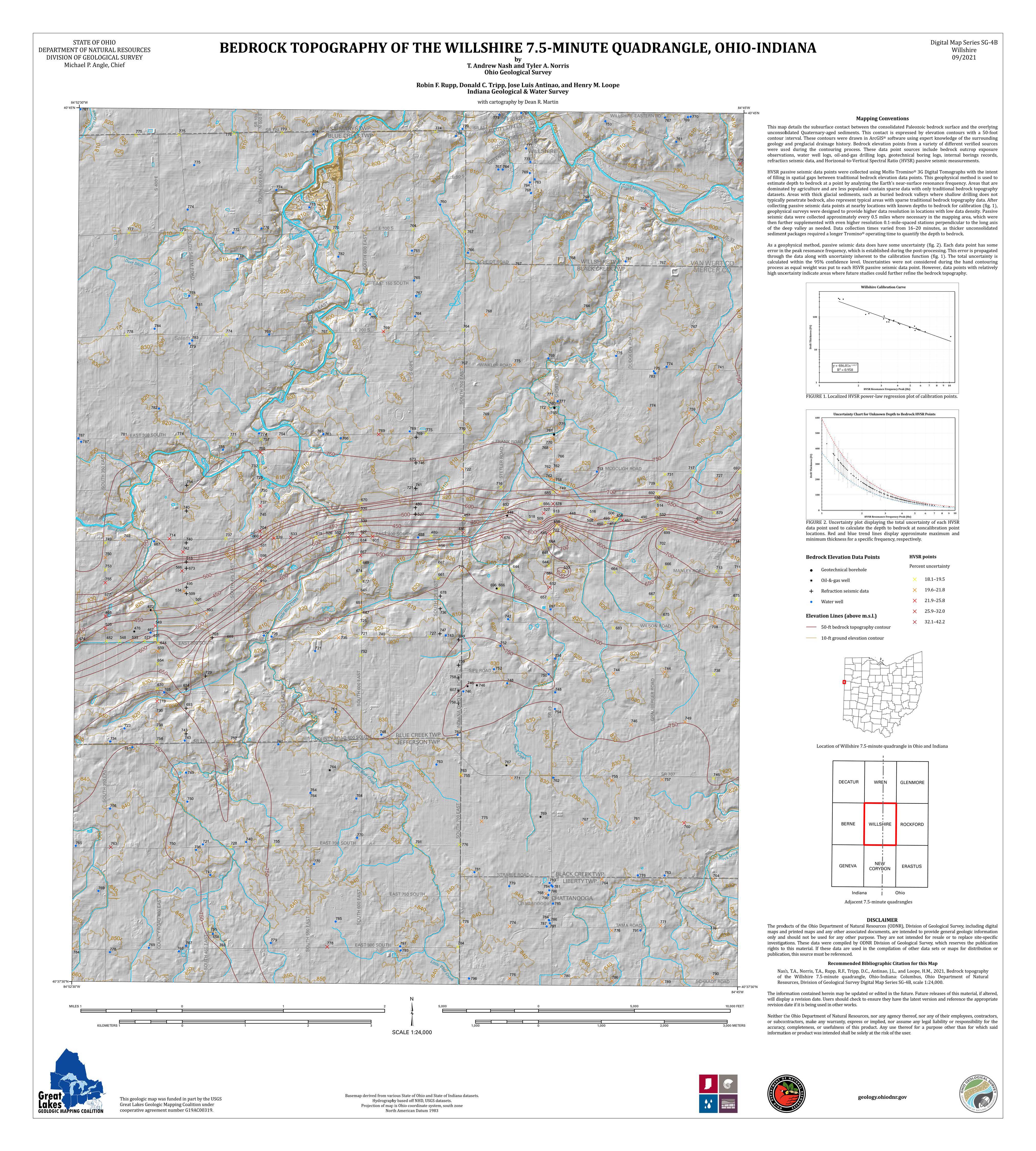
This map details the subsurface contact between the consolidated Paleozoic bedrock surface and the overlying unconsolidated Quaternary-aged sediments. This image is used with the permission of the Ohio Department of Natural Resources, Division of Geological Survey and the Indiana Geological and Water Survey.
Sources/Usage
Public Domain.
Public Domain.
This image is used with the permission of the Indiana Geological and Water Survey and the Ohio Department of Natural Resources, Division of Geological Survey.
Nash, T Andrew, Norris, Tyler A., Rupp, Robin F., Tripp, Donald C., Antiinao, Jose Luis, Loope, Henry M., 2021, Bedrock topography of the Willshire 7.5-minute quadrangle, Ohio-Indiana: Columbus, Ohio Department of Natural Resources, Division of Geological Survey Digital map Series SG-4B, scale 1:24,000.