
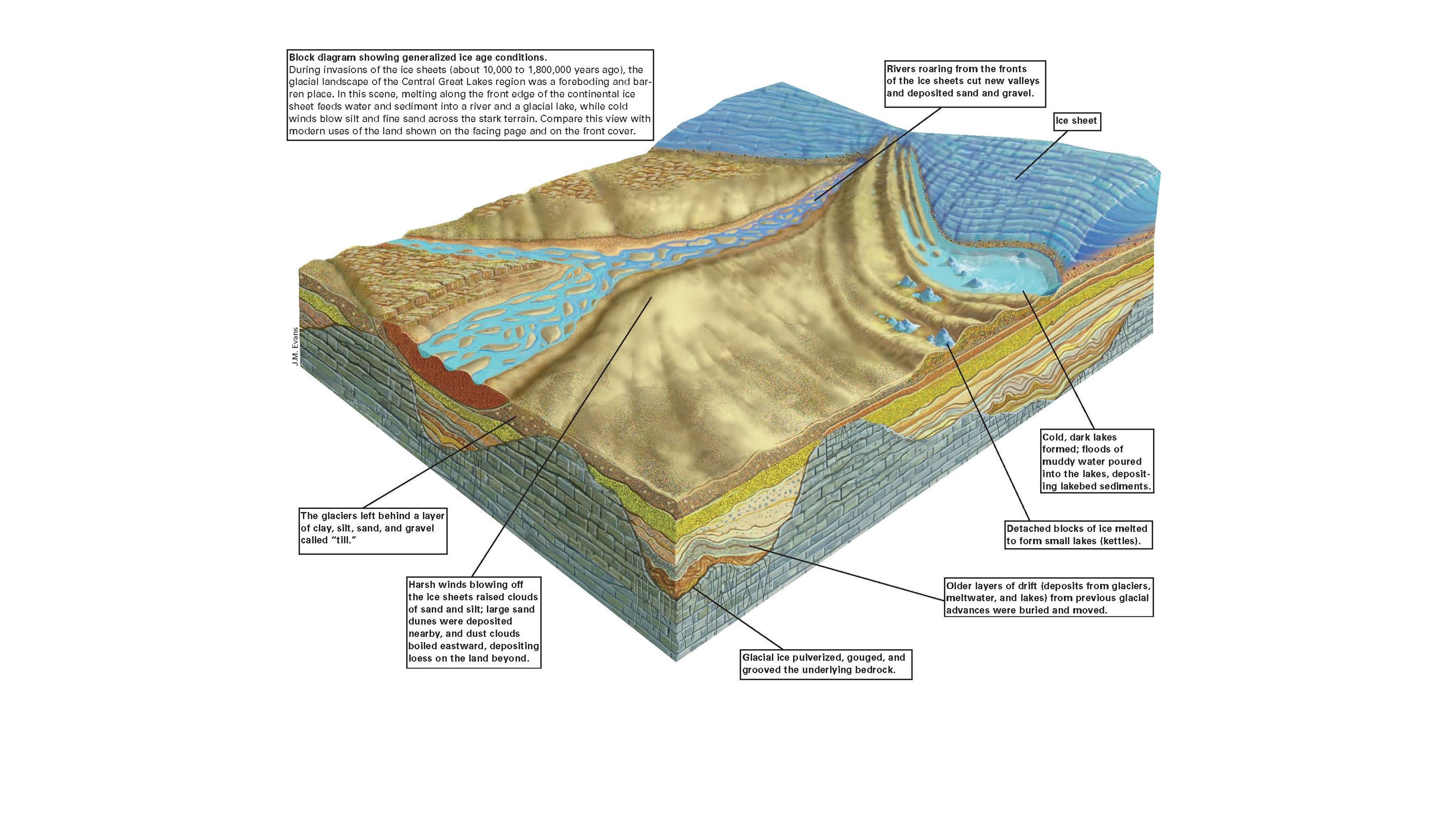
Central Great Lakes Geologic Mapping Coalition (1999): USGS Circular 1190 glacial block diagram showing generalized ice age conditions
By National Cooperative Geologic Mapping Program
1999 (approx.)

Detailed Description
During invasions of the ice sheets (about 10,000 to 1,800,000 years ago), the glacial landscape of the Central Great Lakes region was a foreboding and barren place. In this scene, melting along the front edge of the continental ice sheet feeds water and sediment into a river and glacial lake. This is an artistic depiction of what ice age conditions may have been like.
Sources/Usage
Public Domain.
Diagram developed by J.M. Evans.
Central Great Lakes Geologic Mapping Coalition, Illinois State Geological Survey Indiana Geological Survey Michigan Geological Survey Division Ohio Division of Geological Survey U.S. Geological Survey, 1999, Sustainable Growth in America’s Heartland— 3-D Geologic Maps as the Foundation, U.S. Geological Survey Circular 1190.